Area Overview for NN2 6QR
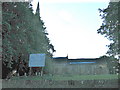
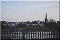
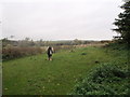
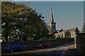
Photos of NN2 6QR


Area Information
Living in NN2 6QR means inhabiting a compact, residential cluster in England’s Northamptonshire. The area covers 7,379 square metres and is home to 1,587 people, translating to a population density of 215,056 per square kilometre — a testament to its tightly knit character. This postcode is defined by its proximity to essential services and a mix of local amenities. The community here is predominantly composed of adults aged 30–64, with a median age of 47, suggesting a stable, established population. Homes in NN2 6QR are largely owner-occupied, with 70% of residents living in houses rather than flats, reflecting a preference for traditional family dwellings. Daily life is shaped by the area’s proximity to schools, retail hubs like Waitrose Kingsthorpe, and transport links including Northampton Railway Station. The high density of the area means amenities are within walking distance, though the small size of the postcode implies a focus on immediate surroundings for broader services.
- Area Type
- Postcode
- Area Size
- 7379 m²
- Population
- 1587
- Population Density
- 2081 people/km²
The property market in NN2 6QR is characterised by a high rate of home ownership (70%), suggesting a stable, long-term resident base. The predominant accommodation type is houses, which is unusual for areas with such high population density. This implies that properties here are likely family homes, offering more space than flats, though the small postcode area means housing stock is limited. Buyers should consider the proximity to essential services, such as schools and transport links, as a key factor. The compact nature of the area means that property values may be influenced more by location than size, with homes near amenities like Northampton Railway Station or retail hubs like Waitrose Kingsthorpe likely to command premium prices. For those seeking rental properties, the data does not indicate a significant presence of lettings, suggesting the market is more geared towards owner-occupiers.
House Prices in NN2 6QR
Showing 20 properties
| Address | Type | Beds | Baths | Last Sale Price | Last Sale Date | |
|---|---|---|---|---|---|---|
| 25 Bishops Drive, Northampton, NN2 6QR | Detached | 2 | 1 | £197,000 | Oct 2025 | |
| 23 Bishops Drive, Northampton, NN2 6QR | Semi-detached | 3 | 1 | £255,000 | Aug 2023 | |
| 3 Bishops Drive, Northampton, NN2 6QR | Bungalow | - | - | £202,500 | Oct 2020 | |
| 21 Bishops Drive, Northampton, NN2 6QR | Semi-detached | 3 | 2 | £220,000 | Sep 2020 | |
| 13 Bishops Drive, Northampton, NN2 6QR | Bungalow | - | - | £176,000 | Mar 2020 | |
| 37 Bishops Drive, Northampton, NN2 6QR | Semi-detached | 2 | - | £180,000 | Sep 2018 | |
| 7 Bishops Drive, Northampton, NN2 6QR | Semi-detached | 2 | - | £168,000 | Mar 2016 | |
| 33 Bishops Drive, Northampton, NN2 6QR | Semi-detached | 2 | - | £142,000 | May 2015 | |
| 17 Bishops Drive, Northampton, NN2 6QR | Bungalow | 2 | - | £108,000 | Jun 2013 | |
| 27 Bishops Drive, Northampton, NN2 6QR | Bungalow | - | - | £141,000 | Apr 2013 |
Energy Efficiency in NN2 6QR
The lifestyle in NN2 6QR is shaped by its proximity to a range of amenities within practical reach. Retail options include five notable venues, such as Waitrose Kingsthorpe, Heron Kingsthorpe, and Cook Kingsthorpe, offering shopping and dining choices. The area’s transport links, including Northampton Railway Station and two bus interchanges, provide easy access to broader regional networks. While the data does not specify parks or leisure facilities, the compact nature of the area suggests that residents may rely on nearby town centres for recreation. The presence of two primary schools and a mix of retail and transport options indicates a community focused on convenience and accessibility, with daily life revolving around local services and short commutes.
Amenities
Schools
Residents of NN2 6QR have access to two primary schools: St John the Baptist CofE Lower School and Kingsthorpe Village Primary School, both of which cater to younger children. Kingsthorpe Village Primary School holds an Ofsted rating of ‘good’, reflecting its quality of education and management. The presence of two primary schools within the area suggests a focus on family-friendly living, with parents likely to prioritise proximity to schools when choosing a home. However, the data does not mention secondary schools or further education institutions, meaning families may need to look beyond NN2 6QR for comprehensive schooling. The availability of primary education within walking distance is a clear advantage for parents, though the absence of secondary options may influence decisions about long-term residency.
| Rank | School | Type | Entry gender | Ages |
|---|
Explore more schools in this area
Go to Schools tabDemographics
NN2 6QR’s population skews towards adults aged 30–64, with a median age of 47. This suggests a community of long-term residents, many of whom may be in their prime working years or nearing retirement. The area is predominantly White, with no specific data on other ethnic groups provided. Home ownership is high, at 70%, indicating a stable housing market where most residents are likely to have long-term ties to the area. The accommodation type is primarily houses, which aligns with the demographic profile of families or individuals seeking more space. The population density of 215,056 per square kilometre — one of the highest in the UK — reflects a densely packed residential cluster, which can mean limited green space but strong community cohesion. This density also implies that public services and amenities are concentrated, reducing the need for long commutes.
Household Size
Accommodation Type
Tenure
Ethnic Group
Religion
Household Composition
Age
Household Deprivation
NS-SEC
Explore more demographic insights in this area
Go to Demographics tabPlanning
Planning Constraints
- Flood RiskPremium
- Ramsar Wetland SitesPremium
- Area of Outstanding Natural BeautyPremium
- Protected Nature ReservePremium
- Protected WoodlandPremium