Area Overview for NN2 6NL
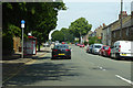
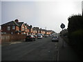
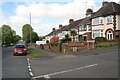
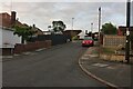
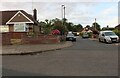
Photos of NN2 6NL

Area Information
Living in NN2 6NL means inhabiting a tightly packed residential cluster in England, where 2122 people reside across just 4878 square metres. This high population density creates a compact, closely knit community, with homes clustered closely together. The area’s small size means daily life is shaped by proximity to amenities, schools, and transport hubs. Residents benefit from being near Northampton Railway Station and multiple bus interchanges, ensuring easy access to urban centres. While the area is not expansive, its strategic location offers a balance between suburban comfort and urban connectivity. The median age of 47 suggests a stable population, with many residents in their prime working years. This is a place where convenience and practicality are prioritised, with homes and services arranged to serve a community that values accessibility over space. For those seeking a manageable, well-serviced area, NN2 6NL offers a snapshot of focused living, where every step feels purposeful.
- Area Type
- Postcode
- Area Size
- 4878 m²
- Population
- 2122
- Population Density
- 3817 people/km²
The property market in NN2 6NL is characterised by a 49% home ownership rate, meaning nearly half of properties are owner-occupied, while the rest are likely rental units. The accommodation type is primarily houses, which is unusual for a densely populated area but may reflect a preference for standalone homes in a compact setting. This suggests a market that balances owner-occupied living with rental availability, though the small area size may limit the diversity of housing stock. Buyers should consider that the high population density could influence property values and availability, with limited scope for expansion. The proximity to transport hubs like Northampton Railway Station may enhance the area’s appeal for commuters, while the predominance of houses might cater to families seeking space within a tightly packed environment. For those considering this small area, the property market is likely to be competitive, with limited options but strong local demand.
House Prices in NN2 6NL
Showing 33 properties
| Address | Type | Beds | Baths | Last Sale Price | Last Sale Date | |
|---|---|---|---|---|---|---|
| 56 Washington Street, Northampton, NN2 6NL | Terraced | 2 | 1 | £228,000 | Dec 2025 | |
| 42 Washington Street, Northampton, NN2 6NL | Terraced | 2 | 1 | £230,000 | Jul 2025 | |
| 32 Washington Street, Northampton, NN2 6NL | Terraced | 3 | 1 | £190,000 | Dec 2024 | |
| 8 Washington Street, Northampton, NN2 6NL | Terraced | 2 | 1 | £196,000 | Oct 2024 | |
| 38 Washington Street, Northampton, NN2 6NL | Terraced | 2 | 1 | £230,000 | Aug 2024 | |
| 58 Washington Street, Northampton, NN2 6NL | Terraced | 3 | 1 | £230,000 | Jun 2024 | |
| 64 Washington Street, Northampton, NN2 6NL | Terraced | 3 | 1 | £230,000 | May 2023 | |
| 16 Washington Street, Northampton, NN2 6NL | Terraced | 3 | 2 | £240,300 | Nov 2022 | |
| 52 Washington Street, Northampton, NN2 6NL | Retail | 2 | 1 | £231,350 | Aug 2022 | |
| 22 Washington Street, Northampton, NN2 6NL | Terraced | 2 | 1 | £236,000 | Mar 2022 |
Energy Efficiency in NN2 6NL
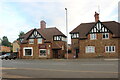
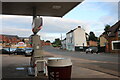
The lifestyle in NN2 6NL is shaped by its proximity to retail, transport, and community hubs. Local shops such as Cook Kingsthorpe, Waitrose Kingsthorpe, and Heron Kingsthorpe provide everyday conveniences, while the University Bus Interchange and Northampton Bus Interchange offer easy access to wider destinations. Northampton Railway Station further enhances mobility, connecting residents to urban centres. The area’s compact nature means amenities are within practical reach, fostering a sense of accessibility. While the data does not mention parks or leisure facilities, the presence of multiple retail and transport options suggests a focus on practicality and convenience. Residents benefit from a lifestyle that prioritises efficiency, with services and transport arranged to meet daily needs without requiring long commutes.
Amenities
Schools
Residents of NN2 6NL have access to three special schools, including Northgate School Arts College and Cambian Northampton School, which holds a ‘good’ Ofsted rating. These institutions cater to students with specific educational needs, offering tailored support and resources. The presence of multiple special schools suggests the area is well-served for families requiring specialist education, though the data does not mention mainstream schools or nurseries. The concentration of special schools may indicate a local focus on inclusive education, but parents seeking a broader range of school types may need to look beyond the immediate vicinity. For families prioritising specialist schooling, NN2 6NL offers a reliable network of educational institutions, though the absence of other school types should be noted in decision-making.
| Rank | School | Type | Entry gender | Ages |
|---|
Explore more schools in this area
Go to Schools tabDemographics
The community in NN2 6NL is predominantly composed of adults aged 30-64, with a median age of 47. This suggests a mature, established population, likely with long-term ties to the area. Home ownership stands at 49%, slightly below half, indicating a mix of owner-occupied and rental properties. The accommodation type is primarily houses, which may reflect a preference for standalone living in a compact area. The predominant ethnic group is White, with no specific data on other demographics provided. The population density of 434,970 people per square kilometre is exceptionally high, implying a densely populated, possibly urbanised environment. While this density may foster a strong sense of community, it also places demands on local infrastructure and services. The data does not indicate deprivation levels, but the high density and age profile suggest a stable, working-age population with established routines and needs.
Household Size
Accommodation Type
Tenure
Ethnic Group
Religion
Household Composition
Age
Household Deprivation
NS-SEC
Explore more demographic insights in this area
Go to Demographics tabPlanning
Planning Constraints
- Flood RiskPremium
- Ramsar Wetland SitesPremium
- Area of Outstanding Natural BeautyPremium
- Protected Nature ReservePremium
- Protected WoodlandPremium