Area Overview for NN2 6NJ
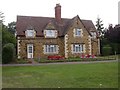
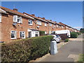
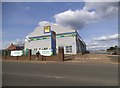
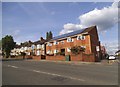
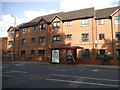
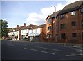
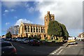
Photos of NN2 6NJ

Area Information
NN2 6NJ is a compact residential postcode in England, covering 2,795 square metres and home to 1,484 residents. Its high population density of 531,036 people per square kilometre reflects a tightly knit community, typical of small urban clusters. This area is characterised by its focus on housing, with a median age of 47 and a majority of residents aged 30–64. The presence of 54% home ownership suggests a stable, long-term population, while the predominantly White demographic underscores its traditional composition. Daily life here is shaped by proximity to retail, transport, and local services, making it a practical choice for those seeking convenience without the sprawl of larger towns. The area’s small size means amenities are within easy reach, though its density may limit green space. For buyers, NN2 6NJ offers a blend of established residential character and modern connectivity, though its compact nature demands careful consideration of space and privacy.
- Area Type
- Postcode
- Area Size
- 2795 m²
- Population
- 1484
- Population Density
- 9195 people/km²
The property market in NN2 6NJ is defined by a 54% home ownership rate, with houses making up the majority of accommodation types. This suggests a market skewed towards owner-occupied homes rather than rentals, though the relatively low ownership percentage indicates a significant proportion of properties are likely rented. The small area size and focus on houses imply a limited housing stock, which could drive competition among buyers. For those considering the area, the predominance of houses may appeal to families or those seeking more space, but the compact nature of NN2 6NJ means buyers must weigh proximity to amenities against potential constraints on property size. The market is unlikely to cater to high-demand rental sectors, given the data, and may attract buyers prioritising long-term stability over investment potential.
House Prices in NN2 6NJ
Showing 32 properties
Energy Efficiency in NN2 6NJ
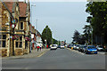
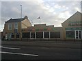
Living in NN2 6NJ grants access to a range of practical amenities within short distances. Retail options include Asda Northampton, Aldi Kingsthorpe, and Co-op Semilong, providing essential shopping and grocery needs. The area’s transport links, such as Northampton Bus Interchange and the nearby railway station, facilitate easy travel to workplaces, educational institutions, and leisure destinations. While the data does not specify parks or recreational spaces, the presence of retail and transport hubs suggests a focus on convenience over expansive green areas. The University Bus Interchange highlights proximity to academic institutions, which may influence the area’s character. For residents, the balance of retail, transport, and connectivity creates a functional lifestyle, though those prioritising natural spaces may need to look further afield.
Amenities
Schools
| Rank | School | Type | Entry gender | Ages |
|---|
Explore more schools in this area
Go to Schools tabDemographics
The community in NN2 6NJ is predominantly composed of adults aged 30–64, with a median age of 47. This suggests a mature, settled population, likely with established careers and families. Home ownership stands at 54%, indicating a mix of owner-occupied properties and rental units. The area’s accommodation is primarily houses, which may appeal to those seeking more space than flats. The predominant ethnic group is White, though no specific data on diversity or deprivation is provided. The age profile and ownership rates imply a community focused on stability, with fewer young families or transient residents. This demographic profile may influence local services and amenities, aligning them with the needs of middle-aged households.
Household Size
Accommodation Type
Tenure
Ethnic Group
Religion
Household Composition
Age
Household Deprivation
NS-SEC
Explore more demographic insights in this area
Go to Demographics tabPlanning
Planning Constraints
- Flood RiskPremium
- Ramsar Wetland SitesPremium
- Area of Outstanding Natural BeautyPremium
- Protected Nature ReservePremium
- Protected WoodlandPremium