Area Overview for NN2 6NA
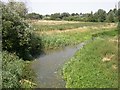
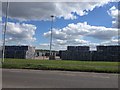
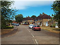
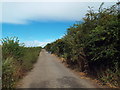
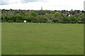
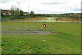
Photos of NN2 6NA


Area Information
NN2 6NA is a small, tightly packed residential cluster in England, spanning just 6 hectares and home to 2122 people. With a population density of 35,529 people per square kilometre, this area is densely populated, creating a compact, community-focused environment. The median age of 47 suggests a mature demographic, with the majority of residents aged between 30 and 64. This makes it a stable, family-oriented area where many have established long-term roots. The proximity of amenities, schools, and transport links within a short radius means daily life is efficient, with little need to travel far. While the area is small, it is well-served by nearby retail hubs, public transport, and educational institutions. Its size and density mean it is not suited to those seeking sprawling landscapes, but it offers convenience and accessibility for those prioritising proximity to services and a tight-knit community.
- Area Type
- Postcode
- Area Size
- 6.0 hectares
- Population
- 2122
- Population Density
- 3817 people/km²
The property market in NN2 6NA is defined by its small size and predominantly house-based housing stock. With 49% of residents owning their homes, the area is not heavily reliant on rental properties, though the proportion of renters suggests a mix of ownership and tenancy. The accommodation type being houses indicates a focus on standalone, family-friendly homes rather than apartments or flats. This makes the area appealing to buyers seeking traditional housing, but the limited area size means the market is constrained. Prospective buyers should consider the compact nature of the area and its proximity to amenities, as the immediate surroundings may offer more options. The high population density also means competition for properties could be fierce, particularly for homes near key services like schools and transport links.
House Prices in NN2 6NA
Showing 1 properties
| Address | Type | Beds | Baths | Last Sale Price | Last Sale Date | |
|---|---|---|---|---|---|---|
| Unit 1 - Unit 3, Queens Park Industrial Estate, Studland Road, Northampton, NN2 6NA | storage_distribution | - | - | - | - |
Energy Efficiency in NN2 6NA
The lifestyle in NN2 6NA is shaped by its proximity to essential amenities. Retail options include Aldi Kingsthorpe, Asda Northampton, and Cook Kingsthorpe, providing convenient access to groceries and everyday shopping. The area’s compact size ensures these venues are within practical reach, supporting a self-contained lifestyle. Public transport links, such as the Northampton Bus Interchange, connect residents to broader networks, facilitating travel to leisure, work, or educational opportunities. While the data does not specify parks or recreational facilities, the presence of multiple retail and transport hubs suggests a practical, service-oriented community. The mix of shops, transport, and nearby schools creates a functional environment where daily needs are met without significant travel.
Amenities
Schools
NN2 6NA is served by three special schools, including Northgate School Arts College and Northgate School Academy Trust, both of which cater to students with specific educational needs. Cambian Northampton School, another special school in the area, holds a ‘good’ Ofsted rating, offering families a reliable option for tailored education. The presence of multiple special schools suggests the area is well-suited for households with children requiring specialist support. While no mainstream schools are listed, the concentration of special schools indicates a focus on inclusive education. This makes NN2 6NA an attractive option for families prioritising accessible, high-quality educational resources for children with diverse learning requirements.
| Rank | School | Type | Entry gender | Ages |
|---|
Explore more schools in this area
Go to Schools tabDemographics
The population of NN2 6NA is predominantly adults aged 30–64, with a median age of 47. This reflects a mature, settled community where many residents are likely to be in their prime working years or nearing retirement. Home ownership stands at 49%, indicating a mix of owner-occupied and rental properties. The accommodation type is primarily houses, which suggests a preference for standalone homes over flats or apartments. The predominant ethnic group is White, though the data does not specify further diversity metrics. With a population density of 35,529 per square kilometre, the area is highly compact, which may influence the character of the community, fostering close interactions among residents. However, the high density also means limited space for expansion or new developments, which could affect housing availability for future buyers.
Household Size
Accommodation Type
Tenure
Ethnic Group
Religion
Household Composition
Age
Household Deprivation
NS-SEC
Explore more demographic insights in this area
Go to Demographics tabPlanning
Planning Constraints
- Flood RiskPremium
- Ramsar Wetland SitesPremium
- Area of Outstanding Natural BeautyPremium
- Protected Nature ReservePremium
- Protected WoodlandPremium