Area Overview for NN2 6JW
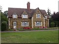
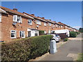
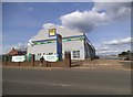
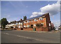
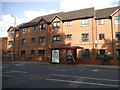
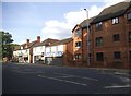
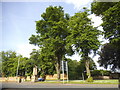
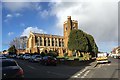
Photos of NN2 6JW

Area Information
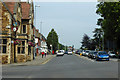
NN2 6JW is a compact residential postcode in England, covering just 3.4 hectares and home to 1330 people. Its high population density of 38,990 people per square kilometre reflects a tightly knit community, though the area’s small size means amenities and services are concentrated within a short radius. The postcode’s character is shaped by its proximity to retail hubs like Asda Northampton and Aldi Kingsthorpe, as well as transport links including Northampton Railway Station and two bus interchanges. Daily life here is defined by accessibility: schools, shops, and public transport are all within practical reach. The area is predominantly occupied by adults aged 30–64, with a median age of 47, suggesting a mature, stable population. While the residential cluster is small, its mix of schools, including academies with good Ofsted ratings, and its connectivity to major routes make it a practical choice for families and commuters.
- Area Type
- Postcode
- Area Size
- 3.4 hectares
- Population
- 1330
- Population Density
- 4178 people/km²
The property market in NN2 6JW is characterised by a 48% home ownership rate, indicating that nearly half of residents rent their homes. The area is dominated by houses, with no data suggesting a significant presence of flats or other housing types. This mix of owner-occupied and rental properties suggests a balance between long-term residents and those seeking temporary housing. Given the area’s small size of 3.4 hectares, the housing stock is likely limited, with properties concentrated in a compact cluster. For buyers, this means competition for available homes may be high, particularly for those prioritising proximity to schools and transport. The predominance of houses may appeal to families seeking more space, but the area’s density could limit options for larger properties.
House Prices in NN2 6JW
Showing 1 properties
| Address | Type | Beds | Baths | Last Sale Price | Last Sale Date | |
|---|---|---|---|---|---|---|
| Malcolm Arnold Preparatory School, Trinity Avenue, Northampton, NN2 6JW | education | - | - | - | - |
Energy Efficiency in NN2 6JW
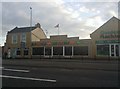
The lifestyle in NN2 6JW is shaped by its proximity to retail and transport hubs. Residents can access major supermarkets like Asda Northampton and Aldi Kingsthorpe, along with the Co-op Semilong, ensuring convenience for shopping. The area’s transport links, including Northampton Railway Station and two bus interchanges, provide easy access to nearby cities and universities. While there is no mention of parks or leisure facilities within the postcode, the compact nature of the area means amenities are closely clustered. This makes daily life efficient, with minimal travel required for essentials. The presence of schools, shops, and transport options creates a functional environment, though buyers should consider whether the area’s density and lack of green spaces align with their preferences.
Amenities
Schools
Residents of NN2 6JW have access to a range of schools, including primary and special needs institutions. Trinity School and Unity College are primary schools, while Fairfields School caters to special educational needs. Malcolm Arnold Academy and Malcolm Arnold Preparatory School are both academies with good Ofsted ratings. This variety ensures families can choose between mainstream education and specialist support. The presence of two academies with good ratings suggests a strong standard of teaching in the area, which is a significant draw for parents. However, the absence of secondary schools within the postcode means students may need to travel to nearby areas for further education. The mix of school types reflects a commitment to addressing diverse educational needs, though buyers should consider the practicalities of school commutes.
| Rank | School | Type | Entry gender | Ages |
|---|
Explore more schools in this area
Go to Schools tabDemographics
The population of NN2 6JW is 1330, with a median age of 47 and the majority of residents falling within the 30–64 age range. This suggests a community of working-age adults, likely with established careers and families. Home ownership is at 48%, meaning nearly half of residents rent their homes. The area is predominantly occupied by houses, with no mention of flats or other accommodation types. The predominant ethnic group is White, though no data on diversity or deprivation is provided. The high population density of 38,990 people per square kilometre indicates a compact, possibly urbanised setting, though the area’s small size means it is not a sprawling suburb. For buyers, this density may translate to limited space for expansion, but it also ensures proximity to essential services and transport.
Household Size
Accommodation Type
Tenure
Ethnic Group
Religion
Household Composition
Age
Household Deprivation
NS-SEC
Explore more demographic insights in this area
Go to Demographics tabPlanning
Planning Constraints
- Flood RiskPremium
- Ramsar Wetland SitesPremium
- Area of Outstanding Natural BeautyPremium
- Protected Nature ReservePremium
- Protected WoodlandPremium