Area Overview for NN2 6BW
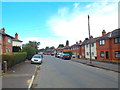
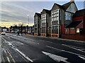
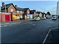
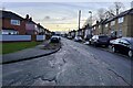
Photos of NN2 6BW


Area Information
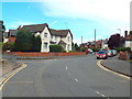
NN2 6BW is a compact residential postcode in England, covering just 455 square metres and home to 2,133 residents. Its high population density—over 4.6 million people per square kilometre—reflects a tightly knit community, though the area itself is small enough to feel intimate. The postcode includes a cluster of homes, predominantly houses, with a median age of 47, suggesting a mature population skewed toward adults aged 30–64. This demographic profile hints at a stable, established community, likely with families and professionals seeking a quieter, more residential setting. Daily life here is shaped by proximity to key amenities, including retail hubs like Asda Northampton and Aldi Kingsthorpe, as well as transport links such as Northampton Railway Station. The area’s low flood risk and crime score of 68/100 further enhance its appeal, offering a balance of safety and practicality. For buyers, NN2 6BW represents a niche market where limited space meets a focused, localised lifestyle.
- Area Type
- Postcode
- Area Size
- 455 m²
- Population
- 2133
- Population Density
- 10591 people/km²
The property market in NN2 6BW is characterised by a low home ownership rate of 31%, suggesting that the majority of residents are renters rather than homeowners. This may be due to the area’s limited size, which restricts the availability of properties and could drive up competition among buyers. The predominant accommodation type is houses, which is noteworthy for a small postcode, as it implies a focus on single-family homes rather than apartments or flats. For buyers, this means a market that prioritises established, possibly older properties over new developments. The small size of the area also means that the immediate surroundings—such as nearby towns like Northampton—may hold more housing options. However, the compact nature of NN2 6BW itself limits the variety of properties available, making it a niche market for those seeking specific characteristics like proximity to amenities or transport links.
House Prices in NN2 6BW
Showing 4 properties
| Address | Type | Beds | Baths | Last Sale Price | Last Sale Date | |
|---|---|---|---|---|---|---|
| 103A St Andrews Road, Northampton, NN2 6BW | Flat | - | - | £99,995 | May 2016 | |
| 101 St Andrews Road, Northampton, NN2 6BW | Terraced | 1 | - | £32,750 | Jul 1997 | |
| 101A St Andrews Road, Northampton, NN2 6BW | Flat | - | - | - | - | |
| 97 St Andrews Road, Northampton, NN2 6BW | Office | - | - | - | - |
Energy Efficiency in NN2 6BW
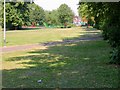
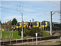
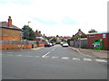
Living in NN2 6BW offers access to a range of nearby amenities that cater to daily needs and leisure. Retail options include Co-op Semilong, Asda Northampton, and Aldi Kingsthorpe, providing a mix of grocery and convenience shopping within practical reach. The area’s proximity to Northampton Railway Station and the two bus interchanges ensures easy travel to other parts of the region, including the University of Northampton. While the postcode itself is small, the surrounding area likely includes parks, green spaces, and other facilities not explicitly named in the data. The presence of multiple retail outlets and transport links contributes to a convenient, self-contained lifestyle, where residents can access essentials without long commutes. The compact nature of the area also fosters a sense of community, with local shops and transport hubs serving as focal points for daily activity.
Amenities
Schools
| Rank | School | Type | Entry gender | Ages |
|---|
Explore more schools in this area
Go to Schools tabDemographics
The population of NN2 6BW is predominantly adults aged 30–64, with a median age of 47. This suggests a community of middle-aged residents, many of whom may be in their peak earning years or nearing retirement. Home ownership is relatively low at 31%, indicating a higher proportion of renters, which could reflect the area’s small size and limited housing stock. The predominant accommodation type is houses, which is unusual for a densely populated postcode but may reflect a mix of older properties and newer developments. The predominant ethnic group is White, though the data does not specify further diversity metrics. With no figures on deprivation or income levels, it is difficult to assess economic challenges, but the low crime rate and safety score of 68/100 suggest a stable environment. This demographic profile positions NN2 6BW as a place where established residents, possibly with families, reside in a compact, low-risk setting.
Household Size
Accommodation Type
Tenure
Ethnic Group
Religion
Household Composition
Age
Household Deprivation
NS-SEC
Explore more demographic insights in this area
Go to Demographics tabPlanning
Planning Constraints
- Flood RiskPremium
- Ramsar Wetland SitesPremium
- Area of Outstanding Natural BeautyPremium
- Protected Nature ReservePremium
- Protected WoodlandPremium