Area Overview for NN2 6AP
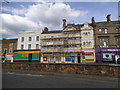
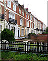
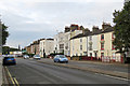
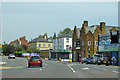
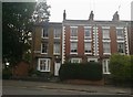
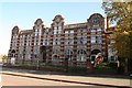
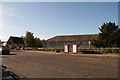
Photos of NN2 6AP


Area Information
NN2 6AP is a compact residential postcode in England, covering 8,380 square metres and home to 2,273 residents. Its population density of 271,226 people per square kilometre reflects a tightly knit, urban environment. The area is characterised by a mature demographic, with a median age of 47 and a majority of residents aged 30–64. This suggests a community of established professionals and families, though the 19% home ownership rate indicates a rental-dominated market. Flats are the predominant housing type, shaping the area’s layout and density. Despite its small size, NN2 6AP offers proximity to essential services, including multiple retail outlets, public transport hubs, and a mix of primary and independent schools. Its location near Northampton Railway Station and bus interchanges ensures connectivity to surrounding regions, while broadband and mobile coverage scores of 90 and 84 respectively support modern lifestyles. However, the area’s high population density and limited green spaces mean daily life is centred around shared amenities and community networks.
- Area Type
- Postcode
- Area Size
- 8380 m²
- Population
- 2273
- Population Density
- 6713 people/km²
NN2 6AP is a small area with limited housing stock, dominated by flats and a low home ownership rate of 19%. This suggests that the majority of residents rent, making the area more of a rental market than an owner-occupied one. The prevalence of flats indicates a compact, high-density living environment, which may suit those prioritising convenience over space. For buyers, the small size of the postcode means competition for properties is likely to be intense, with limited options for alternative housing types. The immediate surroundings may offer similar characteristics, so prospective buyers should consider exploring nearby areas for more variety. The rental market’s dominance also means property prices may be influenced by demand from tenants rather than long-term investment trends.
House Prices in NN2 6AP
Showing 83 properties
| Address | Type | Beds | Baths | Last Sale Price | Last Sale Date | |
|---|---|---|---|---|---|---|
| 24 Hester Street, Northampton, NN2 6AP | house | - | - | £275,000 | Dec 2023 | |
| 9 Hester Street, Northampton, NN2 6AP | house | - | - | £189,000 | Nov 2023 | |
| Dayspring House, 1-3 Hester Street, Northampton, NN2 6AP | Detached | 10 | 6 | £570,000 | Oct 2022 | |
| 23 Hester Street, Northampton, NN2 6AP | house | - | - | £225,000 | May 2022 | |
| 18 Hester Street, Northampton, NN2 6AP | house | 8 | - | £330,000 | Dec 2021 | |
| Flat 5, 7 Hester Street, Northampton, NN2 6AP | Flat | 2 | 1 | £65,000 | Jun 2020 | |
| 14 Hester Street, Northampton, NN2 6AP | Flat | 1 | 1 | £69,000 | Feb 2020 | |
| 10 Hester Street, Northampton, NN2 6AP | Terraced | 1 | 8 | £225,000 | Sep 2019 | |
| 20 Hester Street, Northampton, NN2 6AP | house | - | - | £219,000 | Feb 2008 | |
| 28 Hester Street, Northampton, NN2 6AP | Terraced | 7 | 7 | £190,000 | Dec 2007 |
Energy Efficiency in NN2 6AP
Residents of NN2 6AP benefit from a range of nearby amenities, including retail outlets such as Co-op Semilong, Aldi Earl, and Asda Northampton, which provide everyday shopping convenience. The area’s proximity to Northampton Railway Station and multiple bus interchanges ensures easy access to broader regional networks. While there is no mention of parks or leisure facilities in the data, the availability of retail and transport options suggests a practical, service-oriented lifestyle. The compact nature of the postcode means amenities are within practical reach, supporting a convenient daily routine. For those prioritising accessibility over expansive green spaces, the area’s layout offers a functional, urban living experience.
Amenities
Schools
Residents of NN2 6AP have access to a range of schools, including primary and independent institutions. Castle Primary School and St George’s Middle School cater to younger children, while Northampton Middle School serves the local community. Bosworth Independent School, rated ‘good’ by Ofsted, offers an alternative to state education. The presence of both state and independent schools provides flexibility for families with differing educational preferences. However, the absence of secondary schools in the immediate area may require students to commute to nearby towns. The variety of school types reflects a balanced approach to education, though parents should consider travel times for older children.
| Rank | School | Type | Entry gender | Ages |
|---|
Explore more schools in this area
Go to Schools tabDemographics
The population of NN2 6AP is predominantly adults aged 30–64, with a median age of 47. This suggests a stable, middle-aged community, likely comprising professionals and families. Only 19% of residents own their homes, indicating a rental-heavy market, which may influence the local property dynamics. The area’s accommodation is almost entirely flats, reflecting a lack of larger family homes or detached properties. The predominant ethnic group is White, though no specific data on diversity or deprivation is provided. The high proportion of adults in the 30–64 age range implies a community focused on long-term stability, with fewer young families or retirees. This profile may appeal to those seeking a settled environment but could limit the availability of properties tailored to different household needs.
Household Size
Accommodation Type
Tenure
Ethnic Group
Religion
Household Composition
Age
Household Deprivation
NS-SEC
Explore more demographic insights in this area
Go to Demographics tabPlanning
Planning Constraints
- Flood RiskPremium
- Ramsar Wetland SitesPremium
- Area of Outstanding Natural BeautyPremium
- Protected Nature ReservePremium
- Protected WoodlandPremium