Area Overview for NN18 9NH
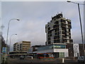
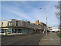
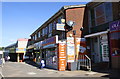
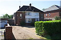
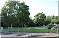
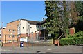
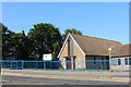
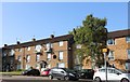
Photos of NN18 9NH


Area Information
NN18 9NH is a compact residential postcode area within the town of Corby, Northamptonshire, covering just 7.3 hectares. With a population of 1,634 and a density of 22,266 people per square kilometre, it is a tightly packed community. Corby, historically a small village, was transformed into a new town in 1950, driven by industrial growth. The area’s name traces back to its Domesday Book entry as “Corbei,” and its symbol, the raven, reflects its ancient roots. Daily life here is shaped by its proximity to industrial heritage and modern amenities. The area is served by Corby Railway Station and a bus interchange, linking residents to nearby towns. Nearby, retail options include Tesco Corby, Lidl Central, and Farmfoods Corby, ensuring practical access to essentials. While the community is small, it is positioned within a town that balances historical significance with contemporary infrastructure, making it a distinct yet functional place to live.
- Area Type
- Postcode
- Area Size
- 7.3 hectares
- Population
- 1634
- Population Density
- 4709 people/km²
The property market in NN18 9NH is characterised by a 42% home ownership rate, meaning the majority of housing is rented. The predominant accommodation type is houses, which contrasts with the higher density of the area. This suggests a limited supply of properties, likely due to the postcode’s small size of 7.3 hectares. Buyers should consider the area’s proximity to Corby’s broader housing stock, as the immediate surroundings may offer more options. The focus on owner-occupied homes is minimal, indicating a rental-driven market. For those seeking to purchase, competition may be fierce, and properties are likely to be older, reflecting Corby’s industrial past. The compact nature of the area also means that buyers must weigh the benefits of proximity to amenities against potential constraints on property choice.
House Prices in NN18 9NH
Showing 42 properties
| Address | Type | Beds | Baths | Last Sale Price | Last Sale Date | |
|---|---|---|---|---|---|---|
| 87 Oakley Road, Corby, NN18 9NH | Terraced | 3 | 1 | £220,000 | Nov 2025 | |
| 107 Oakley Road, Corby, NN18 9NH | Terraced | 2 | 1 | £210,000 | Dec 2024 | |
| 119 Oakley Road, Corby, NN18 9NH | house | 3 | 1 | £205,000 | Nov 2022 | |
| 79 Oakley Road, Corby, NN18 9NH | house | - | - | £210,000 | Aug 2021 | |
| 61 Oakley Road, Corby, NN18 9NH | house | - | - | £138,000 | Dec 2020 | |
| 77 Oakley Road, Corby, NN18 9NH | Terraced | 3 | 1 | £149,000 | Jun 2019 | |
| 93 Oakley Road, Corby, NN18 9NH | Terraced | 2 | 1 | £125,000 | May 2019 | |
| 73 Oakley Road, Corby, NN18 9NH | house | - | - | £135,000 | Mar 2017 | |
| 47 Oakley Road, Corby, NN18 9NH | house | - | - | £130,000 | Dec 2016 | |
| 67 Oakley Road, Corby, NN18 9NH | house | - | - | £101,000 | Apr 2014 |
Energy Efficiency in NN18 9NH
The lifestyle in NN18 9NH is shaped by its proximity to Corby’s retail and transport hubs. Nearby, residents can access Tesco Corby, Lidl Central, and Farmfoods Corby, providing a range of grocery and convenience options. The area’s compact size means these amenities are within walking or short driving distance, enhancing daily convenience. The Corby Railway Station and bus interchange offer easy access to regional destinations, supporting both work and leisure travel. While the area lacks detailed information on parks or leisure facilities, its historical roots in industrial Corby may influence its recreational offerings. The community’s small size fosters a sense of familiarity, though the high population density could impact personal space. Overall, the lifestyle here balances practical accessibility with the town’s character, though further exploration of local amenities would be needed for a complete picture.
Amenities
Schools
The schools near NN18 9NH include Exeter Primary School, Exeter Junior School, Queen Elizabeth School, Corby Community College (listed as primary in the data), and Exeter – A Learning Community Academy. While the latter is an academy, the others are primary schools, offering a range of educational options for younger children. Families with children may benefit from multiple primary school choices, though secondary education options are not explicitly detailed. The presence of both traditional primary schools and an academy suggests a mix of educational approaches, though the specific quality of these institutions is not provided. For parents, the proximity of these schools is a key consideration, as they are within practical reach for residents. However, the lack of explicit Ofsted ratings means further research into individual school performance would be necessary.
| Rank | School | Type | Entry gender | Ages |
|---|
Explore more schools in this area
Go to Schools tabDemographics
The population of NN18 9NH has a median age of 47, with the majority of residents aged 30–64. This suggests a mature, stable community, likely with established careers and families. Home ownership stands at 42%, indicating that over half of households are renters, which may reflect the area’s compact size and limited housing stock. The predominant accommodation type is houses, rather than flats or apartments, aligning with Corby’s historical development as a working-class settlement. The dominant ethnic group is White, though specific diversity metrics are not detailed. With 1,634 residents in such a small area, the community is closely knit, but the high population density raises questions about living space per person. The age profile and ownership rates suggest a mix of long-term residents and those seeking affordable housing, though the area’s industrial legacy may influence its demographic makeup.
Household Size
Accommodation Type
Tenure
Ethnic Group
Religion
Household Composition
Age
Household Deprivation
NS-SEC
Explore more demographic insights in this area
Go to Demographics tabPlanning
Planning Constraints
- Flood RiskPremium
- Ramsar Wetland SitesPremium
- Area of Outstanding Natural BeautyPremium
- Protected Nature ReservePremium
- Protected WoodlandPremium