Area Overview for NN18 9JG
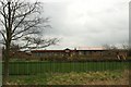
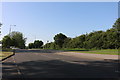
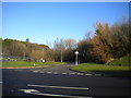
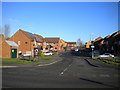
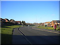
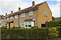
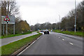
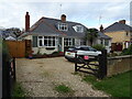
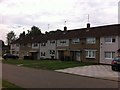
Photos of NN18 9JG

Area Information
NN18 9JG is a small, densely populated postcode area in Corby, Northamptonshire, covering just 1.4 hectares with a population of 1,790. Despite its compact size, it reflects Corby’s industrial heritage, a town designated a new town in 1950. The area’s residents are predominantly middle-aged adults (30–64 years), with a median age of 47, suggesting a stable, long-term community. Daily life here is shaped by proximity to retail, rail, and bus networks, though the area’s high population density—124,523 people per square kilometre—means space is limited. Corby itself, with its historical roots as a settlement named “Kori’s by” by Danish settlers, remains a working town, though its economy has shifted from steelmaking to more diverse industries. Living in NN18 9JG offers convenience through nearby amenities but requires consideration of its small footprint and the challenges of high density. The area’s character is defined by its compactness, with residents likely to rely on local services and transport links to nearby towns.
- Area Type
- Postcode
- Area Size
- 1.4 hectares
- Population
- 1790
- Population Density
- 6856 people/km²
The property market in NN18 9JG is characterised by a low home ownership rate of 29%, suggesting that the area is primarily a rental market rather than one dominated by owner-occupied homes. The accommodation type is predominantly houses, but with such a small area size (1.4 hectares) and high population density, these are likely to be modest or multi-occupancy properties. Buyers considering this area should note its limited footprint and the potential for competition among renters. The immediate surroundings may offer more housing options, but the small size of NN18 9JG itself means that properties are unlikely to be abundant. For those seeking a home, the area’s proximity to transport links and retail amenities could be a draw, though the high density may mean limited space for expansion or development.
House Prices in NN18 9JG
Showing 58 properties
| Address | Type | Beds | Baths | Last Sale Price | Last Sale Date | |
|---|---|---|---|---|---|---|
| 33 Culross Walk, Corby, NN18 9JG | Retail | 1 | 1 | £94,950 | Jun 2022 | |
| 89 Culross Walk, Corby, NN18 9JG | Flat | - | - | £100,000 | Jan 2021 | |
| 57 Culross Walk, Corby, NN18 9JG | house | - | - | £125,000 | Nov 2019 | |
| 11 Culross Walk, Corby, NN18 9JG | Terraced | 1 | 2 | £135,000 | Aug 2019 | |
| 109 Culross Walk, Corby, NN18 9JG | Terraced | 3 | 1 | £99,000 | May 2019 | |
| 103 Culross Walk, Corby, NN18 9JG | house | - | - | £635,000 | Nov 2018 | |
| 101 Culross Walk, Corby, NN18 9JG | house | - | - | £635,000 | Nov 2018 | |
| 71 Culross Walk, Corby, NN18 9JG | Flat | - | - | £50,235 | Oct 2017 | |
| 27 Culross Walk, Corby, NN18 9JG | Terraced | 3 | - | £90,500 | Sep 2015 | |
| 113 Culross Walk, Corby, NN18 9JG | Terraced | - | - | £95,000 | Mar 2008 |
Energy Efficiency in NN18 9JG
Living in NN18 9JG offers access to a range of nearby amenities within practical reach. Retail options include Morrisons Oakley, Tesco Oakley, and Morrisons Daily Corby, providing essential shopping and grocery needs. The area’s proximity to Corby Railway Station and Kettering Railway Station ensures easy access to regional transport, while a bus interchange adds flexibility for local travel. Though the area is small, these amenities contribute to a functional daily life, supporting both household needs and connectivity to wider services. The presence of multiple retail outlets and transport hubs suggests a practical, service-oriented lifestyle, though the compact nature of the postcode means residents may need to venture slightly further for more specialised amenities. The balance of retail, rail, and bus access makes NN18 9JG suitable for those prioritising convenience over expansive leisure options.
Amenities
Schools
| Rank | School | Type | Entry gender | Ages |
|---|
Explore more schools in this area
Go to Schools tabDemographics
The community in NN18 9JG is predominantly composed of adults aged 30–64, with a median age of 47. This suggests a mature population, likely settled in long-term employment or retirement. Home ownership is relatively low at 29%, indicating that most residents rent their homes, which may reflect the area’s small size and limited housing stock. The accommodation type is primarily houses, though the high population density—124,523 people per square kilometre—implies these are often multi-occupancy or smaller dwellings. The predominant ethnic group is White, with no data provided on other demographics. The low home ownership rate may impact community stability, though the area’s proximity to transport and retail could offset this. For quality of life, the lack of specific deprivation data means it’s unclear how socioeconomic challenges might affect residents, though the area’s compactness may limit access to broader services.
Household Size
Accommodation Type
Tenure
Ethnic Group
Religion
Household Composition
Age
Household Deprivation
NS-SEC
Explore more demographic insights in this area
Go to Demographics tabPlanning
Planning Constraints
- Flood RiskPremium
- Ramsar Wetland SitesPremium
- Area of Outstanding Natural BeautyPremium
- Protected Nature ReservePremium
- Protected WoodlandPremium