Area Overview for NN18 9BY
Photos of NN18 9BY
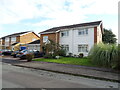
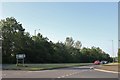
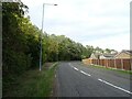
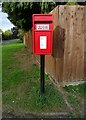
8 photos from this area
Area Information
Key information about the NN18 9BY including its size, population, and administrative classification.
- Area Type
- Postcode
- Area Size
- 9.2 hectares
- Population
- 2064
- Population Density
- 3226 people/km²
House Prices in NN18 9BY
61
Properties
£196,224
Average Sold Price
£162,995
Lowest Price
£242,000
Highest Price
Showing 61 properties
| Address | Type | Beds | Baths | Last Sale Price | Last Sale Date | |
|---|---|---|---|---|---|---|
| 47 Oak Wood Drive, Corby, NN18 9BY | Semi-detached | 3 | 2 | £240,000 | Oct 2024 | |
| 23 Oak Wood Drive, Corby, NN18 9BY | house | - | - | £225,000 | Sep 2024 | |
| 79 Oak Wood Drive, Corby, NN18 9BY | Semi-detached | 3 | 2 | £205,000 | Jun 2024 | |
| 99 Oak Wood Drive, Corby, NN18 9BY | Semi-detached | 3 | 2 | £175,000 | Nov 2023 | |
| 89 Oak Wood Drive, Corby, NN18 9BY | house | - | - | £220,000 | Oct 2023 | |
| 91 Oak Wood Drive, Corby, NN18 9BY | house | - | - | £230,000 | Dec 2021 | |
| 93 Oak Wood Drive, Corby, NN18 9BY | house | - | - | £230,000 | Oct 2021 | |
| 77 Oak Wood Drive, Corby, NN18 9BY | house | - | - | £213,000 | Sep 2021 | |
| 65 Oak Wood Drive, Corby, NN18 9BY | Detached | 3 | 1 | £205,000 | Aug 2021 | |
| 25 Oak Wood Drive, Corby, NN18 9BY | Detached | 3 | 2 | £200,000 | Jun 2021 |
Page 1 of 7
Energy Efficiency in NN18 9BY
Amenities
Schools
| Rank | School | Type | Entry gender | Ages |
|---|
Explore more schools in this area
Go to Schools tabDemographics
Household Size
Family (3-5 people)
most common
Accommodation Type
Houses
most common
Tenure
74
majority
Ethnic Group
White
most common
Religion
N/A
most common
Household Composition
N/A
most common
Age
47
median
Adults (30-64 years)
most common
Household Deprivation
N/A
with no deprivation
NS-SEC
24
in Lower managerial occupations
Explore more demographic insights in this area
Go to Demographics tabPlanning
Planning Constraints
- Flood RiskPremium
- Ramsar Wetland SitesPremium
- Area of Outstanding Natural BeautyPremium
- Protected Nature ReservePremium
- Protected WoodlandPremium