Area Overview for NN18 9AX
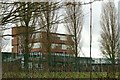
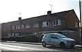
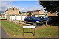
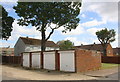
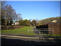
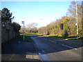
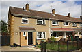
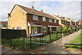
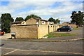
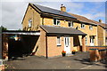
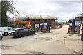
Photos of NN18 9AX

Area Information
NN18 9AX is a small residential cluster in Corby, Northamptonshire, a town designated as a new settlement in 1950. The area covers 9,555 m² and is home to 1,489 residents, making it one of the most densely populated places in England, with 155,839 people per square kilometre. Corby’s history is rooted in industry, particularly steel production, which shaped its growth from a village of 1,500 in 1931 to a town of 12,000 by 1939. Today, NN18 9AX reflects a mature community, with a median age of 47 and a population skewed toward adults aged 30–64. The area is characterised by a high proportion of owner-occupied homes (63%) and a predominantly White demographic. Living here means proximity to primary schools, rail links, and retail hubs, though the compact size means the community is tightly knit. The area’s industrial legacy persists in its infrastructure, but modern amenities like broadband rated 99/100 ensure connectivity for both work and daily life.
- Area Type
- Postcode
- Area Size
- 9555 m²
- Population
- 1489
- Population Density
- 2107 people/km²
NN18 9AX is predominantly an owner-occupied area, with 63% of homes owned by residents rather than rented. The accommodation type is primarily houses, which is uncommon in densely populated urban areas but aligns with Corby’s historical development as a working-class settlement. This suggests a housing stock that may be older, with potential for renovation or extension. The small size of the area (9,555 m²) means the property market is limited, and buyers should consider proximity to nearby towns like Kettering or Northampton for more options. The high proportion of owner-occupied homes indicates stability, but the lack of rental data means it is unclear whether the area attracts long-term residents or transient buyers. For those seeking a house in a compact, service-rich environment, NN18 9AX offers a distinct blend of affordability and proximity to essential amenities.
House Prices in NN18 9AX
Showing 42 properties
| Address | Type | Beds | Baths | Last Sale Price | Last Sale Date | |
|---|---|---|---|---|---|---|
| 74 Northbrook, Corby, NN18 9AX | Terraced | 3 | 1 | £170,000 | Nov 2025 | |
| 24 Northbrook, Corby, NN18 9AX | Terraced | 3 | 2 | £170,000 | Jul 2024 | |
| 66 Northbrook, Corby, NN18 9AX | Terraced | 3 | 1 | £190,000 | Aug 2022 | |
| 14 Northbrook, Corby, NN18 9AX | house | - | - | £158,000 | Nov 2020 | |
| 84 Northbrook, Corby, NN18 9AX | Flat | - | - | £85,000 | Jun 2020 | |
| 72 Northbrook, Corby, NN18 9AX | Semi-detached | 5 | - | £145,000 | Dec 2018 | |
| 12 Northbrook, Corby, NN18 9AX | house | 3 | 1 | £140,000 | Apr 2018 | |
| 2 Northbrook, Corby, NN18 9AX | house | 3 | 1 | £125,000 | Feb 2018 | |
| 60 Northbrook, Corby, NN18 9AX | house | - | - | £133,000 | Jul 2017 | |
| 58 Northbrook, Corby, NN18 9AX | Semi-detached | 3 | 1 | £132,500 | Jun 2017 |
Energy Efficiency in NN18 9AX
The lifestyle in NN18 9AX is defined by proximity to retail and transport hubs. Five notable retail venues include Morrisons Daily Corby, Morrisons Daily, and Morrisons Oakley, offering everyday shopping needs. The area’s rail links to Corby and Kettering, plus a bus interchange, ensure ease of movement for work or leisure. While the data does not mention parks or leisure facilities, the compact size of the area suggests a focus on convenience over expansive recreational spaces. Residents can access essential services within walking or short driving distance, though those seeking larger green spaces may need to travel to nearby towns. The mix of retail, transport, and proximity to schools creates a functional, if modest, lifestyle that prioritises accessibility and practicality.
Amenities
Schools
The area is served by three primary schools: Corby Kingswood Primary School, Kingswood Community Junior School, and Kingswood Primary Academy, which holds a ‘good’ Ofsted rating. These institutions provide a range of primary education options, though the absence of secondary schools nearby means students may need to commute to Corby or Kettering for further education. The concentration of primary schools suggests a focus on early education, which is beneficial for families with young children. However, the lack of data on secondary schooling or specialist provisions (such as grammar schools or academies) means buyers should investigate additional educational resources beyond the immediate area. The presence of three primary schools also implies a demand for local education, potentially influencing the area’s appeal to families.
| Rank | School | Type | Entry gender | Ages |
|---|
Explore more schools in this area
Go to Schools tabDemographics
The population of NN18 9AX is 1,489, with a median age of 47 and a majority of residents aged 30–64. This suggests a community of established professionals and families, with fewer young people or retirees compared to other areas. Home ownership is strong, at 63%, and the predominant accommodation type is houses, reflecting a preference for single-family living. The area’s predominant ethnic group is White, though the data does not specify further diversity metrics. The high population density—155,839 people per square kilometre—indicates a compact, possibly urbanised setting. While this density may mean limited green space, it also implies proximity to services and social networks. The age profile suggests a stable, low-turnover population, which can contribute to a sense of continuity and community cohesion.
Household Size
Accommodation Type
Tenure
Ethnic Group
Religion
Household Composition
Age
Household Deprivation
NS-SEC
Explore more demographic insights in this area
Go to Demographics tabPlanning
Planning Constraints
- Flood RiskPremium
- Ramsar Wetland SitesPremium
- Area of Outstanding Natural BeautyPremium
- Protected Nature ReservePremium
- Protected WoodlandPremium