Area Overview for NN18 8TY
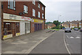
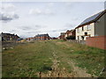
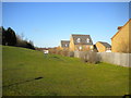
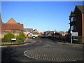
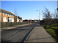
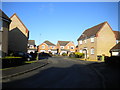
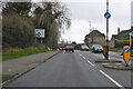
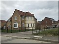
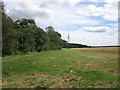
Photos of NN18 8TY


Area Information
NN18 8TY is a compact residential cluster in Corby, Northamptonshire, a town designated a new town in 1950. With a population of 1,887 spread over 8,510 square metres, the area has a population density of 221,730 people per square kilometre — an exceptionally high figure that reflects its small, tightly knit nature. Corby itself has a history rooted in industry, with its origins tracing back to the 8th century when Danish settlers named it “Kori’s by.” Today, the area is characterised by a mature demographic, with a median age of 47 and a majority of residents aged 30–64. Daily life here is shaped by its proximity to retail hubs like Tesco Corby and Lidl Central, as well as rail links to Corby and Kettering stations. The area’s low crime risk score (88/100) and flood risk (0/100) suggest a safe, stable environment. Despite its density, the community’s industrial heritage and modern amenities create a blend of practicality and convenience for residents.
- Area Type
- Postcode
- Area Size
- 8510 m²
- Population
- 1887
- Population Density
- 5558 people/km²
NN18 8TY is primarily an owner-occupied area, with 74% of homes owned by residents rather than rented. The accommodation type is predominantly houses, which is unusual for a small postcode area but aligns with Corby’s historical development as a working-class industrial town. This suggests a housing stock that is largely family-oriented, with larger properties suited to multi-generational living. However, the area’s compact size and high population density may limit availability for buyers, making it necessary to consider nearby postcode areas for more options. The focus on owner-occupation also implies a lower proportion of rental properties, which could affect the local property market’s responsiveness to demand. For buyers, the challenge lies in navigating the limited supply within the postcode itself, requiring a broader search in Corby’s surrounding neighbourhoods.
House Prices in NN18 8TY
Showing 17 properties
| Address | Type | Beds | Baths | Last Sale Price | Last Sale Date | |
|---|---|---|---|---|---|---|
| 23 Rydal Close, Corby, NN18 8TY | Detached | 3 | 2 | £270,000 | Jun 2025 | |
| 25 Rydal Close, Corby, NN18 8TY | Semi-detached | 3 | 1 | £255,000 | Aug 2024 | |
| 19 Rydal Close, Corby, NN18 8TY | Detached | 3 | 2 | £277,500 | Feb 2024 | |
| 4 Rydal Close, Corby, NN18 8TY | Detached | 4 | 3 | £356,000 | Oct 2023 | |
| 17 Rydal Close, Corby, NN18 8TY | house | - | - | £285,000 | Oct 2023 | |
| 6 Rydal Close, Corby, NN18 8TY | Detached | 3 | 2 | £295,000 | Jun 2023 | |
| 13 Rydal Close, Corby, NN18 8TY | house | - | - | £280,000 | Jun 2023 | |
| 1 Rydal Close, Corby, NN18 8TY | Detached | 3 | 3 | £295,000 | Nov 2022 | |
| 11 Rydal Close, Corby, NN18 8TY | Flat | - | - | £180,000 | Oct 2021 | |
| 2 Rydal Close, Corby, NN18 8TY | house | - | - | £229,995 | Mar 2018 |
Energy Efficiency in NN18 8TY
The lifestyle in NN18 8TY is shaped by its proximity to retail, transport, and community hubs. Within practical reach are five retail outlets, including Lidl Central, Tesco Oakley, and Tesco Corby, offering everyday shopping needs. The area’s two railway stations — Corby and Kettering — provide access to regional services, while a nearby bus interchange connects to local routes. Though the data does not mention parks or leisure facilities, the town’s historical focus on industry suggests a pragmatic, functional lifestyle. The high population density means amenities are closely clustered, reducing travel time for essentials. However, the absence of specific data on recreational spaces or dining options means the full character of leisure activities here remains unexplored. For residents, the balance of retail convenience and transport links creates a practical, if utilitarian, daily rhythm.
Amenities
Schools
| Rank | School | Type | Entry gender | Ages |
|---|
Explore more schools in this area
Go to Schools tabDemographics
The population of NN18 8TY is predominantly adults aged 30–64, with a median age of 47. This suggests a community of established professionals and families, rather than students or retirees. Home ownership is high at 74%, indicating a stable, long-term resident base. The area is largely composed of houses, not flats, which aligns with the demographic profile of older, settled households. The predominant ethnic group is White, though the data does not specify further diversity metrics. The population density of 221,730 people per square kilometre is exceptionally high for a residential area, which may influence the character of daily life, fostering a close-knit but potentially crowded environment. The absence of specific data on deprivation means this aspect remains unquantified, but the high home ownership and low crime risk suggest a relatively stable quality of life.
Household Size
Accommodation Type
Tenure
Ethnic Group
Religion
Household Composition
Age
Household Deprivation
NS-SEC
Explore more demographic insights in this area
Go to Demographics tabPlanning
Planning Constraints
- Flood RiskPremium
- Ramsar Wetland SitesPremium
- Area of Outstanding Natural BeautyPremium
- Protected Nature ReservePremium
- Protected WoodlandPremium