Area Overview for NN18 8NX
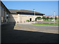
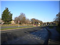
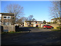
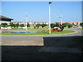
Photos of NN18 8NX


Area Information
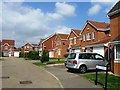
NN18 8NX is a small, densely populated residential cluster in Corby, Northamptonshire, with a population of 1,888 spread across just 1.2 hectares. This compact area reflects Corby’s historical role as a planned new town, established in 1950 to accommodate post-war industrial growth. The community here is characterised by a mature demographic, with a median age of 47 and a majority of residents aged 30–64. Most homes are owner-occupied, with 70% of households owning their properties, and the accommodation is predominantly houses rather than flats. Living here means navigating a tightly knit, high-density environment where proximity to amenities and transport is key. The area’s industrial heritage, once defined by steelworks, now gives way to a more residential character, though the town’s historical roots remain visible in local landmarks and events like the Corby Pole Fair. For buyers, this area offers a blend of practicality and connectivity, with nearby schools, retail, and rail links. However, the small size and high population density mean the housing stock is limited, requiring careful consideration of long-term needs.
- Area Type
- Postcode
- Area Size
- 1.2 hectares
- Population
- 1888
- Population Density
- 5359 people/km²
The property market in NN18 8NX is dominated by owner-occupied homes, with 70% of households owning their properties. This suggests a stable, long-term resident base rather than a rental-heavy market. The accommodation type is primarily houses, which may appeal to families or those seeking more space than flats. Given the area’s small size—just 1.2 hectares—and high population density, the housing stock is limited, making this a niche market for buyers. The compact nature of the area means properties are likely close to amenities and transport links, which could be a draw for those prioritising convenience. However, the limited availability of homes and the high density may also mean competition for properties, particularly for those seeking specific features. Buyers should consider the proximity to nearby towns and the potential for future development, though no data on planning or expansion is provided.
House Prices in NN18 8NX
Showing 37 properties
| Address | Type | Beds | Baths | Last Sale Price | Last Sale Date | |
|---|---|---|---|---|---|---|
| 27 Lavender Close, Corby, NN18 8NX | Detached | 4 | 2 | £327,500 | Jun 2025 | |
| 51 Lavender Close, Corby, NN18 8NX | Semi-detached | 3 | 2 | £226,250 | Mar 2025 | |
| 23 Lavender Close, Corby, NN18 8NX | Semi-detached | 5 | 2 | £280,000 | Mar 2025 | |
| 53 Lavender Close, Corby, NN18 8NX | Detached | 3 | 2 | £240,000 | Mar 2025 | |
| 39 Lavender Close, Corby, NN18 8NX | Terraced | 2 | 1 | £169,950 | Aug 2024 | |
| 31 Lavender Close, Corby, NN18 8NX | house | - | - | £305,000 | Mar 2022 | |
| 69 Lavender Close, Corby, NN18 8NX | house | - | - | £280,000 | Jan 2022 | |
| 35 Lavender Close, Corby, NN18 8NX | house | - | - | £200,000 | Oct 2021 | |
| 71 Lavender Close, Corby, NN18 8NX | Detached | 4 | 2 | £265,000 | Jun 2021 | |
| 67 Lavender Close, Corby, NN18 8NX | house | - | - | £224,500 | Oct 2019 |
Energy Efficiency in NN18 8NX
Residents of NN18 8NX have access to a range of nearby amenities, including five retail outlets such as Tesco Oakley, Morrisons Oakley, and Lidl Central, providing convenience for grocery shopping and daily essentials. The area is served by two rail stations—Corby and Kettering—and a bus interchange, ensuring reliable transport options for commuting or leisure. While the immediate vicinity lacks large-scale parks or leisure facilities, the proximity to Corby itself likely offers more extensive recreational opportunities. The retail options suggest a practical, community-focused lifestyle, with local shops meeting everyday needs. The rail links connect residents to broader networks, enabling access to cultural, professional, and social hubs beyond the immediate area. The combination of retail, transport, and proximity to Corby’s amenities creates a balanced lifestyle, though the small size of NN18 8NX means residents may need to venture slightly further for more diverse leisure options.
Amenities
Schools
The nearest school to NN18 8NX is Corby Primary Academy, a primary school with an Ofsted rating of outstanding. This indicates high-quality education for younger children, which is a significant draw for families. The absence of secondary schools in the immediate area means parents may need to consider commuting to nearby towns for secondary education, though Corby itself likely has secondary schools within a reasonable distance. The presence of a top-rated primary school suggests a focus on early education, potentially attracting families prioritising academic standards. However, the data does not specify the number of schools or their types beyond this one, so the full range of educational options remains unclear. For families relying on local schools, the quality of Corby Primary Academy is a strong positive, though secondary education planning would require further research.
| Rank | School | Type | Entry gender | Ages |
|---|
Explore more schools in this area
Go to Schools tabDemographics
The community in NN18 8NX is predominantly composed of adults aged 30–64, with a median age of 47. This suggests a settled, mature population, likely with established careers and families. Home ownership is high at 70%, indicating a stable residential base rather than a transient rental market. The area is largely composed of houses, with no data on flats or other property types. The predominant ethnic group is White, though no specific data on diversity or deprivation is provided. The population density of 163,087 people per square kilometre is exceptionally high, implying a compact, densely packed environment. This density may influence daily life, with limited private space and a strong emphasis on shared amenities. The age profile suggests a community with a mix of middle-aged professionals and retirees, potentially creating a balanced social dynamic. However, the lack of data on income distribution or deprivation means the quality of life in terms of access to services or economic hardship cannot be fully assessed from the available information.
Household Size
Accommodation Type
Tenure
Ethnic Group
Religion
Household Composition
Age
Household Deprivation
NS-SEC
Explore more demographic insights in this area
Go to Demographics tabPlanning
Planning Constraints
- Flood RiskPremium
- Ramsar Wetland SitesPremium
- Area of Outstanding Natural BeautyPremium
- Protected Nature ReservePremium
- Protected WoodlandPremium