Area Overview for NN18 8NS
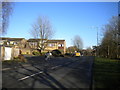
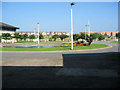
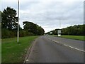
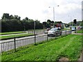
Photos of NN18 8NS


Area Information
NN18 8NS is a small residential cluster in Corby, Northamptonshire, covering just 3.5 hectares. With a population of 1,507 and a density of 42,742 people per square kilometre, this area is compact yet densely populated. It sits within Corby, a town designated a new town in 1950, known for its industrial heritage rooted in steel production. The area’s proximity to historical sites and modern amenities makes it a blend of past and present. Daily life here is shaped by its tight-knit community and access to essential services. While the postcode’s size is limited, its strategic location near rail links and retail hubs adds practicality. The area’s demographics reflect a mature population, with a median age of 47 and a strong presence of owner-occupied homes. For buyers, this means a stable, family-oriented environment with a focus on housing rather than rental properties. The low flood risk and absence of protected natural sites suggest a straightforward planning landscape, though the moderate crime risk warrants standard security measures. Living here offers a mix of convenience and historical context, ideal for those seeking a settled, community-driven lifestyle.
- Area Type
- Postcode
- Area Size
- 3.5 hectares
- Population
- 1507
- Population Density
- 3251 people/km²
The property market in NN18 8NS is characterised by high home ownership (70%) and a focus on houses rather than flats or apartments. This suggests a market skewed towards owner-occupied properties, with limited rental availability. The small area size (3.5 hectares) means the housing stock is constrained, potentially leading to competition among buyers. The prevalence of houses indicates a preference for family homes, which may appeal to those seeking space and privacy. However, the compact nature of the postcode means buyers should consider nearby areas for additional options. The lack of specific data on property prices or trends means the market’s dynamics are not fully defined, but the high ownership rate implies a stable, long-term resident base. For buyers, this area offers a chance to secure a home in a densely populated yet historically significant town, though proximity to Corby’s broader infrastructure may be necessary for larger needs.
House Prices in NN18 8NS
Showing 8 properties
| Address | Type | Beds | Baths | Last Sale Price | Last Sale Date | |
|---|---|---|---|---|---|---|
| 1 Bies Close, Corby, NN18 8NS | house | 3 | 2 | £303,000 | Aug 2022 | |
| 9 Bies Close, Corby, NN18 8NS | Detached | 4 | 2 | £280,000 | Feb 2021 | |
| 2 Bies Close, Corby, NN18 8NS | Detached | 4 | - | £245,000 | Dec 2016 | |
| 6 Bies Close, Corby, NN18 8NS | house | - | - | £124,500 | Feb 2002 | |
| 4 Bies Close, Corby, NN18 8NS | Detached | - | - | £109,950 | Feb 2002 | |
| 3 Bies Close, Corby, NN18 8NS | Semi-detached | 4 | 2 | £85,995 | Jan 2002 | |
| 5 Bies Close, Corby, NN18 8NS | Detached | - | - | £124,500 | Jan 2002 | |
| 7 Bies Close, Corby, NN18 8NS | Detached | 4 | 2 | £124,500 | Dec 2001 |
Energy Efficiency in NN18 8NS
Residents of NN18 8NS benefit from nearby amenities that cater to daily needs. Retail options include Morrisons Oakley, Tesco Oakley, and Morrisons Daily Corby, providing access to groceries and general shopping. The area’s proximity to Corby Railway Station and Kettering Railway Station, along with a bus interchange, ensures ease of travel for work, leisure, or shopping trips. While the postcode itself is small, its integration with Corby’s broader infrastructure means residents can access a wider range of services. The retail presence suggests convenience for household essentials, though dining and leisure options are likely concentrated in Corby’s town centre. The combination of retail and transport links creates a practical lifestyle, balancing local convenience with regional connectivity. For those prioritising accessibility, the area’s amenities are sufficient, though further exploration of Corby’s offerings may be necessary for more diverse experiences.
Amenities
Schools
Residents of NN18 8NS have access to two notable schools: Brooke Weston CTC, a secondary school, and Brooke Weston Academy, an academy with a good Ofsted rating. The presence of both a traditional secondary school and a specialist academy offers families a choice between established educational models and innovative teaching approaches. The good rating at Brooke Weston Academy suggests a school that meets or exceeds national standards in teaching quality and student outcomes. These institutions are likely to serve the broader Corby area, though their proximity to the postcode means they are accessible to local residents. The mix of school types may cater to different educational preferences, from structured curricula to more flexible, academically focused environments. For families prioritising school quality, the good-rated academy provides reassurance, while the secondary school offers a conventional option.
| Rank | School | Type | Entry gender | Ages |
|---|
Explore more schools in this area
Go to Schools tabDemographics
The community in NN18 8NS is predominantly composed of adults aged 30–64, with a median age of 47. This suggests a mature population, likely with established careers and families. Home ownership is high at 70%, indicating a stable, long-term resident base rather than a transient rental market. The area’s accommodation is primarily houses, reflecting a preference for single-family living over flats or apartments. The predominant ethnic group is White, which aligns with broader trends in the region. The population density of 42,742 people per square kilometre is exceptionally high for such a small area, implying a mix of multi-generational households and closely packed housing. This density may influence local services and infrastructure, though the absence of specific deprivation data means quality of life remains unquantified. The demographic profile suggests a community focused on stability, with fewer young families or students compared to other areas.
Household Size
Accommodation Type
Tenure
Ethnic Group
Religion
Household Composition
Age
Household Deprivation
NS-SEC
Explore more demographic insights in this area
Go to Demographics tabPlanning
Planning Constraints
- Flood RiskPremium
- Ramsar Wetland SitesPremium
- Area of Outstanding Natural BeautyPremium
- Protected Nature ReservePremium
- Protected WoodlandPremium