Area Overview for NN18 8HU
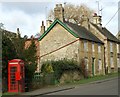
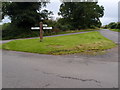
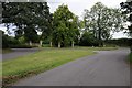
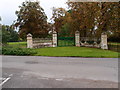
Photos of NN18 8HU

Area Information
Living in NN18 8HU means being part of a tightly knit residential cluster in Corby, Northamptonshire. The area spans just 2.3 hectares, housing 2,292 people in a densely packed layout, with a population density of 100,027 per square kilometre. This makes it one of the most compact postcode areas in the UK. Corby itself is a town with a distinct industrial heritage, designated a new town in 1950 to accommodate workers for the Stewarts & Lloyds steelworks. Today, NN18 8HU reflects a mature community, with a median age of 47 and a population skewed towards adults aged 30–64. Daily life here is shaped by proximity to retail, transport, and the town’s historical roots. Residents benefit from nearby railway stations, including Corby and Kettering, and a mix of local shops such as Aldi Oakley and Morrisons. The area’s compact size means amenities are within practical reach, though its small footprint also means space is limited, with homes predominantly owner-occupied.
- Area Type
- Postcode
- Area Size
- 2.3 hectares
- Population
- 2292
- Population Density
- 2406 people/km²
The property market in NN18 8HU is characterised by a high rate of home ownership—60% of residents own their homes—and a focus on houses rather than flats or apartments. This suggests a community of long-term residents rather than a rental-heavy area. The compact nature of the postcode, covering just 2.3 hectares, means the housing stock is limited, with little scope for new developments. Buyers should consider the proximity to amenities such as Corby Railway Station and local shops, which enhance the area’s appeal. However, the small size of the area may also mean competition for available properties. The predominance of owner-occupied homes indicates a stable market, but the lack of rental properties could make it challenging for those seeking flexibility. For buyers, the key considerations are the limited land area and the need to balance proximity to transport and retail with the constraints of a densely populated postcode.
House Prices in NN18 8HU
Showing 20 properties
| Address | Type | Beds | Baths | Last Sale Price | Last Sale Date | |
|---|---|---|---|---|---|---|
| 12 Horselease Close, Gt Oakley, Corby, NN18 8HU | Detached | 3 | 2 | £253,000 | Jun 2025 | |
| 17 Horselease Close, Gt Oakley, Corby, NN18 8HU | Semi-detached | 2 | 1 | £193,000 | Oct 2024 | |
| 2 Horselease Close, Gt Oakley, Corby, NN18 8HU | Semi-detached | 3 | 1 | £234,000 | Aug 2023 | |
| 8 Horselease Close, Gt Oakley, Corby, NN18 8HU | house | - | - | £215,000 | May 2022 | |
| 3 Horselease Close, Gt Oakley, Corby, NN18 8HU | Semi-detached | 3 | 1 | £230,000 | Apr 2022 | |
| 4 Horselease Close, Gt Oakley, Corby, NN18 8HU | house | - | - | £230,000 | Jul 2021 | |
| 1 Horselease Close, Gt Oakley, Corby, NN18 8HU | house | - | - | £168,000 | Jun 2019 | |
| 7 Horselease Close, Gt Oakley, Corby, NN18 8HU | house | 2 | - | £140,000 | Apr 2018 | |
| 14 Horselease Close, Gt Oakley, Corby, NN18 8HU | Semi-detached | 3 | - | £160,000 | Jul 2016 | |
| 20 Horselease Close, Gt Oakley, Corby, NN18 8HU | house | - | - | £228,000 | Oct 2013 |
Energy Efficiency in NN18 8HU
Residents of NN18 8HU have access to a range of local amenities, including five retail outlets such as Aldi Oakley and Morrisons Daily Corby Gateway, which provide everyday shopping needs. The area’s proximity to Corby Railway Station and Kettering Railway Station, along with a bus interchange, ensures convenient travel for commuting or leisure. While the data does not mention parks or recreational facilities, the presence of nearby retail and transport hubs suggests a practical, community-focused lifestyle. The compact nature of the postcode means amenities are within walking or short driving distance, though the lack of green spaces or leisure venues is not specified. The mix of shops and transport links supports a self-contained lifestyle, making it suitable for those prioritising convenience over expansive recreational options.
Amenities
Schools
| Rank | School | Type | Entry gender | Ages |
|---|
Explore more schools in this area
Go to Schools tabDemographics
The community in NN18 8HU is predominantly middle-aged, with a median age of 47 and the largest age group being adults aged 30–64. Home ownership is strong, with 60% of residents owning their homes, and the primary accommodation type is houses. The predominant ethnic group is White, though no specific diversity data is provided. The high population density—100,027 people per square kilometre—suggests a compact, possibly multi-generational living environment. This density may influence local services and infrastructure, but the data does not indicate deprivation levels. The age profile suggests a stable population with established households, which could mean a quieter, less transient community compared to areas with younger demographics. However, the lack of data on household composition or diversity limits further analysis of the social fabric.
Household Size
Accommodation Type
Tenure
Ethnic Group
Religion
Household Composition
Age
Household Deprivation
NS-SEC
Explore more demographic insights in this area
Go to Demographics tabPlanning
Planning Constraints
- Flood RiskPremium
- Ramsar Wetland SitesPremium
- Area of Outstanding Natural BeautyPremium
- Protected Nature ReservePremium
- Protected WoodlandPremium