Area Overview for NN18 8HL
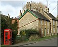
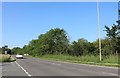
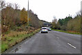
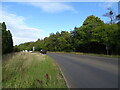
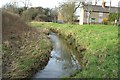
Photos of NN18 8HL

Area Information
Living in NN18 8HL, a small residential cluster in Corby, Northamptonshire, means inhabiting a compact, densely populated area with a distinct character. The postcode covers 1.4 hectares and is home to 1,381 residents, translating to a population density of 1,137 people per square kilometre. This is a place shaped by its industrial heritage, with Corby designated a new town in 1950 to accommodate post-war growth. The area’s compact size means residents live closely together, with a mix of historic and modern influences. The median age of 47 suggests a community of established adults, predominantly in the 30–64 age range, many of whom own their homes. While the area lacks natural designations like AONB or protected woodlands, its proximity to transport hubs and retail amenities offers practical convenience. However, a medium flood risk score of 22.69 indicates residents should consider flood defences. Despite this, the area’s low crime risk—scoring 90/100—suggests a generally safe environment. NN18 8HL is a microcosm of Corby’s transformation from a steelworks town to a settled residential area with a focus on everyday practicality.
- Area Type
- Postcode
- Area Size
- 1.4 hectares
- Population
- 1381
- Population Density
- 1137 people/km²
The property market in NN18 8HL is dominated by owner-occupied homes, with 90% of residents owning their properties. This high rate of home ownership indicates a stable, long-term community rather than a transient rental market. The accommodation type is predominantly houses, which is unusual for a small postcode area but may reflect the historical development of Corby as an industrial town with larger residential plots. Given the area’s compact size—just 1.4 hectares—housing stock is likely limited, meaning buyers must consider nearby areas for more options. The high home ownership rate also suggests strong local demand, potentially leading to competitive pricing. However, the area’s small size and focus on houses may mean limited availability for buyers seeking flats or shared housing. For those prioritising security and a settled community, NN18 8HL’s property market offers a mix of practicality and stability, though its narrow footprint may require careful consideration of broader regional opportunities.
House Prices in NN18 8HL
Showing 7 properties
| Address | Type | Beds | Baths | Last Sale Price | Last Sale Date | |
|---|---|---|---|---|---|---|
| 1 Field Cottages, Great Oakley, Corby, NN18 8HL | Semi-detached | 2 | 1 | £235,000 | May 2017 | |
| 6 Field Cottages, Great Oakley, Corby, NN18 8HL | house | - | - | £270,000 | Jan 2013 | |
| 3 Field Cottages, Great Oakley, Corby, NN18 8HL | house | 2 | 1 | - | - | |
| 5 Field Cottages, Great Oakley, Corby, NN18 8HL | Semi-detached | - | - | - | - | |
| 2 Field Cottages, Great Oakley, Corby, NN18 8HL | house | - | - | - | - | |
| 4 Field Cottages, Great Oakley, Corby, NN18 8HL | house | - | - | - | - | |
| Annexe At, 6 Field Cottages, Great Oakley, Corby, NN18 8HL | Bungalow | - | - | - | - |
Energy Efficiency in NN18 8HL
Daily life in NN18 8HL is shaped by its proximity to essential amenities. Within practical reach are five retail outlets, including Aldi Oakley, Morrisons Oakley, and Morrisons Daily Corby Gateway, providing access to groceries and everyday essentials. The area’s transport network includes Corby and Kettering Railway Stations, offering links to regional hubs, while a nearby bus interchange facilitates local travel. Although the area lacks parks or leisure facilities, its retail and transport options ensure convenience for residents. The compact layout means amenities are closely clustered, reducing the need for long commutes. However, the absence of detailed information about dining or recreational venues suggests a focus on functional rather than leisurely living. For those prioritising practicality, NN18 8HL’s amenities meet basic needs, but those seeking a broader range of lifestyle options may need to look beyond the immediate postcode. The area’s character is one of efficiency, with services tailored to a mature, settled population.
Amenities
Schools
| Rank | School | Type | Entry gender | Ages |
|---|
Explore more schools in this area
Go to Schools tabDemographics
The community in NN18 8HL is defined by its age profile, with a median age of 47 and a majority of residents aged 30–64. This suggests a mature, stable population, likely with long-term ties to the area. Home ownership is exceptionally high at 90%, reflecting a community of property owners rather than renters. The accommodation type is predominantly houses, which aligns with the area’s compact layout and density. The predominant ethnic group is White, though specific diversity data is not provided. With 1,381 residents in 1.4 hectares, the population density of 1,137 people per square kilometre indicates a closely knit, perhaps even tightly packed, neighbourhood. This density may influence the character of daily life, with shared spaces and a sense of proximity. The absence of detailed deprivation data means quality of life factors like access to services or employment opportunities are not quantified here, but the high home ownership and low crime risk suggest a reasonably secure, self-contained community.
Household Size
Accommodation Type
Tenure
Ethnic Group
Religion
Household Composition
Age
Household Deprivation
NS-SEC
Explore more demographic insights in this area
Go to Demographics tabPlanning
Planning Constraints
- Flood RiskPremium
- Ramsar Wetland SitesPremium
- Area of Outstanding Natural BeautyPremium
- Protected Nature ReservePremium
- Protected WoodlandPremium