Area Overview for NN18 8GH
Photos of NN18 8GH

Area Information
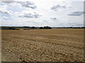
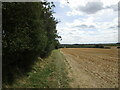
NN18 8GH is a small, tightly knit residential area in England, covering just 5.9 hectares and home to 1643 residents. With a population density of 82 people per square kilometre, it’s a quiet, low-rise community where most properties are houses. The area’s compact size means it’s easy to navigate on foot, and its proximity to nearby towns like Corby and Kettering offers access to broader amenities without the hustle of a larger city. The median age of 47 suggests a mature, stable population, with the majority of residents falling within the 30-64 age range. This demographic likely contributes to the area’s calm, family-oriented atmosphere. While there are no major landmarks or tourist attractions, the simplicity of NN18 8GH appeals to those seeking a peaceful, manageable lifestyle. The low flood risk and absence of environmental constraints make it a practical choice for buyers prioritising safety and planning certainty. For those looking to settle in a place where community ties are strong and daily life moves at a relaxed pace, this postcode offers a straightforward, no-frills alternative to more densely populated zones.
- Area Type
- Postcode
- Area Size
- 5.9 hectares
- Population
- 1643
- Population Density
- 82 people/km²
The property market in NN18 8GH is characterised by a high rate of home ownership—76% of residents own their homes—which suggests a stable, long-term community rather than a rental-heavy area. The accommodation type is predominantly houses, which is typical of smaller, low-density postcodes. This means the housing stock is likely to be more varied in size and style than in high-rise or apartment-dominated areas. For buyers, this presents an opportunity to find homes that are spacious and private, though the small area size of 5.9 hectares means the number of properties available is limited. The absence of planning constraints such as protected woodlands or areas of outstanding natural beauty may also make development more straightforward, though the data does not confirm current building activity. The market is likely to appeal to those seeking a quiet, established home with minimal environmental risk, though the small footprint of the area means buyers should consider proximity to nearby towns for additional services.
House Prices in NN18 8GH
No properties found in this postcode.
Energy Efficiency in NN18 8GH
The lifestyle in NN18 8GH is shaped by its proximity to essential retail and transport hubs. Within practical reach are three Tesco stores—Little, Corby, and Oakley—offering everyday shopping convenience. The area’s rail stations at Corby and Kettering connect residents to broader networks, while a nearby bus interchange provides additional local transport options. Though the data does not mention parks or leisure facilities, the low population density and absence of environmental constraints suggest space for informal outdoor activities. The compact nature of the area means amenities are accessible without long commutes, supporting a lifestyle that balances local convenience with the ability to travel further for more specialised services. The mix of retail and transport options ensures daily life remains functional, though residents may need to venture slightly beyond the postcode for more diverse leisure opportunities.
Amenities
Schools
The nearest school to NN18 8GH is Geddington Church of England Primary School, which serves the local community with a good Ofsted rating. This primary school is the only educational institution listed in the data, meaning families in the area must rely on nearby towns for secondary education. The presence of a well-rated primary school is a positive factor for families with young children, though the lack of secondary schools within the immediate vicinity may require commuting. The school’s good rating suggests it provides a reliable foundation for early education, but parents should investigate further to understand the full range of educational options available. For those prioritising schools, the proximity to Geddington Church of England Primary School is a key consideration, though the absence of other schools in the data indicates the area is not a hub for larger educational institutions.
| Rank | School | Type | Entry gender | Ages |
|---|---|---|---|---|
| 1 | Geddington Church of England Primary School | primary | N/A | N/A |
Explore more schools in this area
Go to Schools tabDemographics
The residents of NN18 8GH are predominantly adults aged 30-64, with a median age of 47. This suggests a population that is largely in their prime working years, with many likely to be established in careers or retired. Home ownership is high, at 76%, indicating a community of long-term residents rather than a transient rental market. The accommodation type is primarily houses, which aligns with the area’s low density and residential character. The predominant ethnic group is White, though the data does not provide further breakdowns of diversity. The population density of 82 people per square kilometre is low, which may contribute to a sense of space and privacy for residents. With no specific data on deprivation levels, it’s reasonable to infer that the area’s stability and safety—reflected in its low crime risk—support a quality of life that is consistent with its demographic profile. The mix of ages and ownership rates suggests a community that values continuity and security over rapid change.
Household Size
Accommodation Type
Tenure
Ethnic Group
Religion
Household Composition
Age
Household Deprivation
NS-SEC
Explore more demographic insights in this area
Go to Demographics tabPlanning
Planning Constraints
- Flood RiskPremium
- Ramsar Wetland SitesPremium
- Area of Outstanding Natural BeautyPremium
- Protected Nature ReservePremium
- Protected WoodlandPremium
- Crime RiskPremium