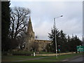
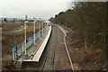
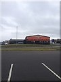
Area Overview for NN18 8ES
Photos of NN18 8ES
Area Information
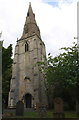
NN18 8ES lies within the town of Corby in Northamptonshire, a historically industrialised settlement designated a new town in 1950. This postcode area covers just 1.4 hectares, housing 1,873 residents in a compact residential cluster. The population density of 620 people per square kilometre reflects a tightly knit community, with a median age of 47 and a majority of adults aged 30–64. Daily life here is shaped by its proximity to Corby’s infrastructure, including its railway station and retail hubs. While the area lacks natural conservation designations, it benefits from modern connectivity, with broadband scores rated excellent (93/100) and mobile coverage good (83/100). The presence of Corby Old Village Primary School, rated ‘good’ by Ofsted, suggests a focus on family-oriented living. However, the area’s small size means amenities are limited to immediate surroundings, requiring residents to travel for broader services. Its history as a steelworks town still influences the local economy, though modern retail and transport options now define its character.
- Area Type
- Postcode
- Area Size
- 1.4 hectares
- Population
- 1873
- Population Density
- 620 people/km²
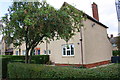
The property market in NN18 8ES is characterised by a 43% home ownership rate, suggesting that nearly half of properties are rented. The area is dominated by houses rather than flats or apartments, reflecting a preference for traditional housing stock. Given the small size of the postcode (1.4 hectares), the housing stock is limited, and buyers may need to consider nearby areas for more options. The low home ownership rate implies a significant rental market, which could affect property values and availability. For buyers, this means competition may be fierce, particularly for family homes. The absence of flats or apartments may also limit choices for those seeking alternative housing types. The compact nature of the area means that proximity to amenities like the railway station and retail outlets is a key selling point, though residents may need to travel further for broader services.
House Prices in NN18 8ES
Showing 10 properties
| Address | Type | Beds | Baths | Last Sale Price | Last Sale Date | |
|---|---|---|---|---|---|---|
| 16 Stanion Lane, Corby, NN18 8ES | Detached | 8 | 4 | £305,000 | Feb 2024 | |
| 14 Stanion Lane, Corby, NN18 8ES | Detached | 4 | 1 | £410,000 | May 2022 | |
| 13 Stanion Lane, Corby, NN18 8ES | house | - | - | £130,000 | Nov 2019 | |
| 17 Stanion Lane, Corby, NN18 8ES | house | 5 | - | £530,000 | Nov 2018 | |
| 18 Stanion Lane, Corby, NN18 8ES | Detached | 3 | 2 | £360,000 | Aug 2006 | |
| 15 Stanion Lane, Corby, NN18 8ES | Detached | 3 | 2 | £79,000 | Oct 1997 | |
| 7 Stanion Lane, Corby, NN18 8ES | Detached | 4 | - | - | - | |
| 5 Stanion Lane, Corby, NN18 8ES | Terraced | - | - | - | - | |
| 11 Stanion Lane, Corby, NN18 8ES | house | - | - | - | - | |
| 9 Stanion Lane, Corby, NN18 8ES | Terraced | - | - | - | - |
Energy Efficiency in NN18 8ES
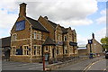
The lifestyle in NN18 8ES is shaped by its proximity to retail and transport hubs. Nearby, Iceland Corby, Tesco Corby, and M&S Corby offer essential shopping and dining options, making daily errands convenient. The area’s compact size means these amenities are within practical reach, though larger leisure or entertainment facilities are likely located further afield. The railway station provides access to broader services and social opportunities beyond Corby. While the data does not mention parks or recreational spaces, the absence of protected natural areas suggests a focus on urban living rather than green spaces. The convenience of retail and transport infrastructure supports a practical, community-oriented lifestyle, though residents may seek additional leisure options outside the immediate area.
Amenities
Schools
The nearest school to NN18 8ES is Corby Old Village Primary School, which serves the local community with a ‘good’ Ofsted rating. This primary school is a key asset for families, offering a solid foundation for early education. However, the data does not list secondary schools or further education institutions within the immediate vicinity, which may require residents to travel to nearby areas for comprehensive schooling. The presence of a well-rated primary school suggests a focus on family-friendly living, though the absence of higher education facilities could be a consideration for parents planning long-term. The school’s rating indicates acceptable standards, but it does not provide information on class sizes, resources, or specialist facilities.
| Rank | School | Type | Entry gender | Ages |
|---|
Explore more schools in this area
Go to Schools tabDemographics
The population of NN18 8ES is predominantly middle-aged, with a median age of 47 and 62% of residents falling within the 30–64 age range. Home ownership stands at 43%, indicating a mix of owner-occupied and rental properties. The area is largely composed of houses, with no flats or apartments recorded. The predominant ethnic group is White, reflecting the broader demographic of Corby. With a population density of 620 people per square kilometre, the community is moderately compact but not overcrowded. This density may influence local services and amenities, though the data does not specify deprivation levels. The age profile suggests a stable, working-age population, which could affect demand for schools and healthcare. The relatively low home ownership rate may indicate a higher proportion of renters, potentially impacting property market dynamics.
Household Size
Accommodation Type
Tenure
Ethnic Group
Religion
Household Composition
Age
Household Deprivation
NS-SEC
Explore more demographic insights in this area
Go to Demographics tabPlanning
Planning Constraints
- Flood RiskPremium
- Ramsar Wetland SitesPremium
- Area of Outstanding Natural BeautyPremium
- Protected Nature ReservePremium
- Protected WoodlandPremium