Area Overview for NN18 8AR
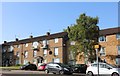
Photos of NN18 8AR


Area Information
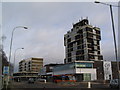
NN18 8AR lies within Corby, a town in Northamptonshire designated a new town in 1950. This postcode area covers 1.6 hectares, housing 1,634 residents in a densely packed residential cluster. Corby’s history is steeped in industry, with its origins tracing back to the 8th century and a name derived from “Kori’s settlement” by Danish invaders. The town’s modern identity was forged by Stewarts & Lloyds’ steelworks, which transformed it from a village of 1,500 to a bustling hub by 1939. Today, NN18 8AR reflects a mature community, with a median age of 47 and a population density of 104,033 people per square kilometre. Daily life here is shaped by proximity to essential services, including multiple primary schools, retail outlets, and transport links. The area’s compact size means residents are within walking distance of amenities, though the high population density may influence the pace of life. For those seeking a mix of historical legacy and modern convenience, NN18 8AR offers a distinct slice of Corby’s evolving character.
- Area Type
- Postcode
- Area Size
- 1.6 hectares
- Population
- 1634
- Population Density
- 4709 people/km²
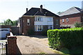
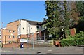
The property market in NN18 8AR is characterised by a 42% home ownership rate, with houses being the predominant accommodation type. This suggests a community where owner-occupation is common, though the relatively low ownership rate indicates a significant portion of the housing stock may be rented. The area’s small size—just 1.6 hectares—means the housing stock is limited, potentially creating competition among buyers. Given the high population density, properties are likely to be closely spaced, with little scope for large developments. For prospective buyers, this small area’s immediate surroundings may offer limited alternatives, making location and proximity to amenities critical factors. The predominance of houses over flats or apartments also implies a preference for traditional, family-oriented housing, which may appeal to those seeking stability in a mature community.
House Prices in NN18 8AR
No properties found in this postcode.
Energy Efficiency in NN18 8AR
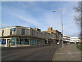
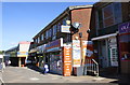
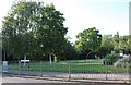
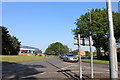
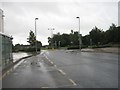
The lifestyle in NN18 8AR is shaped by its proximity to retail, transport, and community hubs. Nearby amenities include Lidl Central, Iceland Corby, and Farmfoods Corby, offering essential shopping and grocery needs within practical reach. The Corby Railway Station and bus interchange provide easy access to regional travel, while the compact layout of the area ensures that daily errands can be completed on foot or by bike. Though the data does not mention parks or leisure facilities, the presence of multiple schools and retail outlets suggests a focus on practical living over expansive recreational spaces. The area’s industrial heritage may influence its character, but the availability of local services and transport links makes it convenient for residents seeking a balance between community and accessibility.
Amenities
Schools
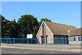
Residents of NN18 8AR have access to several primary schools, including Exeter Primary School, Exeter Junior School, Queen Elizabeth School, and Corby Community College. A Learning Community Academy, an academy school, also serves the area. The presence of multiple primary schools suggests a strong focus on early education, with options for both state and academy-led institutions. For families, this diversity allows for choices based on educational preferences, though the absence of secondary schools in the immediate vicinity may necessitate commuting. The concentration of primary schools aligns with the area’s demographic profile, which includes a significant proportion of working-age adults and likely a growing number of school-age children. Parents may find the proximity of these schools a key advantage, though the lack of data on Ofsted ratings means outcomes remain unverified.
| Rank | School | Type | Entry gender | Ages |
|---|---|---|---|---|
| 1 | Exeter Primary School | primary | N/A | N/A |
| 2 | Exeter Junior School | primary | N/A | N/A |
| 3 | Queen Elizabeth School | primary | N/A | N/A |
| 4 | Corby Community College | primary | N/A | N/A |
| 5 | Exeter - A Learning Community Academy | academy | N/A | N/A |
Explore more schools in this area
Go to Schools tabDemographics
The community in NN18 8AR is predominantly composed of adults aged 30–64, with a median age of 47. Home ownership stands at 42%, indicating a mix of owner-occupied and rental properties. The area is primarily inhabited by White residents, reflecting broader demographic trends in Corby. The high population density of 104,033 people per square kilometre suggests a compact, tightly knit neighbourhood where social interactions are frequent. However, this density may also contribute to challenges such as limited private space and competition for local amenities. The age profile suggests a stable, working-age population, which aligns with the presence of nearby schools and employment opportunities linked to the town’s industrial heritage. For buyers, this demographic profile implies a community focused on practical living, with needs centred on education, transport, and accessible services rather than luxury or novelty.
Household Size
Accommodation Type
Tenure
Ethnic Group
Religion
Household Composition
Age
Household Deprivation
NS-SEC
Explore more demographic insights in this area
Go to Demographics tabPlanning
Planning Constraints
- Flood RiskPremium
- Ramsar Wetland SitesPremium
- Area of Outstanding Natural BeautyPremium
- Protected Nature ReservePremium
- Protected WoodlandPremium
- Crime RiskPremium