Area Overview for NN18 0TP
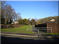
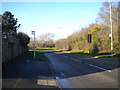
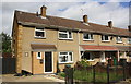
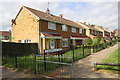
Photos of NN18 0TP

Area Information
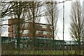
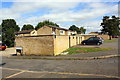
NN18 0TP is a compact residential cluster in Corby, Northamptonshire, a town designated as a new town in 1950. The area spans 4.3 hectares and is densely populated, with 2064 residents per square kilometre. This small postcode sits within Corby’s industrial heartland, a town that transformed from a village of 1,500 in 1931 to a bustling hub after Stewarts & Lloyds built a steelworks in 1934. Today, NN18 0TP reflects a mature community, with a median age of 47 and a predominance of households aged 30–64. Its proximity to Corby Railway Station and Kettering offers easy access to regional transport networks. The area’s character is shaped by its history as a steelmaking centre, though modern life here is defined by proximity to retail outlets like Morrisons Daily and a mix of primary and secondary schools. Living in NN18 0TP means navigating a tightly knit, high-density environment with a focus on practicality, where daily life is influenced by the town’s industrial legacy and modern infrastructure.
- Area Type
- Postcode
- Area Size
- 4.3 hectares
- Population
- 2064
- Population Density
- 3226 people/km²
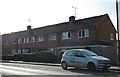
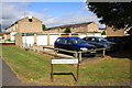
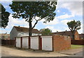
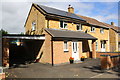
NN18 0TP is a predominantly owner-occupied area, with 74% of homes owned by residents rather than rented. The accommodation type is exclusively houses, which is unusual for a high-density postcode but reflects the area’s historical development as a working-class settlement. The compact size of the area—just 4.3 hectares—means the housing stock is limited, with little scope for new builds. This scarcity could make the property market competitive, particularly for buyers seeking larger homes or investment opportunities. The high home ownership rate suggests a stable, long-term resident base, which may contribute to property value retention. However, the small size of the area means buyers should consider nearby suburbs for more options. The mix of houses and high density also indicates a focus on practical, family-oriented living, with homes likely to be well-maintained and suited to the needs of the local demographic.
House Prices in NN18 0TP
Showing 88 properties
| Address | Type | Beds | Baths | Last Sale Price | Last Sale Date | |
|---|---|---|---|---|---|---|
| 22 Spiers Close, Corby, NN18 0TP | Semi-detached | 3 | 1 | £98,000 | Dec 2024 | |
| 127 Spiers Close, Corby, NN18 0TP | Semi-detached | 3 | 1 | £96,000 | Apr 2024 | |
| 91 Spiers Close, Corby, NN18 0TP | Retail | 2 | 1 | £80,000 | Aug 2022 | |
| 42 Spiers Close, Corby, NN18 0TP | house | - | - | £76,000 | May 2022 | |
| 89 Spiers Close, Corby, NN18 0TP | house | - | - | £82,000 | Sep 2020 | |
| 34 Spiers Close, Corby, NN18 0TP | house | - | - | £75,375 | Aug 2020 | |
| 119 Spiers Close, Corby, NN18 0TP | house | - | - | £82,000 | Jun 2020 | |
| 131 Spiers Close, Corby, NN18 0TP | house | - | - | £123,750 | Mar 2020 | |
| 69 Spiers Close, Corby, NN18 0TP | Detached | 2 | 1 | - | - | |
| 105 Spiers Close, Corby, NN18 0TP | house | - | - | - | - |
Energy Efficiency in NN18 0TP
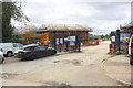
Residents of NN18 0TP have access to essential retail amenities, including Morrisons Daily stores in Corby and Oakley, which provide grocery and daily necessities. The area’s proximity to rail stations and a bus interchange enhances mobility, making it easier to reach larger towns like Kettering or Northampton for leisure, dining, or shopping. While the data does not list specific parks or recreational facilities, the town’s industrial past suggests limited green spaces. The presence of multiple schools and retail outlets indicates a focus on practicality over leisure. For those prioritising convenience, the area’s compact size means amenities are within walking or short driving distance. However, buyers should consider whether the lack of detailed information on parks or cultural venues aligns with their lifestyle preferences.
Amenities
Schools
Residents of NN18 0TP have access to a range of primary and secondary schools. Nearby primary schools include Beanfield Infant School, Beanfield Junior School, The Kingswood School, and Beanfield Primary School, offering multiple options for younger children. The Our Lady and Pope John Catholic Secondary School serves the area’s secondary education needs. This mix of school types ensures families can choose between state and faith-based institutions. The presence of multiple primary schools within close proximity is a significant advantage, reducing travel time for parents and children. However, the data does not specify Ofsted ratings or academic performance, so prospective buyers should conduct further research. The density of schools reflects the area’s focus on family-friendly infrastructure, though the limited number of secondary schools may require commuting for older students.
| Rank | School | Type | Entry gender | Ages |
|---|
Explore more schools in this area
Go to Schools tabDemographics
The population of NN18 0TP is predominantly adults aged 30–64, with a median age of 47. This suggests a community of established professionals and families, rather than a younger demographic. Home ownership is high at 74%, indicating a stable, long-term resident base. The accommodation type is primarily houses, which aligns with the area’s compact size and historical development as a working-class settlement. The predominant ethnic group is White, reflecting Corby’s demographic profile. The high population density—47,852 people per square kilometre—means the area is intensely lived-in, with limited space for expansion. This density can impact quality of life, though it also fosters a close-knit community. The lack of diversity data suggests a homogenous population, which may influence social dynamics and local services. For buyers, this profile indicates a mature market with a focus on owner-occupied properties rather than rental demand.
Household Size
Accommodation Type
Tenure
Ethnic Group
Religion
Household Composition
Age
Household Deprivation
NS-SEC
Explore more demographic insights in this area
Go to Demographics tabPlanning
Planning Constraints
- Flood RiskPremium
- Ramsar Wetland SitesPremium
- Area of Outstanding Natural BeautyPremium
- Protected Nature ReservePremium
- Protected WoodlandPremium