Area Overview for NN18 0TB
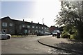
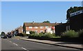
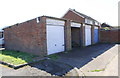
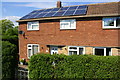
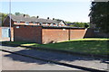
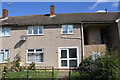
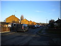
Photos of NN18 0TB


Area Information
Living in NN18 0TB means being part of a compact, densely populated residential cluster in Corby, Northamptonshire. This small area, spanning just 1.3 hectares, is home to 2,064 people, creating a tightly knit community with a high population density of 161,859 people per square kilometre. Corby itself, the town that encompasses this postcode, has roots dating back to the 8th century, when it was named “Kori’s by” by Danish settlers. Today, it is a town shaped by its 20th-century industrial past, though NN18 0TB reflects a quieter, residential character. The area is served by nearby schools, retail outlets, and transport links, making it practical for daily life. While the town’s history is marked by steelworks and economic transformation, this postcode offers a modern, family-oriented environment. Its proximity to Corby Railway Station and Kettering Railway Station, along with local amenities like Morrisons and M&S, ensures connectivity and convenience. For those seeking a small, manageable area with a clear sense of community, NN18 0TB balances practicality with the legacy of a historic town.
- Area Type
- Postcode
- Area Size
- 1.3 hectares
- Population
- 2064
- Population Density
- 3226 people/km²
The property market in NN18 0TB is dominated by owner-occupied homes, with 74% of residents living in properties they own. This contrasts with areas where rental markets are more prevalent, indicating a community of long-term residents rather than transient populations. The accommodation type is exclusively houses, which is notable in a region where flats are more common. This suggests a focus on family homes, likely with gardens or larger living spaces, catering to the area’s median age group. Given the small size of the postcode (1.3 hectares) and the high population density, the housing stock is limited, making it a niche market for buyers seeking a compact, established area. The lack of new developments or high-rise housing reinforces the residential, suburban character of NN18 0TB. For buyers, this means competition for a small number of properties, but also a stable, low-risk investment in a mature community.
House Prices in NN18 0TB
Showing 16 properties
| Address | Type | Beds | Baths | Last Sale Price | Last Sale Date | |
|---|---|---|---|---|---|---|
| 7 Knights Close, Corby, NN18 0TB | Semi-detached | 4 | 2 | £220,000 | Mar 2025 | |
| 17 Knights Close, Corby, NN18 0TB | Retail | 3 | 1 | £235,000 | Apr 2022 | |
| 10 Knights Close, Corby, NN18 0TB | Detached | 4 | 1 | £235,000 | Dec 2020 | |
| 13 Knights Close, Corby, NN18 0TB | Detached | 3 | - | £164,950 | Dec 2015 | |
| 8 Knights Close, Corby, NN18 0TB | house | - | - | £115,000 | Jul 2010 | |
| 4 Knights Close, Corby, NN18 0TB | Detached | 3 | 1 | £140,500 | Nov 2009 | |
| 14 Knights Close, Corby, NN18 0TB | Semi-detached | - | - | £142,500 | May 2007 | |
| 5 Knights Close, Corby, NN18 0TB | Detached | 4 | 1 | £100,000 | Dec 2006 | |
| 1 Knights Close, Corby, NN18 0TB | Detached | - | - | £181,000 | Aug 2004 | |
| 12 Knights Close, Corby, NN18 0TB | house | - | - | £55,000 | Oct 1999 |
Energy Efficiency in NN18 0TB
The lifestyle in NN18 0TB is shaped by its practical amenities and proximity to Corby’s town centre. Residents have access to five retail outlets, including Morrisons Daily and M&S, offering everyday shopping needs. The nearby rail stations and bus interchange provide connectivity to surrounding areas, while the absence of large supermarkets or entertainment venues suggests a focus on convenience over leisure. The area’s compact size means amenities are within walking or short driving distance, though it lacks expansive parks or recreational spaces. For families, the presence of multiple schools and a stable community environment supports a routine-focused lifestyle. The high broadband quality also facilitates remote work and online activities. While the area is not a destination for tourism or nightlife, its accessibility to Corby’s broader offerings—such as cultural events or larger retail centres—makes it a practical base for those prioritising functionality over vibrancy.
Amenities
Schools
Residents of NN18 0TB have access to a range of primary and secondary schools within practical reach. The area includes Beanfield Infant School and Beanfield Junior School, both primary institutions, as well as The Kingswood School and Beanfield Primary School, which serve younger students. For secondary education, Our Lady and Pope John Catholic Secondary School provides a comprehensive option. The mix of schools ensures that families have choices across different stages of education, from early years to adolescence. The presence of multiple primary schools in close proximity may indicate a strong local focus on early education, while the secondary school offers a broader curriculum. This diversity supports families at various life stages, though the lack of independent or specialist schools may be a consideration for those seeking alternative educational pathways.
| Rank | School | Type | Entry gender | Ages |
|---|
Explore more schools in this area
Go to Schools tabDemographics
The community in NN18 0TB is predominantly middle-aged, with a median age of 47 and the most common age range being adults aged 30–64. This suggests a stable population with strong family ties, as 74% of residents own their homes, a figure well above the national average. The area is characterised by houses rather than flats, reflecting a preference for single-family dwellings. The predominant ethnic group is White, which aligns with broader trends in the East Midlands. The high home ownership rate and age profile indicate a mature, settled population with long-term residency patterns. While no specific data on deprivation is provided, the high proportion of homeowners and the presence of schools and amenities suggest a relatively stable quality of life. The absence of significant demographic diversity, however, means the community is less cosmopolitan than larger urban areas.
Household Size
Accommodation Type
Tenure
Ethnic Group
Religion
Household Composition
Age
Household Deprivation
NS-SEC
Explore more demographic insights in this area
Go to Demographics tabPlanning
Planning Constraints
- Flood RiskPremium
- Ramsar Wetland SitesPremium
- Area of Outstanding Natural BeautyPremium
- Protected Nature ReservePremium
- Protected WoodlandPremium