Area Overview for NN18 0RG
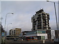
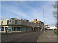
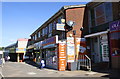
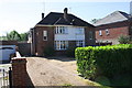
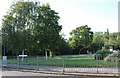
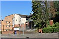
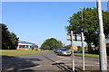
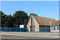
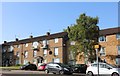
Photos of NN18 0RG


Area Information
NN18 0RG is a small, densely populated postcode area in Corby, Northamptonshire, covering just 2.7 hectares and home to 1,853 residents. Its compact size means the community is tightly knit, with daily life centred around the town’s industrial heritage and modern infrastructure. Corby, designated a new town in 1950, has roots stretching back to the 8th century, with its name derived from “Kori’s by,” a Danish settlement. The area’s economy was historically shaped by the steelworks built in 1934, though today it blends residential clusters with retail and transport hubs. Living here offers proximity to amenities like Corby Railway Station and a mix of primary schools, including Hazel Leys Academy, which has a good Ofsted rating. The population density of 67,692 people per square kilometre reflects a mature, family-oriented demographic, with many residents owning their homes. While the area’s industrial past is evident, its modern appeal lies in practical connectivity, strong broadband, and a balance of local services that cater to everyday needs.
- Area Type
- Postcode
- Area Size
- 2.7 hectares
- Population
- 1853
- Population Density
- 4915 people/km²
The property market in NN18 0RG is characterised by a 53% home ownership rate, with houses being the predominant type of accommodation. This suggests a market skewed towards owner-occupied properties rather than rentals, likely attracting buyers seeking long-term stability. The small area size—just 2.7 hectares—means housing stock is limited, potentially increasing competition for available homes. Given the high population density, properties here are likely to be tightly packed, with little scope for new developments. For buyers, this implies a need to act decisively, as the market may be competitive, particularly for family homes. The lack of flats or apartments indicates a focus on traditional housing, which could appeal to those prioritising space and privacy. However, the limited land area also means proximity to amenities and transport links is a key selling point, balancing the constraints of the environment.
House Prices in NN18 0RG
Showing 61 properties
| Address | Type | Beds | Baths | Last Sale Price | Last Sale Date | |
|---|---|---|---|---|---|---|
| 57 Gainsborough Road, Corby, NN18 0RG | Terraced | 1 | - | £200,000 | Aug 2025 | |
| 27 Gainsborough Road, Corby, NN18 0RG | Terraced | 3 | 2 | £199,000 | Mar 2025 | |
| 15 Gainsborough Road, Corby, NN18 0RG | Terraced | 3 | 1 | £170,000 | Feb 2023 | |
| 3 Gainsborough Road, Corby, NN18 0RG | Detached | 4 | 2 | £1,442,133 | Jul 2022 | |
| 19 Gainsborough Road, Corby, NN18 0RG | Terraced | 3 | 1 | £182,985 | Jul 2022 | |
| 51 Gainsborough Road, Corby, NN18 0RG | Retail | 3 | 1 | £210,000 | Jun 2022 | |
| 5 Gainsborough Road, Corby, NN18 0RG | Terraced | 3 | 1 | £191,000 | Oct 2021 | |
| 17 Gainsborough Road, Corby, NN18 0RG | house | - | - | £164,000 | Sep 2021 | |
| 41 Gainsborough Road, Corby, NN18 0RG | Terraced | 3 | 1 | £150,000 | May 2021 | |
| 70 Gainsborough Road, Corby, NN18 0RG | Terraced | 3 | 1 | £160,000 | Mar 2021 |
Energy Efficiency in NN18 0RG
The lifestyle in NN18 0RG is shaped by its proximity to retail and transport hubs. Nearby amenities include Lidl Central, Iceland Corby, and Farmfoods Corby, offering grocery and household essentials within practical reach. These stores cater to daily needs, reducing the necessity for long trips to larger centres. The area’s transport links, including Corby Railway Station and the bus interchange, further enhance accessibility to leisure, shopping, and employment opportunities. While the data does not specify parks or recreational facilities, the presence of multiple schools and retail outlets suggests a community-focused environment. The compact nature of the area means residents are likely to rely on local services, fostering a sense of familiarity. However, the absence of detailed information on leisure options means the full extent of recreational opportunities remains unclear.
Amenities
Schools
Residents of NN18 0RG have access to several primary schools, including Hazel Leys Nursery and Primary School, Hazel Leys Junior School, and St Patrick’s Catholic Primary School in Corby, which holds a good Ofsted rating. Hazel Leys Academy, an academy school with a good rating, serves older students. The mix of state and faith-based schools offers families choice, with St Patrick’s providing a Catholic education and Hazel Leys Academy potentially offering specialist curricula. The presence of multiple primary schools within the area suggests a strong focus on early education, though no secondary schools are listed in the data. For families, this cluster of schools ensures proximity to education, reducing commute times and supporting a community-oriented lifestyle. The good Ofsted ratings indicate that at least some institutions meet or exceed national standards, though outcomes at other schools remain unspecified.
| Rank | School | Type | Entry gender | Ages |
|---|
Explore more schools in this area
Go to Schools tabDemographics
The population of NN18 0RG has a median age of 47, with the majority of residents aged between 30 and 64. This suggests a community skewed towards middle-aged adults, likely with established careers and families. Home ownership stands at 53%, indicating a mix of owner-occupied properties and rental units. The area is predominantly composed of houses, rather than flats, reflecting a suburban or semi-rural character. The predominant ethnic group is White, though no specific data on diversity or deprivation is provided. The age profile implies a stable, long-term resident base, with fewer young families or elderly populations compared to other areas. For buyers, this demographic suggests a focus on practical, family-friendly housing, though the high population density may mean limited space for expansion. The absence of detailed diversity metrics means the community’s cultural makeup remains less defined in the data.
Household Size
Accommodation Type
Tenure
Ethnic Group
Religion
Household Composition
Age
Household Deprivation
NS-SEC
Explore more demographic insights in this area
Go to Demographics tabPlanning
Planning Constraints
- Flood RiskPremium
- Ramsar Wetland SitesPremium
- Area of Outstanding Natural BeautyPremium
- Protected Nature ReservePremium
- Protected WoodlandPremium