Area Overview for NN18 0LR
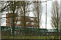
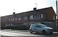
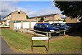
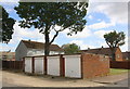
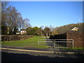
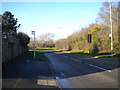
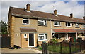
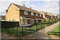
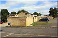
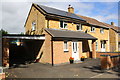
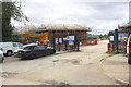
Photos of NN18 0LR
Area Information
Living in NN18 0LR means being part of a small, densely populated residential cluster in Corby, Northamptonshire. The area covers just 9,777 square metres, yet it hosts 1,534 residents, translating to a population density of 156,900 people per square kilometre. This compact postcode is nestled in a town with a distinct industrial heritage, shaped by its 1930s steelworks and 1950s designation as a new town. Corby’s historical roots as a settlement named “Kori’s by” by Danish invaders in the 8th century echo in its modern character, where the raven remains a symbol of local identity. Daily life here is defined by proximity to amenities, with nearby rail stations and retail outlets within practical reach. While the area’s high density suggests a tight-knit community, its small size means residents are likely to know their neighbours. The postcode’s location in a town that once housed 12,000 people by 1939, now balanced by modern infrastructure, offers a blend of historical context and contemporary living.
- Area Type
- Postcode
- Area Size
- 9777 m²
- Population
- 1534
- Population Density
- 6416 people/km²
The property market in NN18 0LR is characterised by a 53% home ownership rate, suggesting a balance between owner-occupied and rental properties. The area’s accommodation type is predominantly houses, which may appeal to families or those seeking more space. Given the small size of the postcode—just 9,777 square metres—this implies a limited number of homes, potentially leading to competition for properties. The high population density (156,900 per square kilometre) further underscores the compact nature of the area, which may affect property prices and availability. For buyers, this small cluster of homes means that the immediate surroundings, such as nearby Corby, likely offer more extensive housing options. However, the focus on houses rather than flats or apartments may cater to specific buyer preferences, though the lack of data on property types beyond “houses” limits deeper analysis.
House Prices in NN18 0LR
Showing 23 properties
| Address | Type | Beds | Baths | Last Sale Price | Last Sale Date | |
|---|---|---|---|---|---|---|
| 88 Greenhill Rise, Corby, NN18 0LR | house | - | - | £180,000 | Oct 2024 | |
| 79 Greenhill Rise, Corby, NN18 0LR | Flat | - | - | £75,000 | Nov 2018 | |
| 94 Greenhill Rise, Corby, NN18 0LR | Terraced | - | - | £52,500 | Dec 2008 | |
| 98 Greenhill Rise, Corby, NN18 0LR | house | 3 | 1 | £92,000 | Nov 2005 | |
| 92 Greenhill Rise, Corby, NN18 0LR | Terraced | 3 | 1 | - | - | |
| 77 Greenhill Rise, Corby, NN18 0LR | Flat | - | - | - | - | |
| 91 Greenhill Rise, Corby, NN18 0LR | Flat | - | - | - | - | |
| 99 Greenhill Rise, Corby, NN18 0LR | Flat | - | - | - | - | |
| 100 Greenhill Rise, Corby, NN18 0LR | house | - | - | - | - | |
| 95 Greenhill Rise, Corby, NN18 0LR | Flat | - | - | - | - |
Energy Efficiency in NN18 0LR
Residents of NN18 0LR have access to a range of nearby amenities, including five retail outlets such as Morrisons Daily Corby, Morrisons Daily, and Morrisons Oakley, offering convenience for daily shopping. Two rail stations—Corby and Kettering—provide easy access to regional transport, while a bus interchange ensures local connectivity. Though the area’s small size means amenities are limited in number, the proximity of these services suggests a practical lifestyle for residents. The presence of multiple supermarkets indicates that essential goods are readily available, reducing the need for longer trips. The area’s compact nature also means that community events, such as the Corby Pole Fair, may be within walking distance, fostering a sense of local identity. However, the absence of detailed data on parks or leisure facilities means that recreational options remain unspecified.
Amenities
Schools
| Rank | School | Type | Entry gender | Ages |
|---|
Explore more schools in this area
Go to Schools tabDemographics
The demographic profile of NN18 0LR reflects a mature population, with a median age of 47 and the majority of residents aged between 30 and 64. This suggests a community with a strong presence of working-age adults, potentially influencing local services and employment patterns. Home ownership stands at 53%, indicating a mix of owner-occupied properties and rental units. The area is predominantly composed of houses, rather than flats or apartments, which aligns with the higher proportion of family households typical of such demographics. The predominant ethnic group is White, though specific data on diversity is not provided. With a population density of 156,900 per square kilometre, the area is highly compact, which may impact living space per household and community dynamics. The absence of detailed information on deprivation or income levels means that quality-of-life factors like access to services and housing affordability remain unquantified in this dataset.
Household Size
Accommodation Type
Tenure
Ethnic Group
Religion
Household Composition
Age
Household Deprivation
NS-SEC
Explore more demographic insights in this area
Go to Demographics tabPlanning
Planning Constraints
- Flood RiskPremium
- Ramsar Wetland SitesPremium
- Area of Outstanding Natural BeautyPremium
- Protected Nature ReservePremium
- Protected WoodlandPremium