Area Overview for NN18 0EG
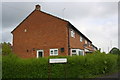
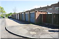
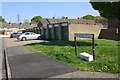
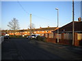
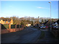
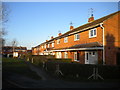
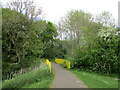
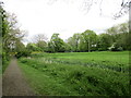
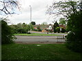
Photos of NN18 0EG


Area Information
Living in NN18 0EG means inhabiting a compact residential cluster in Northamptonshire, part of the larger town of Corby. This small area spans just 1.9 hectares, yet it supports a population of 1,318 people, making it one of the most densely populated places in England, with over 67,877 residents per square kilometre. The community is defined by its proximity to Corby’s industrial heritage, though modern life here balances that history with contemporary amenities. The area’s compact size means residents are close to local services, while the town’s designation as a new town in 1950 reflects its planned development. Despite its small footprint, NN18 0EG sits within a town with a rich past, from its medieval market rights to its 20th-century steelworks. Daily life here is shaped by the surrounding infrastructure, including nearby retail outlets and transport links, though the area’s character is defined by its tight-knit residential focus and the broader context of Corby’s evolving identity.
- Area Type
- Postcode
- Area Size
- 1.9 hectares
- Population
- 1318
- Population Density
- 3377 people/km²
The property market in NN18 0EG is characterised by a mix of owner-occupied and rental properties, with 47% of households owning their homes. Given the area’s small size and the prevalence of houses as the primary accommodation type, the housing stock is likely to consist of family homes rather than apartments or flats. This suggests a market that caters to households seeking stability, possibly including retirees or long-term residents. The compact nature of the area means that properties are likely to be in close proximity to local amenities, though the high population density may limit availability for new buyers. For those considering the area, the focus on houses rather than rental units indicates a community that values private ownership, though the relatively low home ownership rate also suggests opportunities for investment or rental income. Prospective buyers should note that the limited size of NN18 0EG means competition for properties could be fierce, particularly for those seeking to move into the area.
House Prices in NN18 0EG
Showing 22 properties
| Address | Type | Beds | Baths | Last Sale Price | Last Sale Date | |
|---|---|---|---|---|---|---|
| 9 Beanfield Avenue, Corby, NN18 0EG | Semi-detached | 3 | 1 | £235,000 | Dec 2022 | |
| 23 Beanfield Avenue, Corby, NN18 0EG | house | 3 | 1 | £152,500 | Aug 2019 | |
| 28 Beanfield Avenue, Corby, NN18 0EG | house | - | - | £175,000 | Apr 2019 | |
| 13 Beanfield Avenue, Corby, NN18 0EG | Semi-detached | 3 | 1 | £129,000 | Nov 2016 | |
| 27 Beanfield Avenue, Corby, NN18 0EG | house | - | - | £132,000 | Nov 2016 | |
| 30 Beanfield Avenue, Corby, NN18 0EG | house | - | - | £108,000 | Jul 2013 | |
| 11 Beanfield Avenue, Corby, NN18 0EG | house | - | - | £82,000 | Oct 2012 | |
| 20 Beanfield Avenue, Corby, NN18 0EG | house | 3 | - | £90,000 | Jun 2011 | |
| 22 Beanfield Avenue, Corby, NN18 0EG | Semi-detached | 3 | 1 | £97,000 | Oct 2006 | |
| 1 Beanfield Avenue, Corby, NN18 0EG | Semi-detached | 3 | - | £55,000 | Jul 2003 |
Energy Efficiency in NN18 0EG
Residents of NN18 0EG have access to a range of nearby amenities within practical reach. The retail sector includes Morrisons Daily Corby, Spar, and other local stores, ensuring that everyday shopping needs are met without the need for long commutes. The Corby Railway Station and nearby bus interchange provide reliable transport options for commuting or travel beyond the immediate area. While the data does not specify parks or leisure facilities, the proximity to Corby’s town centre likely offers additional options for dining, entertainment, and cultural activities. The presence of multiple retail outlets and transport links suggests a convenient lifestyle, with services and connectivity supporting both daily routines and broader mobility. For those seeking a balance between convenience and community, the area’s compact size and accessible amenities make it a practical choice for residents prioritising ease of access to essential services.
Amenities
Schools
| Rank | School | Type | Entry gender | Ages |
|---|
Explore more schools in this area
Go to Schools tabDemographics
The community in NN18 0EG is predominantly composed of adults aged 30–64, with a median age of 47. This suggests a population skewed towards middle-aged residents, many of whom may be established in their careers or nearing retirement. Home ownership rates stand at 47%, indicating that nearly half of households are owner-occupied, while the remaining 53% are likely to be renters. The accommodation type is primarily houses, which is notable given the area’s high density. The predominant ethnic group is White, reflecting the broader demographic patterns of the region. With a population of 1,318, the area’s small size means social interactions are likely to be frequent, though the high density could also imply a need for community planning to manage shared spaces. The absence of specific data on deprivation or income levels means that quality of life assessments must rely on other metrics, such as connectivity and safety.
Household Size
Accommodation Type
Tenure
Ethnic Group
Religion
Household Composition
Age
Household Deprivation
NS-SEC
Explore more demographic insights in this area
Go to Demographics tabPlanning
Planning Constraints
- Flood RiskPremium
- Ramsar Wetland SitesPremium
- Area of Outstanding Natural BeautyPremium
- Protected Nature ReservePremium
- Protected WoodlandPremium