Area Overview for NN18 0BN
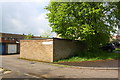
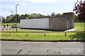
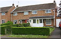
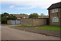
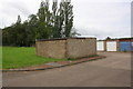
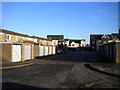
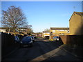
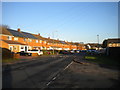
Photos of NN18 0BN
Area Information
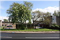
Living in NN18 0BN means inhabiting a compact, densely populated residential cluster in Northamptonshire. With a population of 1,909 spread across just 1.5 hectares, this area is small but tightly knit. Its history as part of Corby, a town designated a new town in 1950, shapes its character. Originally a village of 1,500 in 1931, Corby expanded rapidly with the arrival of steelworks, transforming it into a hub of industrial activity. Today, NN18 0BN reflects a mature community, with residents predominantly aged 30–64. Daily life here is shaped by proximity to retail outlets, a railway station, and schools, while the area’s low crime risk and excellent broadband connectivity support both domestic and professional needs. The compact size means amenities are within easy reach, though the density also means space is limited. For buyers, this is a place where convenience and historical legacy intersect, offering a snapshot of Corby’s evolution from a small settlement to a modern town.
- Area Type
- Postcode
- Area Size
- 1.5 hectares
- Population
- 1909
- Population Density
- 4938 people/km²
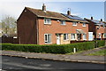
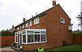
The property market in NN18 0BN is characterised by a high rate of home ownership—56% of residents own their homes—suggesting a stable, long-term demographic. The accommodation type is predominantly houses, which is unusual for a small area of 1.5 hectares. This implies limited housing stock, potentially making the market competitive for buyers. The compact size of the area means properties are likely to be closely spaced, with little scope for expansion. For buyers, this presents both challenges and opportunities: the limited supply may drive up prices, but the presence of houses rather than flats or apartments may appeal to those seeking family-friendly homes. The area’s proximity to retail and transport links, combined with low crime risk, adds to its desirability, though the small size means buyers must consider the broader Corby area for more options.
House Prices in NN18 0BN
Showing 31 properties
| Address | Type | Beds | Baths | Last Sale Price | Last Sale Date | |
|---|---|---|---|---|---|---|
| 34 Wimbourne Walk, Corby, NN18 0BN | Terraced | 3 | 1 | £185,000 | Aug 2024 | |
| 41 Wimbourne Walk, Corby, NN18 0BN | house | - | - | £145,000 | Mar 2024 | |
| 36 Wimbourne Walk, Corby, NN18 0BN | Terraced | 3 | 1 | £185,000 | Oct 2022 | |
| 2 Wimbourne Walk, Corby, NN18 0BN | Terraced | 3 | - | £150,000 | Oct 2018 | |
| 47 Wimbourne Walk, Corby, NN18 0BN | house | - | - | £164,000 | Apr 2018 | |
| 49 Wimbourne Walk, Corby, NN18 0BN | Semi-detached | 3 | 1 | £137,000 | Dec 2017 | |
| 42 Wimbourne Walk, Corby, NN18 0BN | Terraced | 3 | 1 | £149,250 | Nov 2017 | |
| 6 Wimbourne Walk, Corby, NN18 0BN | Semi-detached | 3 | 1 | £133,000 | Nov 2015 | |
| 32 Wimbourne Walk, Corby, NN18 0BN | Terraced | 3 | 1 | £101,000 | May 2014 | |
| 39 Wimbourne Walk, Corby, NN18 0BN | Semi-detached | - | - | £100,000 | Jun 2008 |
Energy Efficiency in NN18 0BN
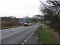
Residents of NN18 0BN have access to five retail outlets within practical reach, including M&S Fourways Corby BP and Morrisons Daily, offering everyday shopping convenience. The Corby Railway Station provides direct links to nearby towns and cities, enhancing connectivity for commuters and shoppers. While the area lacks detailed data on parks or leisure facilities, the presence of multiple retail options suggests a focus on practical amenities. The compact size of the area means residents can walk or cycle to shops, reducing reliance on cars. For those seeking more leisure options, Corby itself offers historical sites and events like the Corby Pole Fair. The combination of retail access and transport links ensures a functional lifestyle, though buyers should consider whether additional recreational facilities are available beyond the immediate vicinity.
Amenities
Schools
Near NN18 0BN are several schools, including St Brendan’s Catholic Primary School, which has an Ofsted rating of ‘good’, and Beanfield Community College, though its type is listed as primary, which may be an error. Red Kite Academy is a special school, catering to students with specific needs. The presence of both primary and special schools suggests a range of educational options for families, though the data does not confirm the quality of secondary education. The ‘good’ rating at St Brendan’s indicates a reliable primary school, but the lack of detailed Ofsted ratings for others means buyers must verify current standards. The mix of school types may be beneficial for families with diverse needs, but the absence of a named secondary school raises questions about long-term educational planning. Parents should investigate further to ensure alignment with their children’s requirements.
| Rank | School | Type | Entry gender | Ages |
|---|
Explore more schools in this area
Go to Schools tabDemographics
The community in NN18 0BN is predominantly middle-aged, with a median age of 47 and the majority of residents falling within the 30–64 age range. Home ownership is relatively high at 56%, suggesting a stable population with long-term commitments to the area. The accommodation type is primarily houses, reflecting a preference for single-family dwellings over flats or apartments. The predominant ethnic group is White, though specific data on diversity or deprivation is not provided. The high population density—124,662 people per square kilometre—indicates a compact, possibly multi-generational living environment. This density may influence local services and infrastructure, but the area’s safety profile and access to schools suggest it is well-suited for families. The demographic mix implies a community focused on stability, with a balance between working-age adults and older residents.
Household Size
Accommodation Type
Tenure
Ethnic Group
Religion
Household Composition
Age
Household Deprivation
NS-SEC
Explore more demographic insights in this area
Go to Demographics tabPlanning
Planning Constraints
- Flood RiskPremium
- Ramsar Wetland SitesPremium
- Area of Outstanding Natural BeautyPremium
- Protected Nature ReservePremium
- Protected WoodlandPremium