Area Overview for NN17 5ZA
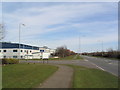
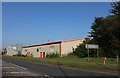
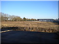
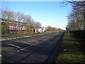
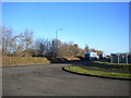
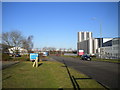
Photos of NN17 5ZA
Area Information
NN17 5ZA is a small, residential postcode area in England covering 47.3 hectares with a population of 2405 people. Its low population density of 37 people per square kilometre suggests a quiet, spread-out community. The area is characterised by a mix of older and newer housing stock, with 69% of homes owned by residents rather than rented. This reflects a stable, long-term population, with the median age at 47 and the majority of residents aged between 30 and 64. Daily life here is likely to be low-key, with limited commercial activity beyond essential services. The proximity to Corby, a nearby town, may offer more amenities, but NN17 5ZA itself appears to be a self-contained, low-traffic environment. The area’s small size means it is unlikely to have significant local landmarks or public spaces, but its safety profile and proximity to transport links make it a practical choice for those prioritising security and connectivity. Living here would suit individuals or families seeking a settled, low-density lifestyle with minimal urban pressure.
- Area Type
- Postcode
- Area Size
- 47.3 hectares
- Population
- 2405
- Population Density
- 37 people/km²
The property market in NN17 5ZA is dominated by owner-occupied homes, with 69% of properties owned by residents. This suggests a stable market with limited rental activity, likely due to the area’s small size and low population density. The accommodation type is predominantly houses, which may appeal to those seeking larger, private spaces. However, the limited number of properties means the market is unlikely to be competitive, and buyers should consider the area’s proximity to amenities such as Corby’s retail and transport hubs. The lack of planning constraints, such as protected landscapes or wetlands, may make development less restricted, though the area’s small footprint means expansion is unlikely. For buyers, this presents a niche opportunity to purchase in a low-density, secure environment, though the limited housing stock could restrict choices.
House Prices in NN17 5ZA
Showing 9 properties
| Address | Type | Beds | Baths | Last Sale Price | Last Sale Date | |
|---|---|---|---|---|---|---|
| Unit 4, Priestley Court, Baird Road, Corby, NN17 5ZA | Industrial | - | - | - | - | |
| Unit 1, Priestley Court, Baird Road, Corby, NN17 5ZA | office_workshop | - | - | - | - | |
| Unit 2, Priestley Court, Baird Road, Corby, NN17 5ZA | general_industrial | - | - | - | - | |
| Unit 3, Priestley Court, Baird Road, Corby, NN17 5ZA | office_workshop | - | - | - | - | |
| Label House, Baird Road, Corby, NN17 5ZA | Industrial | - | - | - | - | |
| Unit 5, Priestley Court, Baird Road, Corby, NN17 5ZA | general_industrial | - | - | - | - | |
| Parker, Baird Road, Corby, NN17 5ZA | Industrial | - | - | - | - | |
| Insignia Manufacturing Limited, Belgrave House, Baird Road, Corby, NN17 5ZA | Industrial | - | - | - | - | |
| Bca, Corby Baird Road Remarketing Centre, Baird Road, Corby, NN17 5ZA | warehouse | - | - | - | - |
Energy Efficiency in NN17 5ZA
Residents of NN17 5ZA have access to nearby retail outlets in Corby, including M&S Corby, Iceland Corby, and Asda Corby. These stores provide essential shopping and grocery options within practical reach. The area also benefits from Corby Railway Station, which connects to broader transport networks. While the data does not mention parks or leisure facilities, the low population density and lack of planning constraints suggest the area may have open spaces or rural surroundings. The combination of retail access and rail connectivity offers a balance of convenience and quiet living. However, the absence of specific details on dining or recreational options means the full lifestyle picture remains incomplete.
Amenities
Schools
Residents of NN17 5ZA have access to three primary schools: Kings Cliffe Endowed Primary School, Bulwick CofE Primary School, and King’s Cliffe Middle School. Kings Cliffe Endowed Primary School holds an Ofsted rating of ‘good’, indicating a reliable standard of education, while the others are primary schools without specified ratings. The presence of multiple primary schools suggests the area is well-served for families with young children, though secondary education options are not listed. The mix of schools may offer parents a choice between different educational philosophies, such as faith-based or state-run institutions. However, the absence of secondary schools in the data means families may need to look beyond NN17 5ZA for comprehensive schooling.
| Rank | School | Type | Entry gender | Ages |
|---|
Explore more schools in this area
Go to Schools tabDemographics
The community in NN17 5ZA is predominantly middle-aged, with a median age of 47 and 69% of residents owning their homes. The majority of households are adults aged 30–64, indicating a mature population with established careers and family structures. The area is largely composed of houses rather than flats, which aligns with the home ownership rate and suggests a preference for traditional, single-family dwellings. The predominant ethnic group is White, with no specific data provided on other demographics. The low population density of 37 people per square kilometre implies a sparse, possibly rural or semi-rural setting. While no deprivation data is available, the high home ownership rate and low crime risk suggest a stable, secure environment. However, the absence of detailed diversity statistics means the full range of community experiences cannot be assessed.
Household Size
Accommodation Type
Tenure
Ethnic Group
Religion
Household Composition
Age
Household Deprivation
NS-SEC
Explore more demographic insights in this area
Go to Demographics tabPlanning
Planning Constraints
- Flood RiskPremium
- Ramsar Wetland SitesPremium
- Area of Outstanding Natural BeautyPremium
- Protected Nature ReservePremium
- Protected WoodlandPremium