Area Overview for NN17 5XY
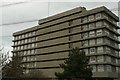
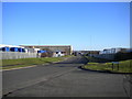
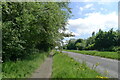
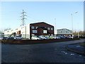
Photos of NN17 5XY


Area Information
NN17 5XY is a compact residential cluster in Corby, Northamptonshire, covering 6 hectares with a population of 1,970 people. Its population density of 472 people per square kilometre reflects a tight-knit community. Corby, designated a new town in 1950, has roots in the 8th century, with its name derived from “Kori’s by,” a Danish settlement. The area’s industrial heritage is evident, shaped by the 1930s steelworks that transformed it from a village into a bustling town. Today, NN17 5XY retains a residential character, with homes predominantly occupied by adults aged 30–64. Daily life here is influenced by the town’s historical ties to industry, though modern amenities like retail outlets and rail links provide contemporary convenience. The area’s small size means proximity to key services, but its character is defined by a balance of historical legacy and practical living. For buyers, it offers a snapshot of a mature, stable community with a clear identity rooted in both past and present.
- Area Type
- Postcode
- Area Size
- 6.0 hectares
- Population
- 1970
- Population Density
- 472 people/km²
The property market in NN17 5XY is characterised by a 47% home ownership rate, meaning nearly half of properties are owner-occupied, while the remainder are likely rented. The accommodation type is predominantly houses, which suggests a focus on single-family homes rather than apartments or terraced housing. Given the area’s small size—just 6 hectares—the housing stock is limited, and buyers may need to consider nearby zones for more options. The presence of houses indicates a market skewed toward established, possibly larger properties, which may appeal to families or individuals seeking space. However, the relatively low home ownership rate hints at a rental market segment, though its scale is unclear. For buyers, this means competition for available homes could be fierce, and proximity to amenities like schools and transport is a key consideration.
House Prices in NN17 5XY
Showing 4 properties
| Address | Type | Beds | Baths | Last Sale Price | Last Sale Date | |
|---|---|---|---|---|---|---|
| Strathcarrons, Unit C, Gaydon House, Trevithick Road, Corby, NN17 5XY | office_workshop | - | - | - | - | |
| Delmari Bathroom Furniture, Trevithick Road, Corby, NN17 5XY | Industrial | - | - | - | - | |
| Welding Services Ltd, Trevithick Road, Corby, NN17 5XY | Industrial | - | - | - | - | |
| Ems, 6, Darwin Court, Trevithick Road, Corby, NN17 5XY | warehouse | - | - | - | - |
Energy Efficiency in NN17 5XY
Residents of NN17 5XY have access to five retail outlets within practical reach, including M&S Corby, Iceland Corby, and Co-op Occupation. These shops provide everyday essentials, from groceries to general retail, supporting a convenient lifestyle. The Corby Railway Station adds connectivity, allowing easy travel to other parts of the region. While the data does not specify parks or leisure facilities, the presence of retail and transport options suggests a functional, community-focused environment. The proximity to schools and retail hubs means daily errands and family needs can be met without long journeys. However, the lack of detailed information on parks or recreational spaces means potential buyers may need to assess the area’s green spaces independently. Overall, the lifestyle here balances practicality with the necessities of modern living.
Amenities
Schools
Residents of NN17 5XY have access to Rockingham Primary School, a primary school with an Ofsted rating of “good,” and the Pen Green Centre for Children and Their Families, a nursery. These institutions cater to young children, offering a range of early years and primary education. The presence of a primary school with a positive Ofsted rating is a strong indicator of quality for families with school-age children, while the nursery provides support for younger ones. The combination of these facilities suggests the area is well-served for families requiring early education and primary schooling. However, the data does not mention secondary schools or further education options, so parents may need to look beyond the immediate vicinity for comprehensive schooling.
| Rank | School | Type | Entry gender | Ages |
|---|
Explore more schools in this area
Go to Schools tabDemographics
The population of NN17 5XY has a median age of 47, with the majority of residents falling within the 30–64 age range. This suggests a community of established adults, likely focused on long-term living rather than transient populations. Home ownership stands at 47%, indicating a mix of owner-occupied and rental properties, though the latter is not dominant. The area’s accommodation is primarily houses, reflecting a preference for single-family dwellings over flats or apartments. Ethnically, the population is predominantly White, with no specific data provided on other groups. The age profile and home ownership rate suggest a stable, low-turnover community. However, the lack of detailed diversity data means broader demographic insights remain limited. The median age also implies a potential gap in services for younger families or retirees, though this is not explicitly addressed in the data.
Household Size
Accommodation Type
Tenure
Ethnic Group
Religion
Household Composition
Age
Household Deprivation
NS-SEC
Explore more demographic insights in this area
Go to Demographics tabPlanning
Planning Constraints
- Flood RiskPremium
- Ramsar Wetland SitesPremium
- Area of Outstanding Natural BeautyPremium
- Protected Nature ReservePremium
- Protected WoodlandPremium