Area Overview for NN17 5XG
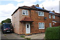
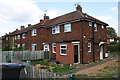
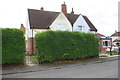
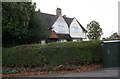
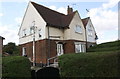
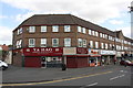
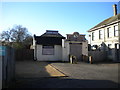
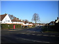
Photos of NN17 5XG


Area Information
Living in NN17 5XG means being part of a small, tightly knit residential cluster in Corby, Northamptonshire. The area covers 5.5 hectares and is home to 1,873 people, giving it a population density of 620 people per square kilometre. This postcode area is part of Corby, a town designated a new town in 1950, known for its industrial heritage and historical roots. The name Corby appears in the Domesday Book as “Corbei,” reflecting its long-standing presence in the region. Daily life here is shaped by its proximity to Corby’s central amenities, including retail hubs and transport links. While the area is compact, it offers access to essential services within walking or short driving distance. The community is predominantly composed of adults aged 30–64, with a median age of 47, suggesting a mature, stable population. For those considering NN17 5XG, it is a place where practicality meets historical significance, with a focus on local connectivity and a clear sense of place.
- Area Type
- Postcode
- Area Size
- 5.5 hectares
- Population
- 1873
- Population Density
- 620 people/km²
The property market in NN17 5XG is characterised by a 43% home ownership rate, indicating that less than half of properties are owner-occupied, with the remainder likely in the rental market. The accommodation type is predominantly houses, which is typical for this small residential cluster. Given the area’s limited size—just 5.5 hectares—the housing stock is constrained, meaning competition for properties could be high. Buyers should consider the small footprint of the area and its immediate surroundings, as there is little scope for expansion. The presence of houses suggests a focus on family-friendly homes, though the exact range of property types is not specified. For those seeking investment or a place to live, the market’s balance between rental and ownership may present opportunities, but the area’s size means buyers must act decisively to secure a property.
House Prices in NN17 5XG
Showing 1 properties
| Address | Type | Beds | Baths | Last Sale Price | Last Sale Date | |
|---|---|---|---|---|---|---|
| The Storage Team, Units, 1-6 Commercial Road, Corby, NN17 5XG | Office | - | - | - | - |
Energy Efficiency in NN17 5XG
The lifestyle in NN17 5XG is shaped by its proximity to essential amenities. Nearby retail options include Iceland Corby, M&S Corby, and Tesco Corby, providing access to groceries, clothing, and household goods. These stores are within practical reach, making daily errands convenient. The area also has Corby Railway Station, offering transport links to other parts of the region. While the postcode area itself is small, the surrounding Corby town likely offers additional leisure and dining options. The presence of retail and transport hubs suggests a functional, practical lifestyle, ideal for those prioritising accessibility over expansive recreational spaces. For residents, the combination of shops and transport connectivity ensures a manageable, efficient daily routine.
Amenities
Schools
The nearest school to NN17 5XG is Corby Old Village Primary School, a primary school with a good Ofsted rating. This school serves the local community, providing education for younger children and offering a reliable option for families. The absence of secondary schools in the immediate vicinity means parents may need to look further afield for secondary education, though Corby itself likely has options. The presence of a well-rated primary school is a significant draw for families, as it suggests quality teaching and a supportive learning environment. For those prioritising proximity to schools, Corby Old Village Primary School is a key asset of the area. The single school listed reflects the small scale of the postcode area, but it meets the basic needs of local children.
| Rank | School | Type | Entry gender | Ages |
|---|
Explore more schools in this area
Go to Schools tabDemographics
The community in NN17 5XG is defined by its age profile and household composition. With a median age of 47 and the most common age range being 30–64 years, the area is predominantly populated by adults, suggesting a mature, established demographic. Home ownership stands at 43%, indicating a mix of owner-occupied and rented properties. The accommodation type is primarily houses, which aligns with the area’s residential character. The predominant ethnic group is White, reflecting the broader demographic trends in Corby. The population density of 620 people per square kilometre means the area is neither overly crowded nor sparsely populated, offering a balance between space and community interaction. This density, combined with the age profile, suggests a community focused on stability and long-term residency. For prospective buyers, understanding the demographic makeup is key to assessing the area’s social and economic dynamics.
Household Size
Accommodation Type
Tenure
Ethnic Group
Religion
Household Composition
Age
Household Deprivation
NS-SEC
Explore more demographic insights in this area
Go to Demographics tabPlanning
Planning Constraints
- Flood RiskPremium
- Ramsar Wetland SitesPremium
- Area of Outstanding Natural BeautyPremium
- Protected Nature ReservePremium
- Protected WoodlandPremium