Area Overview for NN17 4SW
Photos of NN17 4SW
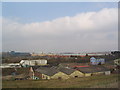
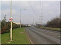
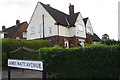
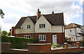
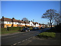
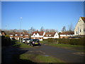
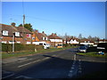
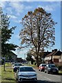
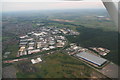
10 photos from this area
Area Information
Key information about the NN17 4SW including its size, population, and administrative classification.
- Area Type
- Postcode
- Area Size
- 6.2 hectares
- Population
- 2269
- Population Density
- 1083 people/km²
House Prices in NN17 4SW
7
Properties
-
Average Sold Price
-
Lowest Price
-
Highest Price
Showing 7 properties
| Address | Type | Beds | Baths | Last Sale Price | Last Sale Date | |
|---|---|---|---|---|---|---|
| Orchard House Foods Unit 1, Bell House, Fleming Road, Earlstrees Industrial Estate, Corby, NN17 4SW | storage_distribution | - | - | - | - | |
| Orchard House Foods Unit 2, Bell House, Fleming Road, Earlstrees Industrial Estate, Corby, NN17 4SW | Industrial | - | - | - | - | |
| 4-5, Alexander Court, Fleming Road, Earlstrees Industrial Estate, Corby, NN17 4SW | Industrial | - | - | - | - | |
| Roscope Interform Products, 5 Fleming Road, Earlstrees Industrial Estate, Corby, NN17 4SW | Industrial | - | - | - | - | |
| Tt Body Repair Services, 7, Alexander Court, Fleming Road, Earlstrees Industrial Estate, Corby, NN17 4SW | Industrial | - | - | - | - | |
| 6, Alexander Court, Fleming Road, Earlstrees Industrial Estate, Corby, NN17 4SW | general_industrial | - | - | - | - | |
| Rulmeca Uk Ltd, Brunel Road, Earlstrees Industrial Estate, Corby, NN17 4SW | Industrial | - | - | - | - |
Energy Efficiency in NN17 4SW
Amenities
Schools
| Rank | School | Type | Entry gender | Ages |
|---|
Explore more schools in this area
Go to Schools tabDemographics
Household Size
Family (3-5 people)
most common
Accommodation Type
Houses
most common
Tenure
49
majority
Ethnic Group
White
most common
Religion
N/A
most common
Household Composition
N/A
most common
Age
47
median
Adults (30-64 years)
most common
Household Deprivation
N/A
with no deprivation
NS-SEC
19
in Lower managerial occupations
Explore more demographic insights in this area
Go to Demographics tabPlanning
Planning Constraints
- Flood RiskPremium
- Ramsar Wetland SitesPremium
- Area of Outstanding Natural BeautyPremium
- Protected Nature ReservePremium
- Protected WoodlandPremium