Area Overview for NN17 3JP
Photos of NN17 3JP
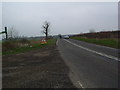
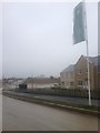
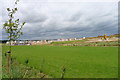
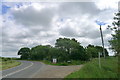
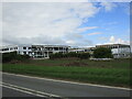
6 photos from this area
Area Information
Key information about the NN17 3JP including its size, population, and administrative classification.
- Area Type
- Postcode
- Area Size
- 1.7 hectares
- Population
- 1898
- Population Density
- 203 people/km²
House Prices in NN17 3JP
16
Properties
£279,205
Average Sold Price
£117,300
Lowest Price
£440,000
Highest Price
Showing 16 properties
| Address | Type | Beds | Baths | Last Sale Price | Last Sale Date | |
|---|---|---|---|---|---|---|
| Stone Cottage, 14 Deene End, Weldon, NN17 3JP | Semi-detached | 4 | 1 | £440,000 | Nov 2025 | |
| 7 Deene End, Weldon, NN17 3JP | Detached | 4 | - | £377,000 | May 2018 | |
| 11 Deene End, Weldon, NN17 3JP | Detached | 4 | - | £313,000 | Jul 2017 | |
| 12 Deene End, Weldon, NN17 3JP | house | - | - | £164,950 | Jun 2015 | |
| 1 Deene End, Weldon, NN17 3JP | Detached | 4 | - | £390,000 | Oct 2014 | |
| 5 Deene End, Weldon, NN17 3JP | Detached | - | - | £325,000 | Jul 2006 | |
| Ivy Cottage, 2A Deene End, Weldon, NN17 3JP | house | - | - | £250,000 | Dec 2005 | |
| Inglenook Cottage, 8 Deene End, Weldon, NN17 3JP | Detached | 4 | 3 | £265,000 | Aug 2004 | |
| Acorn Cottage, 4 Deene End, Weldon, NN17 3JP | Detached | - | - | £297,500 | May 2004 | |
| The Sycamores, 6 Deene End, Weldon, NN17 3JP | Detached | - | - | £131,500 | Dec 1996 |
Page 1 of 2
Energy Efficiency in NN17 3JP
Amenities
Schools
| Rank | School | Type | Entry gender | Ages |
|---|
Explore more schools in this area
Go to Schools tabDemographics
Household Size
Two person
most common
Accommodation Type
Houses
most common
Tenure
87
majority
Ethnic Group
White
most common
Religion
N/A
most common
Household Composition
N/A
most common
Age
47
median
Adults (30-64 years)
most common
Household Deprivation
N/A
with no deprivation
NS-SEC
39
in Lower managerial occupations
Explore more demographic insights in this area
Go to Demographics tabPlanning
Planning Constraints
- Flood RiskPremium
- Ramsar Wetland SitesPremium
- Area of Outstanding Natural BeautyPremium
- Protected Nature ReservePremium
- Protected WoodlandPremium