Area Overview for NN17 2UE
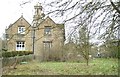
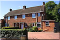
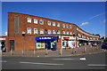
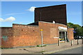
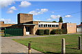
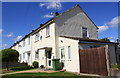
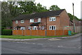
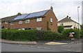
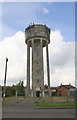
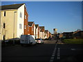
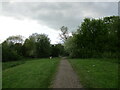
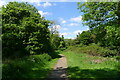
Photos of NN17 2UE
Area Information
NN17 2UE is a small residential cluster in Corby, Northamptonshire, a town designated a new town in 1950. The area covers 2.6 hectares and is home to 1,782 people, making it one of the most densely populated places in the UK, with 69,420 people per square kilometre. Corby’s history as an industrial hub, shaped by the steelworks built in 1934, still influences its character today. The area is part of a town that once grew rapidly from a village of 1,500 to a population of 12,000 by 1939. Modern residents benefit from proximity to Corby Railway Station and nearby retail outlets like Co-op Welland and Spar. While the area lacks natural landscapes, its compact size and established infrastructure make it convenient for those seeking a practical, community-focused lifestyle. The median age of 47 suggests a mature population, with many residents likely drawn to the area for its historical roots and accessibility to transport links.
- Area Type
- Postcode
- Area Size
- 2.6 hectares
- Population
- 1782
- Population Density
- 2986 people/km²
NN17 2UE is primarily a home-ownership area, with 52% of properties owned by residents. The accommodation type is predominantly houses, which is notable given the area’s small size. This suggests a focus on family-oriented housing, though the high population density implies limited space for expansion. The presence of houses may appeal to buyers seeking more private living space, but the compact nature of the area means proximity to amenities and transport is a key feature. Given the town’s industrial history, property values may reflect a balance between historical infrastructure and modern demands. Buyers should consider the area’s limited size and the potential for shared community spaces, as well as the availability of nearby retail and transport links.
House Prices in NN17 2UE
Showing 58 properties
| Address | Type | Beds | Baths | Last Sale Price | Last Sale Date | |
|---|---|---|---|---|---|---|
| 9 Wensleydale Park, Corby, NN17 2UE | house | - | - | £185,000 | Sep 2025 | |
| 55 Wensleydale Park, Corby, NN17 2UE | Bungalow | 2 | 1 | £225,000 | Jan 2025 | |
| 57 Wensleydale Park, Corby, NN17 2UE | Bungalow | - | - | £293,000 | Jan 2024 | |
| 45 Wensleydale Park, Corby, NN17 2UE | Bungalow | 3 | 1 | £250,000 | Dec 2023 | |
| 50 Wensleydale Park, Corby, NN17 2UE | Bungalow | 3 | 1 | £280,000 | Oct 2023 | |
| 42 Wensleydale Park, Corby, NN17 2UE | Semi-detached | 3 | 1 | £238,000 | Feb 2023 | |
| 31 Wensleydale Park, Corby, NN17 2UE | house | - | - | £245,000 | Sep 2022 | |
| 37 Wensleydale Park, Corby, NN17 2UE | house | - | - | £200,000 | Jan 2020 | |
| 11 Wensleydale Park, Corby, NN17 2UE | Semi-detached | 2 | 1 | £145,000 | Dec 2019 | |
| 35 Wensleydale Park, Corby, NN17 2UE | house | - | - | £134,000 | Mar 2019 |
Energy Efficiency in NN17 2UE
The lifestyle in NN17 2UE is shaped by its proximity to essential amenities. Retail options include Co-op Welland, Spar, and Co-op Occupation, offering everyday shopping needs within practical reach. The area’s small size means most services are accessible on foot or by bike, though larger retail centres would require a trip to Corby town centre. The historical industrial character of Corby influences the local atmosphere, with a focus on practicality and community. While the data does not mention parks or leisure facilities, the railway station provides a connection to broader recreational opportunities. The compact nature of the area fosters a close-knit community, though the high population density may affect the availability of private outdoor space.
Amenities
Schools
| Rank | School | Type | Entry gender | Ages |
|---|
Explore more schools in this area
Go to Schools tabDemographics
The population of NN17 2UE is 1,782, with a median age of 47 and the majority of residents aged 30–64. This indicates a mature community, likely comprising professionals, retirees, and families with established careers. Home ownership stands at 52%, with houses being the primary accommodation type. The predominant ethnic group is White, reflecting the area’s historical ties to industrial migration patterns. The high population density of 69,420 people per square kilometre suggests a tightly packed residential layout, which may influence the availability of private outdoor space. While the data does not specify deprivation levels, the high density and age profile suggest a mix of long-term residents and those seeking affordability in a town with a strong industrial legacy.
Household Size
Accommodation Type
Tenure
Ethnic Group
Religion
Household Composition
Age
Household Deprivation
NS-SEC
Explore more demographic insights in this area
Go to Demographics tabPlanning
Planning Constraints
- Flood RiskPremium
- Ramsar Wetland SitesPremium
- Area of Outstanding Natural BeautyPremium
- Protected Nature ReservePremium
- Protected WoodlandPremium