Area Overview for NN17 1YR
Photos of NN17 1YR
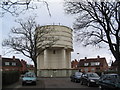
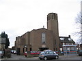
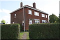
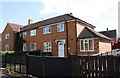
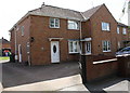
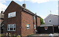
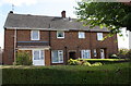
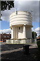
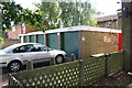
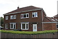
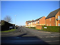
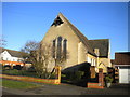
38 photos from this area
Area Information
Key information about the NN17 1YR including its size, population, and administrative classification.
- Area Type
- Postcode
- Area Size
- 5.4 hectares
- Population
- 1428
- Population Density
- 1558 people/km²
House Prices in NN17 1YR
60
Properties
£134,937
Average Sold Price
£39,000
Lowest Price
£285,000
Highest Price
Showing 60 properties
| Address | Type | Beds | Baths | Last Sale Price | Last Sale Date | |
|---|---|---|---|---|---|---|
| 107 Charnwood Road, Corby, NN17 1YR | house | 3 | 1 | £285,000 | Jun 2024 | |
| 67 Charnwood Road, Corby, NN17 1YR | house | - | - | £210,000 | Mar 2023 | |
| 75 Charnwood Road, Corby, NN17 1YR | house | - | - | £273,000 | Jan 2023 | |
| 101 Charnwood Road, Corby, NN17 1YR | house | - | - | £216,000 | Nov 2022 | |
| 66 Charnwood Road, Corby, NN17 1YR | Detached | 3 | 1 | £225,000 | Mar 2022 | |
| 97 Charnwood Road, Corby, NN17 1YR | house | - | - | £198,000 | Jan 2022 | |
| 76 Charnwood Road, Corby, NN17 1YR | Semi-detached | 3 | - | £219,995 | Jul 2021 | |
| 96 Charnwood Road, Corby, NN17 1YR | house | - | - | £212,500 | Jul 2020 | |
| 78 Charnwood Road, Corby, NN17 1YR | Detached | 4 | 2 | £266,000 | Apr 2020 | |
| 61 Charnwood Road, Corby, NN17 1YR | house | - | - | £180,000 | Oct 2017 |
Page 1 of 6
Energy Efficiency in NN17 1YR
Amenities
Schools
| Rank | School | Type | Entry gender | Ages |
|---|
Explore more schools in this area
Go to Schools tabDemographics
Household Size
Two person
most common
Accommodation Type
Houses
most common
Tenure
48
majority
Ethnic Group
White
most common
Religion
N/A
most common
Household Composition
N/A
most common
Age
47
median
Adults (30-64 years)
most common
Household Deprivation
N/A
with no deprivation
NS-SEC
21
in Lower managerial occupations
Explore more demographic insights in this area
Go to Demographics tabPlanning
Planning Constraints
- Flood RiskPremium
- Ramsar Wetland SitesPremium
- Area of Outstanding Natural BeautyPremium
- Protected Nature ReservePremium
- Protected WoodlandPremium