Area Overview for NN17 1PB
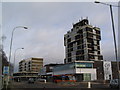
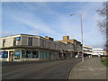
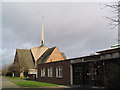
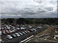
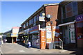
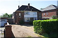
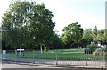
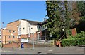
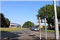
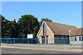
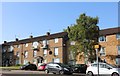
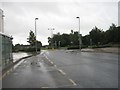
Photos of NN17 1PB
Area Information
Living in NN17 1PB means being part of Corby, a town in Northamptonshire with a distinct industrial heritage. This postcode covers a small residential cluster within the larger town, where 1,428 people live across just 1.1 hectares. The population density is exceptionally high at 127,412 people per square kilometre, reflecting a compact, tightly packed community. Corby itself was designated a new town in 1950, and its history is rooted in iron and steel production, which shaped its character. Today, the area is home to a mix of long-standing residents and those drawn to its proximity to retail and transport hubs. With a median age of 47 and a population skewed toward adults aged 30–64, the community is largely established, with a strong focus on family living. The presence of schools like Corby Technical School and nearby amenities such as Farmfoods Corby suggest a practical, service-oriented lifestyle. For buyers, NN17 1PB offers a snapshot of Corby’s evolving identity, where industrial past meets modern living.
- Area Type
- Postcode
- Area Size
- 1.1 hectares
- Population
- 1428
- Population Density
- 1558 people/km²
The property market in NN17 1PB is characterised by a 48% home ownership rate, indicating that nearly half of the area’s residents rent their homes. The predominant accommodation type is houses, which suggests a focus on family-sized properties rather than flats or apartments. This mix of ownership and rental options creates a dynamic market, but the small area size—just 1.1 hectares—means the housing stock is limited. Buyers should expect a compact selection of properties, with houses forming the bulk of available homes. The high population density of 127,412 people per square kilometre further underscores the scarcity of space, which may drive competition for properties in this postcode. For those considering NN17 1PB, the emphasis on houses implies a need to prioritise location over size, with proximity to amenities like Corby Railway Station and retail outlets such as Lidl Central being key factors.
House Prices in NN17 1PB
Showing 7 properties
| Address | Type | Beds | Baths | Last Sale Price | Last Sale Date | |
|---|---|---|---|---|---|---|
| Second Floor Flat, 30 New Post Office Square, Corby, NN17 1PB | Terraced | - | - | - | - | |
| Icon Clothing, Deene House, New Post Office Square, Corby, NN17 1PB | Retail | - | - | - | - | |
| Second Floor Flat, 31 New Post Office Square, Corby, NN17 1PB | Flat | - | - | - | - | |
| Nationwide, 16 New Post Office Square, Corby, NN17 1PB | retail_financial | - | - | - | - | |
| The Corby Candle, 1 New Post Office Square, Corby, NN17 1PB | restaurant_cafe | - | - | - | - | |
| Corby Supermarket, 3 New Post Office Square, Corby, NN17 1PB | retail_financial | - | - | - | - | |
| The Schooner, 8-9 New Post Office Square, Corby, NN17 1PB | restaurant_cafe | - | - | - | - |
Energy Efficiency in NN17 1PB
Life in NN17 1PB is shaped by its proximity to essential amenities, including five retail outlets such as Farmfoods Corby, Iceland Corby, and Lidl Central. These stores offer convenience for daily shopping, from groceries to household goods. The presence of Corby Railway Station further enhances accessibility, allowing residents to travel easily to other parts of the region. While the area lacks detailed information on parks or leisure facilities, the density of retail and transport options suggests a practical, service-oriented lifestyle. The compact nature of NN17 1PB means that most necessities are within walking or short driving distance, reducing the need for long commutes. For families, the availability of schools and shops in close proximity adds to the area’s appeal. The mix of retail and transport infrastructure ensures that daily life in NN17 1PB is efficient, though the absence of specific data on leisure or green spaces means these aspects remain unexplored in the current analysis.
Amenities
Schools
The schools near NN17 1PB include Firdale School and Forest Gate School, both of which are special schools catering to students with specific educational needs. Corby Technical School, an academy with an outstanding Ofsted rating, provides a broader secondary education option. This mix of school types offers families a range of choices, from specialist provisions to mainstream academic pathways. The presence of Corby Technical School, in particular, highlights the area’s commitment to quality education, as its outstanding rating suggests strong performance and resources. For parents, the availability of both special and mainstream schools ensures flexibility, whether their child requires tailored support or a traditional curriculum. The proximity of these institutions to NN17 1PB means families can access a comprehensive educational network without long commutes, reinforcing the area’s appeal for those prioritising schools in their home search.
| Rank | School | Type | Entry gender | Ages |
|---|
Explore more schools in this area
Go to Schools tabDemographics
The demographic profile of NN17 1PB is defined by its 1,428 residents, 48% of whom own their homes. The majority of the population falls within the 30–64 age range, indicating a community centred on working-age adults and families. The predominant ethnic group is White, which shapes the cultural and social dynamics of the area. With a median age of 47, the population is relatively mature, suggesting a stable, long-term resident base. The high home ownership rate of 48% contrasts with the 52% rental market, reflecting a balance between owner-occupied properties and private rentals. The area’s accommodation type is predominantly houses, which aligns with the traditional suburban layout of Corby. This mix of demographics and housing suggests a community that prioritises stability and family-oriented living. However, the high population density—127,412 people per square kilometre—means space is limited, influencing both housing availability and the character of daily life.
Household Size
Accommodation Type
Tenure
Ethnic Group
Religion
Household Composition
Age
Household Deprivation
NS-SEC
Explore more demographic insights in this area
Go to Demographics tabPlanning
Planning Constraints
- Flood RiskPremium
- Ramsar Wetland SitesPremium
- Area of Outstanding Natural BeautyPremium
- Protected Nature ReservePremium
- Protected WoodlandPremium