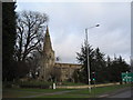
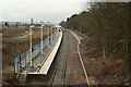
Area Overview for NN17 1DY
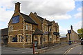
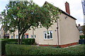
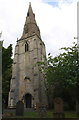
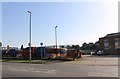
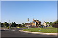
Photos of NN17 1DY


Area Information
NN17 1DY is a small, densely populated residential cluster in Corby, Northamptonshire. With a population of 1,445 spread across just 1.6 hectares, the area is compact and highly built-up, reflecting Corby’s history as a planned new town. The median age of 47 suggests a community of middle-aged adults, many of whom are homeowners—71% of households own their homes, with houses being the predominant accommodation type. This reflects a stable, long-term demographic, though the high population density of 89,797 people per square kilometre underscores the area’s limited space. Corby itself, designated a new town in 1950, has roots in industrial development, notably the Stewarts & Lloyds steelworks that transformed it from a village into a bustling hub. Today, NN17 1DY benefits from proximity to essential amenities, including retail outlets and a railway station, while its compact size means daily life is centred around local services and community networks.
- Area Type
- Postcode
- Area Size
- 1.6 hectares
- Population
- 1445
- Population Density
- 2960 people/km²
The property market in NN17 1DY is characterised by high home ownership—71% of residents live in owner-occupied homes—suggesting a community of long-term residents. The accommodation type is predominantly houses, reflecting a lack of flats or apartments in this small area. Given the compact size of NN17 1DY (just 1.6 hectares), the housing stock is limited, and the immediate surroundings likely offer few additional options. This makes the area attractive for buyers seeking a stable, established environment but may limit choice for those prioritising property diversity. The historical industrial legacy of Corby, with its focus on steelworks, may influence property values, though specific market trends are not detailed. Buyers should consider the area’s density and the proximity to essential services when evaluating its appeal.
House Prices in NN17 1DY
Showing 18 properties
| Address | Type | Beds | Baths | Last Sale Price | Last Sale Date | |
|---|---|---|---|---|---|---|
| 4 Lime Trees Grove, Corby, NN17 1DY | Semi-detached | 3 | 2 | £245,000 | Dec 2024 | |
| 11 Lime Trees Grove, Corby, NN17 1DY | Terraced | 3 | 1 | £255,000 | Dec 2023 | |
| 6 Lime Trees Grove, Corby, NN17 1DY | Semi-detached | 2 | 1 | £260,000 | May 2023 | |
| 17 Lime Trees Grove, Corby, NN17 1DY | Retail | 3 | 1 | £210,000 | Sep 2022 | |
| 13 Lime Trees Grove, Corby, NN17 1DY | Retail | 3 | 1 | £195,000 | Mar 2022 | |
| 9 Lime Trees Grove, Corby, NN17 1DY | house | - | - | £200,000 | Nov 2021 | |
| 15 Lime Trees Grove, Corby, NN17 1DY | house | - | - | £193,500 | Nov 2019 | |
| 3 Lime Trees Grove, Corby, NN17 1DY | house | - | - | £133,000 | May 2011 | |
| 10 Lime Trees Grove, Corby, NN17 1DY | house | - | - | £129,000 | Mar 2010 | |
| 1 Lime Trees Grove, Corby, NN17 1DY | Semi-detached | - | - | £124,995 | May 2006 |
Energy Efficiency in NN17 1DY
The lifestyle in NN17 1DY is shaped by its proximity to essential amenities within practical reach. Retail options include Co-op Occupation, Iceland Corby, and Tesco Corby, providing access to groceries and daily necessities. The Corby Railway Station offers transport links, though the area’s small size means leisure and recreational facilities are limited to what is immediately available. The lack of named parks or leisure venues suggests a focus on utilitarian living, with community life likely centred around local shops and transport. For residents, the convenience of nearby retail and rail services balances the area’s compact nature, though those seeking extensive leisure options may need to travel further.
Amenities
Schools
Residents of NN17 1DY have access to multiple primary schools, all named Our Lady of Walsingham Catholic Primary School. These include a junior school, an infant school in Corby, and a primary school with an Ofsted rating of “good.” The concentration of Catholic schools suggests a community with strong religious affiliation, though no secondary schools are listed in the data. Families with young children benefit from multiple options within walking distance, though parents seeking secondary education may need to look beyond the immediate area. The presence of four primary schools, including one with a positive Ofsted rating, indicates a focus on early education, but the lack of secondary provision could be a consideration for long-term family planning.
| Rank | School | Type | Entry gender | Ages |
|---|
Explore more schools in this area
Go to Schools tabDemographics
The community in NN17 1DY is predominantly middle-aged, with a median age of 47 and the most common age range being adults aged 30–64. This suggests a stable population with established households, though the area’s high population density—89,797 people per square kilometre—raises questions about living space per person. Home ownership is strong, at 71%, with houses being the primary accommodation type. The predominant ethnic group is White, though specific data on diversity is not provided. The age profile indicates a mature population, which may influence local services and social dynamics. With no data on deprivation levels, it is unclear how economic pressures might affect quality of life, but the high home ownership rate suggests a degree of financial stability.
Household Size
Accommodation Type
Tenure
Ethnic Group
Religion
Household Composition
Age
Household Deprivation
NS-SEC
Explore more demographic insights in this area
Go to Demographics tabPlanning
Planning Constraints
- Flood RiskPremium
- Ramsar Wetland SitesPremium
- Area of Outstanding Natural BeautyPremium
- Protected Nature ReservePremium
- Protected WoodlandPremium