Area Overview for NN16 9QS
Photos of NN16 9QS
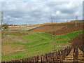
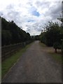
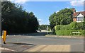
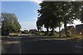
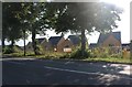
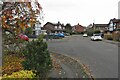
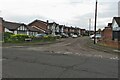
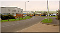
10 photos from this area
Area Information
Key information about the NN16 9QS including its size, population, and administrative classification.
- Area Type
- Postcode
- Area Size
- 1.8 hectares
- Population
- 1860
- Population Density
- 5869 people/km²
House Prices in NN16 9QS
35
Properties
£208,952
Average Sold Price
£75,000
Lowest Price
£410,000
Highest Price
Showing 35 properties
| Address | Type | Beds | Baths | Last Sale Price | Last Sale Date | |
|---|---|---|---|---|---|---|
| 87 Beatrice Road, Kettering, NN16 9QS | Detached | 3 | 2 | £410,000 | Feb 2024 | |
| 12 Beatrice Road, Kettering, NN16 9QS | Detached | - | - | £110,000 | Jul 2022 | |
| 60 Beatrice Road, Kettering, NN16 9QS | Detached | 3 | - | £335,000 | Mar 2022 | |
| 50 Beatrice Road, Kettering, NN16 9QS | Detached | 4 | 3 | £350,000 | Dec 2019 | |
| 70 Beatrice Road, Kettering, NN16 9QS | Semi-detached | 3 | 2 | £213,000 | Oct 2019 | |
| 59 Beatrice Road, Kettering, NN16 9QS | house | - | - | £292,000 | Dec 2018 | |
| 56 Beatrice Road, Kettering, NN16 9QS | Detached | 3 | 2 | £295,000 | Oct 2016 | |
| 55 Beatrice Road, Kettering, NN16 9QS | house | - | - | £241,000 | Dec 2014 | |
| 67 Beatrice Road, Kettering, NN16 9QS | house | - | - | £172,000 | Aug 2014 | |
| 66 Beatrice Road, Kettering, NN16 9QS | house | - | - | £250,000 | Apr 2014 |
Page 1 of 4
Energy Efficiency in NN16 9QS
Amenities
Schools
| Rank | School | Type | Entry gender | Ages |
|---|
Explore more schools in this area
Go to Schools tabDemographics
Household Size
Family (3-5 people)
most common
Accommodation Type
Houses
most common
Tenure
67
majority
Ethnic Group
White
most common
Religion
N/A
most common
Household Composition
N/A
most common
Age
47
median
Adults (30-64 years)
most common
Household Deprivation
N/A
with no deprivation
NS-SEC
29
in Lower managerial occupations
Explore more demographic insights in this area
Go to Demographics tabPlanning
Planning Constraints
- Flood RiskPremium
- Ramsar Wetland SitesPremium
- Area of Outstanding Natural BeautyPremium
- Protected Nature ReservePremium
- Protected WoodlandPremium