Area Overview for NN16 9PQ
Photos of NN16 9PQ
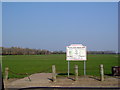
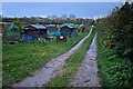
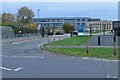
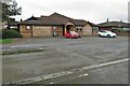
5 photos from this area
Area Information
Key information about the NN16 9PQ including its size, population, and administrative classification.
- Area Type
- Postcode
- Area Size
- 1.2 hectares
- Population
- 1578
- Population Density
- 6973 people/km²
House Prices in NN16 9PQ
33
Properties
£155,021
Average Sold Price
£32,500
Lowest Price
£325,000
Highest Price
Showing 33 properties
| Address | Type | Beds | Baths | Last Sale Price | Last Sale Date | |
|---|---|---|---|---|---|---|
| 119 Almond Road, Kettering, NN16 9PQ | Semi-detached | 3 | 1 | £270,000 | Jun 2025 | |
| 111 Almond Road, Kettering, NN16 9PQ | Semi-detached | 4 | 1 | £325,000 | Jan 2025 | |
| 115 Almond Road, Kettering, NN16 9PQ | house | - | - | £235,300 | Aug 2021 | |
| 114 Almond Road, Kettering, NN16 9PQ | house | - | - | £136,500 | Oct 2019 | |
| 107 Almond Road, Kettering, NN16 9PQ | house | - | - | £195,000 | Mar 2018 | |
| 87 Almond Road, Kettering, NN16 9PQ | Semi-detached | 2 | 1 | £125,000 | May 2016 | |
| 109 Almond Road, Kettering, NN16 9PQ | house | - | - | £91,500 | May 2010 | |
| 89 Almond Road, Kettering, NN16 9PQ | house | - | - | £123,000 | Nov 2008 | |
| 116 Almond Road, Kettering, NN16 9PQ | Terraced | - | - | £129,950 | Apr 2007 | |
| 108 Almond Road, Kettering, NN16 9PQ | Terraced | - | - | £86,500 | Mar 2006 |
Page 1 of 4
Energy Efficiency in NN16 9PQ
Amenities
Schools
| Rank | School | Type | Entry gender | Ages |
|---|
Explore more schools in this area
Go to Schools tabDemographics
Household Size
Family (3-5 people)
most common
Accommodation Type
Houses
most common
Tenure
55
majority
Ethnic Group
White
most common
Religion
N/A
most common
Household Composition
N/A
most common
Age
47
median
Adults (30-64 years)
most common
Household Deprivation
N/A
with no deprivation
NS-SEC
17
in Lower managerial occupations
Explore more demographic insights in this area
Go to Demographics tabPlanning
Planning Constraints
- Flood RiskPremium
- Ramsar Wetland SitesPremium
- Area of Outstanding Natural BeautyPremium
- Protected Nature ReservePremium
- Protected WoodlandPremium