Area Overview for NN16 9LL
Photos of NN16 9LL
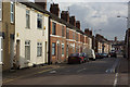
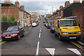
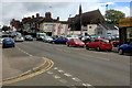
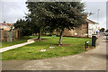
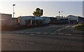
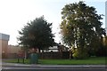
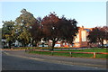
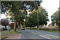
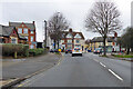
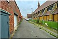
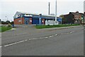
13 photos from this area
Area Information
Key information about the NN16 9LL including its size, population, and administrative classification.
- Area Type
- Postcode
- Area Size
- 9932 m²
- Population
- 1860
- Population Density
- 5869 people/km²
House Prices in NN16 9LL
40
Properties
£209,538
Average Sold Price
£71,500
Lowest Price
£350,000
Highest Price
Showing 40 properties
| Address | Type | Beds | Baths | Last Sale Price | Last Sale Date | |
|---|---|---|---|---|---|---|
| 84 Park Road, Kettering, NN16 9LL | Terraced | 3 | 1 | £290,000 | Jun 2024 | |
| 36 Park Road, Kettering, NN16 9LL | house | - | - | £320,000 | Jun 2023 | |
| 32 Park Road, Kettering, NN16 9LL | Semi-detached | 4 | 1 | £350,000 | May 2023 | |
| 64 Park Road, Kettering, NN16 9LL | Terraced | 4 | 2 | £265,000 | Jan 2023 | |
| 82 Park Road, Kettering, NN16 9LL | house | 3 | - | £285,000 | Jun 2022 | |
| 88 Park Road, Kettering, NN16 9LL | house | 4 | - | £310,000 | May 2022 | |
| 52 Park Road, Kettering, NN16 9LL | house | - | - | £307,500 | Apr 2022 | |
| 14 Park Road, Kettering, NN16 9LL | Terraced | 4 | 4 | £332,500 | Nov 2020 | |
| 70 Park Road, Kettering, NN16 9LL | Terraced | 3 | 1 | £260,000 | Mar 2018 | |
| 74 Park Road, Kettering, NN16 9LL | house | - | - | £192,000 | Jul 2014 |
Page 1 of 4
Energy Efficiency in NN16 9LL
Amenities
Schools
| Rank | School | Type | Entry gender | Ages |
|---|
Explore more schools in this area
Go to Schools tabDemographics
Household Size
Family (3-5 people)
most common
Accommodation Type
Houses
most common
Tenure
67
majority
Ethnic Group
White
most common
Religion
N/A
most common
Household Composition
N/A
most common
Age
47
median
Adults (30-64 years)
most common
Household Deprivation
N/A
with no deprivation
NS-SEC
29
in Lower managerial occupations
Explore more demographic insights in this area
Go to Demographics tabPlanning
Planning Constraints
- Flood RiskPremium
- Ramsar Wetland SitesPremium
- Area of Outstanding Natural BeautyPremium
- Protected Nature ReservePremium
- Protected WoodlandPremium