Area Overview for NN16 8UZ
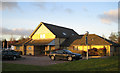
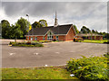
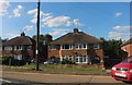
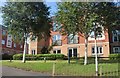
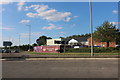
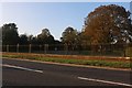
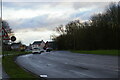
Photos of NN16 8UZ


Area Information
NN16 8UZ represents a specific residential cluster within the broader north of Kettering, a historic market town with roots tracing back to 956 AD. You are looking at a postcode covering 4.0 hectares, a compact footprint that defines the immediate neighbourhood dynamics. The area holds a population of 1482 residents, creating a tight-knit community rather than the anonymity often found in larger suburbs. This density results in 1031 people per square kilometre, ensuring services remain centrally accessible yet the streets feel local. Living in NN16 8UZ means you are part of a neighbourhood shaped by the area's transition from a Roman iron-smelting centre to an industrial hub famous for shoe-making. The town centre, centred around the Market Square and the High Street near the parish church of St Peter and St Paul, sits just a short distance away. You have access to the town's rich heritage, including the Sawyer family's Manor House museum and Tresher College in Windmill Road. Daily life here balances proximity to Kettering's historic character with the quietude of a defined residential zone. The location places you within a 75-mile radius of London, benefiting from a transport network established since the mid-19th century. Whether you value historical significance or convenient access to regional employment, this postcode offers a grounded slice of Northamptonshire living.
- Area Type
- Postcode
- Area Size
- 4.0 hectares
- Population
- 1482
- Population Density
- 1031 people/km²
You will find that homes in NN16 8UZ are characterised by a high level of private ownership within a stock primarily composed of houses. The data confirms that 65% of residents are homeowners, meaning the market is heavily weighted towards owner-occupiers rather than landlords or investors. This dynamic typically results in a stable environment where house values respond more to local demand than to short-term rental yields. Since the accommodation type is listed as houses, you can expect detached, semi-detached, or terraced family homes rather than high-rise developments or purpose-built student blocks. This mix suits families seeking garden space and long-term security over the volatile rental sector. The small area size of 4.0 hectares limits the sheer volume of properties available immediately within the postcode, creating a sense of exclusivity and scarcity. When buying in this specific cluster, you are entering a market where competition may be fierce for right-sized homes as the population stands at 1482 residents. The heritage of the area, once a shoemaking centre, likely influences the architectural style of many properties, featuring elements common to 19th-century industrial towns. Buyers looking for NN16 8UZ are likely prioritising established neighbourhoods over new builds, valuing the maturity of the current stock.
House Prices in NN16 8UZ
Showing 92 properties
Energy Efficiency in NN16 8UZ
Your daily life in NN16 8UZ benefits from immediate access to key retail and transport hubs situated within practical reach. You have five major retail options nearby, including Co-op COMF, Iceland Kettering, and Aldi Weekley, covering essential grocery and daily shopping needs without long drives. Transferring staff or visitors can utilise the bus interchange for local travel, while regular commuters rely on Kettering Railway Station for connections to the wider East Midlands. Living in this postcode means you do not require a car for every errand, as these amenities are concentrated close to the residential cluster. The area surrounds a 4.0 hectare residential zone where walking shortcuts to the main town centre are feasible. While specific parks or leisure venues are not listed in the immediate amenity data, the proximity to Kettering ensures access to the town's historic football clubs, museum, and royal chapel. Residents enjoy the convenience of weekly markets established in 1227, now housed in the modern shopping centre, alongside factory outowns and residential terraced streets marking the town's industrial past. The nearby bus interchange connects you to the broader network, reducing travel friction for social outings or appointments. This balance of near-term retail convenience and regional transport links defines the lifestyle of someone choosing this specific address.
Amenities
Schools
| Rank | School | Type | Entry gender | Ages |
|---|
Explore more schools in this area
Go to Schools tabDemographics
The community in NN16 8UZ reflects a mature demographic profile, which directly influences the local housing demand and school entry patterns. The median age stands at 47 years, indicating that most residents are adults rather than recent movers or families with very young children. The most common age range falls between 30 and 64 years, suggesting a population of established families and professionals settled in the area over time. Home ownership is a defining feature of this cluster, with 65% of residents owning their property outright or with a mortgage. This high figure suggests stability and long-term residency compared to areas dominated by rentals. Accommodation types are predominantly houses, fitting the description of a residential suburb rather than a flat-heavy urban district. The predominant ethnic group is White, aligning with the broader regional makeup of the East Midlands. You should expect a neighbourhood where neighbours have likely known each other for considerable periods. This demographic stability contributes to a low turnover of residents, fostering familiar streets and established routines. For anyone considering homes in NN16 8UZ, the age structure implies that schools near the area will cater primarily to teenagers and young adults, while local shops will serve a broad age group including active retirees and working professionals.
Household Size
Accommodation Type
Tenure
Ethnic Group
Religion
Household Composition
Age
Household Deprivation
NS-SEC
Explore more demographic insights in this area
Go to Demographics tabPlanning
Planning Constraints
- Flood RiskPremium
- Ramsar Wetland SitesPremium
- Area of Outstanding Natural BeautyPremium
- Protected Nature ReservePremium
- Protected WoodlandPremium