Area Overview for NN16 8PX
Photos of NN16 8PX
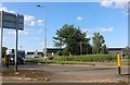
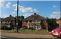
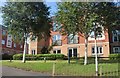
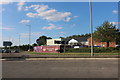
30 photos from this area
Area Information
Key information about the NN16 8PX including its size, population, and administrative classification.
- Area Type
- Postcode
- Area Size
- 16.3 hectares
- Population
- 1482
- Population Density
- 1031 people/km²
House Prices in NN16 8PX
7
Properties
-
Average Sold Price
-
Lowest Price
-
Highest Price
Showing 7 properties
| Address | Type | Beds | Baths | Last Sale Price | Last Sale Date | |
|---|---|---|---|---|---|---|
| S J Electronics Ltd, First Floor, Unit 3B, Vernon Court, Kettering, NN16 8PX | Industrial | - | - | - | - | |
| Oracle Asbestos Solutions, 4 Henson Way, Kettering, NN16 8PX | Industrial | - | - | - | - | |
| Rexson Systems Limited, Unit 1, Kingsthorne Park, Henson Way, Kettering, NN16 8PX | warehouse | - | - | - | - | |
| Kettering Bituminous Products Ltd, 12 Henson Close, Kettering, NN16 8PX | warehouse | - | - | - | - | |
| Certas Depot, Unit 3, Kingsthorne Park, Henson Way, Kettering, NN16 8PX | storage_distribution | - | - | - | - | |
| M's Beauty Natural Wellness, Unit 1, Adam Business Centre, Henson Way, Kettering, NN16 8PX | retail_financial | - | - | - | - | |
| Jewson, Henson Way, Kettering, NN16 8PX | shop | - | - | - | - |
Energy Efficiency in NN16 8PX
Amenities
Schools
| Rank | School | Type | Entry gender | Ages |
|---|
Explore more schools in this area
Go to Schools tabDemographics
Household Size
Two person
most common
Accommodation Type
Houses
most common
Tenure
65
majority
Ethnic Group
White
most common
Religion
N/A
most common
Household Composition
N/A
most common
Age
47
median
Adults (30-64 years)
most common
Household Deprivation
N/A
with no deprivation
NS-SEC
41
in Lower managerial occupations
Explore more demographic insights in this area
Go to Demographics tabPlanning
Planning Constraints
- Flood RiskPremium
- Ramsar Wetland SitesPremium
- Area of Outstanding Natural BeautyPremium
- Protected Nature ReservePremium
- Protected WoodlandPremium