Area Overview for NN16 8NH
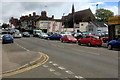
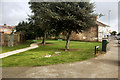
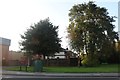
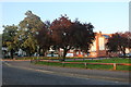
Photos of NN16 8NH


Area Information
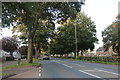
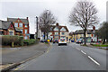
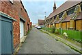
The postcode NN16 8NH identifies a specific residential cluster located within Kettering, a historic market town in Northamptonshire. This small neighbourhood forms part of a community of 2,123 residents, offering a quieter alternative to the town centre while maintaining access to established local amenities. Situated approximately eight miles north of Wellingborough and seventy-five miles from London, the area benefits from a strong industrial heritage rooted in the boot and shoe trade that began in the late 18th century. The name Kettering itself derives from Anglo-Saxon origins, meaning "the people of Ketter," dating back to a charter granted in 1227 by King Henry III. Residents of NN16 8NH live in an environment characterised by houses rather than flats, reflecting the town's traditional residential development. The area offers a stable setting where daily life revolves around practical access to schools, retail outlets, and transport links. The neighbourhood sits within a region that has seen significant transformation since the opening of the railway station in 1857, which connected the town to London by 1867. Living in NN16 8NH provides a connection to this historical narrative while offering modern conveniences for families and professionals. The low population density of this specific cluster ensures a sense of space without isolating residents from the wider services of Kettering.
- Area Type
- Postcode
- Area Size
- Not available
- Population
- 2123
- Population Density
- 11927 people/km²
The property market in NN16 8NH is defined by a housing stock consisting entirely of houses. This specific postcode area does not contain any flats or apartment blocks, creating a uniform environment for buyers and renters. With 34 percent of the local population owning their homes, the majority of residents are tenants. This dynamic means that the area functions more as a rental market than an owner-occupied estate. Potential buyers looking for properties in NN16 8NH should expect houses as their primary option. The lower ownership rate compared to national averages could reflect the age of the property stock or local economic factors influencing mortgage uptake. For those seeking to purchase, the mix is straightforward: houses only. There is no diversification into flat living within this cluster. The 34 percent ownership figure indicates that investors or private sellers dealing in the rental market may find more opportunity here than in areas where ownership exceeds fifty percent. Residents who rent enjoy the stability of living in established houses without the burden of a mortgage, but they face less equity growth than owners. The lack of mixed-tenure developments like housing associations or flats suggests a traditional market structure. If you prefer the specific layout and space of a house, NN16 8NH delivers exactly that. Buyers should be aware that purchasing power dynamics are different here due to the high number of tenants relative to owners. The area serves as a practical residential base for those prioritising house living over the convenience of flats.
House Prices in NN16 8NH
No properties found in this postcode.
Energy Efficiency in NN16 8NH
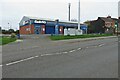
Everyday life in NN16 8NH involves easy access to a variety of retail and transport amenities. Residents can shop at Iceland Kettering, Sainsburys Kettering, and the Co-op Stamford, providing all the daily essentials for food and household goods. These stores are located within practical reach of the neighbourhood, ensuring residents do not need to travel far for basic needs. Transport options include a bus interchange, plus access to Kettering Railway Station and Corby Railway Station. This variety supports commuting to London or local travel across Northamptonshire. The area is part of the historic town of Kettering, which features landmarks like the parish church of St Peter and St Paul. The Sawyer family's Manor House operates as a museum, and Toller Chapel remains a historic feature built in 1723. While specific parks or leisure centres are not named in the immediate amenity list, the town infrastructure supports a wide range of activities. The presence of Tresham College and a Grammar School in Windmill Road highlights the town's educational focus. Living in NN16 8NH offers a blend of historic charm and modern retail convenience. You can enjoy a walk past historic sites while having supermarkets nearby. The proximity to these amenities makes daily errands simple and efficient for all household members.
Amenities
Schools
Families living in NN16 8NH have access to several education providers within the Kettering area. The nearest primary options include Park Junior School and Kettering Park Infant School. Both institutions sit in the primary category, offering early education for local children. Closer to secondary transition age, Kettering Park Infant Academy and Kettering Park Junior Academy provide academy placements. Both of these academies hold a good Ofsted rating, indicating a standard of education that meets regulatory requirements. This configuration offers two distinct primary schools and a secondary-level academy chain close by. The presence of academy status at the park schools means these institutions operate under different governing frameworks than community or voluntary-aided schools. For families moving to NN16 8NH, this proximity to schools rated good provides a clear educational baseline. The mix includes both infant and junior designations, suggesting a geographic spread of children through different stages of their primary schooling. While secondary schools are not listed in the immediate data for this postcode, the nearby academies indicate a structured educational network in the wider Kettering region. Parents should verify catchment areas for Kettering Park Infant Academy and Kettering Park Junior Academy if they intend to settle permanently in NN16 8NH. The local cluster supports families with young children through these specific named institutions.
| Rank | School | Type | Entry gender | Ages |
|---|
Explore more schools in this area
Go to Schools tabDemographics
The community in NN16 8NH reflects a mature age profile, with a median age of 47. The most common age range comprises adults between 30 and 64 years, suggesting a population stable in mid-life rather than dominated by young families or retirees. Approximately 34 percent of households own their properties, indicating that a significant majority reside in the rental sector. This high proportion of rental homes contrasts with the area's accommodation type, which consists exclusively of houses. There are no flats or apartment blocks recorded in this specific postcode cluster. The predominant ethnic group within NN16 8NH is White, aligning with the broader demographic trends of many established market towns in the East Midlands. This area does not display data for other specific sectors such as deprivation indices or income levels. The demographic reality points to a residential zone where established households often rent rather than own, a pattern distinct from newer developments where ownership is usually higher. The absence of young children in the primary age bracket suggests that families with young dependents may be less prevalent here compared to areas with a lower median age. Instead, the population likely includes working professionals and adults supporting themselves without small children. The housing stock of houses supports single-family living, fitting the demographic of older adults or couples without young dependents.
Household Size
Accommodation Type
Tenure
Ethnic Group
Religion
Household Composition
Age
Household Deprivation
NS-SEC
Explore more demographic insights in this area
Go to Demographics tabPlanning
Planning Constraints
- Flood RiskPremium
- Ramsar Wetland SitesPremium
- Area of Outstanding Natural BeautyPremium
- Protected Nature ReservePremium
- Protected WoodlandPremium