Area Overview for NN15 7NX
Photos of NN15 7NX


Area Information
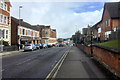
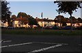
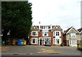
Living in NN15 7NX places you within a specific residential cluster in Kettering, a historic market town in Northamptonshire. This postcode covers an area of 1,215 square metres, housing a population of 2,344 residents. The location inherits the town's legacy, developing from a modest Anglo-Saxon settlement into an industrial centre known for boot manufacturing. You are situated approximately 8 miles north of Wellingborough and 75 miles from London, offering a balance between town living and regional connectivity. The neighbourhood is defined by its proximity to landmarks such as the parish church of St Peter and St Paul, which features a distinctive crocketed spire just off the Market Square. The area has deep historical roots, with documented history dating back to 956 AD when King Edwy granted land to Ælfsige the Goldsmith. Industrial transformation occurred in the late 18th century following Thomas Gotch founding his shoe-making enterprise in 1778. The opening of Kettering railway station in 1857 provided crucial economic stimulus, linking the town to London by 1867. Today, the residential cluster retains these characteristics while serving a community dominated by adults. You find yourselves in a setting rich in heritage, where modern life intersects with centuries of tradition, making it a distinct choice for those seeking a grounded environment within the East Midlands.
- Area Type
- Postcode
- Area Size
- 1215 m²
- Population
- 2344
- Population Density
- 7863 people/km²
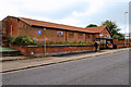
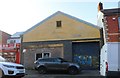
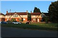
The property market in NN15 7NX is characterised by a clear predominance of houses, which are the primary accommodation type for residents. With 48% of households owning their homes, the area demonstrates healthy homeownership levels, suggesting a stable investment environment. This ownership rate implies that many residents have deep roots in the community, often associating with the historic fabric of Kettering and its older districts. The remaining 52% of the market likely consists of private rented accommodation, catering to professionals or smaller households seeking flexible living arrangements. Given the small footprint of 1,215 square metres, finding homes in NN15 7NX requires focusing on the immediate cluster rather than a wide neighbourhood. Buyers should expect properties that reflect the town's industrial history, potentially including converted period homes or traditional houses built during the 19th-century shoe manufacturing boom. The mix of owned and rented stock creates a flexible market, though the dominance of single-family homes limits options for those specifically seeking flats. Prices and values are supported by the 48% ownership figure, indicating that sellers often have a vested interest in maintaining property standards. This makes NN15 7NX a practical choice for buyers prioritising space and traditional house layouts over urban convenience.
House Prices in NN15 7NX
Showing 1 properties
| Address | Type | Beds | Baths | Last Sale Price | Last Sale Date | |
|---|---|---|---|---|---|---|
| Pharmacy, Medical Centre, 54 Linden Avenue, Kettering, NN15 7NX | retail_financial | - | - | - | - |
Energy Efficiency in NN15 7NX
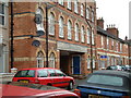
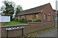
Daily life in NN15 7NX benefits from a range of amenities within practical reach of the 2,344 residents living in this small cluster. For retail needs, you have access to five key locations, including the Tesco Kettering Windmill, the main Tesco Kettering, and the Co-op Stamford. These supermarkets provide comprehensive shopping options for groceries and household essentials without requiring a long journey. Transport infrastructure supports a mobile lifestyle, with a dedicated Bus Interchange nearby and Kettering Railway Station located just a short distance away. This allows you to access Wellingborough, which lies 8 miles south, or travel towards London via the Midland Railway branches. The area's character is enriched by historical sites, such as the parish church of St Peter and St Paul with its famous spire, and local heritage spots like the Sawyer family's Manor House in Sheep Street, now a museum. Shopping and transport conveniences are closely integrated with historical charm, offering a balanced lifestyle where modern convenience meets town history.
Amenities
Schools
Families considering NN15 7NX will find educational options anchored by St Mary's Church of England Voluntary Aided Primary School. This institution serves the local community and holds an Ofsted rating of good, signifying a level of quality that meets national educational standards. As a voluntary aided primary school, it operates under the Church of England structure while receiving state funding, ensuring a curriculum that balances religious values with academic requirements. Currently, the data lists only this specific primary institution for the immediate vicinity of NN15 7NX. For parents with older children, hoping to find comprehensive schools or secondary options relies on looking slightly beyond this specific postcode cluster, as the provided information restricts school references to this primary facility. The presence of a rated good primary school suggests a foundational education level available to young residents without a long commute. If you require secondary education, you must expand your search scope beyond NN15 7NX, as no secondary schools appear in the provided dataset for this immediate area.
| Rank | School | Type | Entry gender | Ages |
|---|
Explore more schools in this area
Go to Schools tabDemographics
The community in NN15 7NX is defined by a mature age profile, with a median age of 47 years. Most residents fall into the 30 to 64 years age range, indicating an area populated primarily by established adults rather than young families or retirees. This demographic skew influences the local culture, favouring stability over trend-driven retail. Home ownership stands at 48%, meaning roughly half of the households in this postcode own their properties outright or with a mortgage, while the remainder likely rent. The predominant accommodation type in NN15 7NX is houses, reflecting a preference for detached or semi-detached living over flats. This aligns with the residential cluster description and the historical development of the town's terraced streets near former factories. The ethnic composition is predominantly White, which mirrors the broader demographic trends often found in historic East Midlands towns. With a population density figure suggesting a concentrated living environment, the area feels intimate despite being part of a larger market town. You are surrounded by neighbours who have likely lived in the area for significant periods, contributing to a stable social fabric without the bustle of a high-density urban centre.
Household Size
Accommodation Type
Tenure
Ethnic Group
Religion
Household Composition
Age
Household Deprivation
NS-SEC
Explore more demographic insights in this area
Go to Demographics tabPlanning
Planning Constraints
- Flood RiskPremium
- Ramsar Wetland SitesPremium
- Area of Outstanding Natural BeautyPremium
- Protected Nature ReservePremium
- Protected WoodlandPremium