Area Overview for NN15 7NT
Photos of NN15 7NT
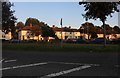
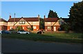
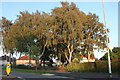

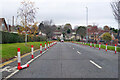
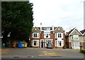
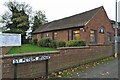
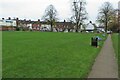
20 photos from this area
Area Information
Key information about the NN15 7NT including its size, population, and administrative classification.
- Area Type
- Postcode
- Area Size
- 3798 m²
- Population
- 1788
- Population Density
- 5007 people/km²
House Prices in NN15 7NT
12
Properties
£137,931
Average Sold Price
£75,000
Lowest Price
£199,995
Highest Price
Showing 12 properties
| Address | Type | Beds | Baths | Last Sale Price | Last Sale Date | |
|---|---|---|---|---|---|---|
| 147 Linden Avenue, Kettering, NN15 7NT | Terraced | 2 | 1 | £175,000 | Mar 2021 | |
| 161 Linden Avenue, Kettering, NN15 7NT | Semi-detached | 4 | 2 | £199,995 | Jun 2017 | |
| 158 Linden Avenue, Kettering, NN15 7NT | Semi-detached | 3 | 1 | £179,500 | Nov 2016 | |
| 149 Linden Avenue, Kettering, NN15 7NT | house | - | - | £104,000 | Jan 2013 | |
| 155 Linden Avenue, Kettering, NN15 7NT | Semi-detached | - | - | £128,000 | Jun 2007 | |
| 159 Linden Avenue, Kettering, NN15 7NT | Semi-detached | 3 | - | £137,000 | May 2006 | |
| 157 Linden Avenue, Kettering, NN15 7NT | Semi-detached | 3 | 1 | £104,950 | Jul 2004 | |
| 153 Linden Avenue, Kettering, NN15 7NT | Semi-detached | - | - | £75,000 | Oct 2002 | |
| 160 Linden Avenue, Kettering, NN15 7NT | Semi-detached | - | - | - | - | |
| 151 Linden Avenue, Kettering, NN15 7NT | house | - | - | - | - |
Page 1 of 2
Energy Efficiency in NN15 7NT
Amenities
Schools
| Rank | School | Type | Entry gender | Ages |
|---|
Explore more schools in this area
Go to Schools tabDemographics
Household Size
Two person
most common
Accommodation Type
Houses
most common
Tenure
74
majority
Ethnic Group
White
most common
Religion
N/A
most common
Household Composition
N/A
most common
Age
47
median
Adults (30-64 years)
most common
Household Deprivation
N/A
with no deprivation
NS-SEC
30
in Lower managerial occupations
Explore more demographic insights in this area
Go to Demographics tabPlanning
Planning Constraints
- Flood RiskPremium
- Ramsar Wetland SitesPremium
- Area of Outstanding Natural BeautyPremium
- Protected Nature ReservePremium
- Protected WoodlandPremium