Area Overview for NN15 6NY
Photos of NN15 6NY

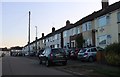
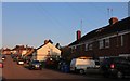
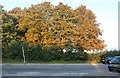
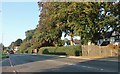
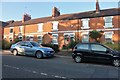
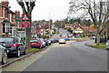
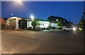
31 photos from this area
Area Information
Key information about the NN15 6NY including its size, population, and administrative classification.
- Area Type
- Postcode
- Area Size
- 1.5 hectares
- Population
- 1481
- Population Density
- 2378 people/km²
House Prices in NN15 6NY
48
Properties
£146,871
Average Sold Price
£35,000
Lowest Price
£245,000
Highest Price
Showing 48 properties
| Address | Type | Beds | Baths | Last Sale Price | Last Sale Date | |
|---|---|---|---|---|---|---|
| 68 Wallis Road, Kettering, NN15 6NY | Semi-detached | 3 | 1 | £232,000 | Sep 2025 | |
| 58 Wallis Road, Kettering, NN15 6NY | Semi-detached | 3 | 1 | £228,000 | Nov 2024 | |
| 41 Wallis Road, Kettering, NN15 6NY | Semi-detached | 3 | 1 | £245,000 | Sep 2024 | |
| 82 Wallis Road, Kettering, NN15 6NY | Semi-detached | 3 | 2 | £225,000 | Jun 2024 | |
| 38 Wallis Road, Kettering, NN15 6NY | Terraced | 3 | 2 | £123,000 | Oct 2023 | |
| 29 Wallis Road, Kettering, NN15 6NY | house | - | - | £220,000 | Dec 2022 | |
| 60 Wallis Road, Kettering, NN15 6NY | Semi-detached | 3 | 1 | £228,000 | Oct 2022 | |
| 74 Wallis Road, Kettering, NN15 6NY | house | 3 | 1 | £245,000 | Jun 2022 | |
| 40 Wallis Road, Kettering, NN15 6NY | house | - | - | £175,000 | Jan 2022 | |
| 35 Wallis Road, Kettering, NN15 6NY | Semi-detached | 3 | 1 | £200,000 | Mar 2019 |
Page 1 of 5
Energy Efficiency in NN15 6NY
Amenities
Schools
| Rank | School | Type | Entry gender | Ages |
|---|
Explore more schools in this area
Go to Schools tabDemographics
Household Size
Two person
most common
Accommodation Type
Houses
most common
Tenure
87
majority
Ethnic Group
White
most common
Religion
N/A
most common
Household Composition
N/A
most common
Age
47
median
Adults (30-64 years)
most common
Household Deprivation
N/A
with no deprivation
NS-SEC
29
in Lower managerial occupations
Explore more demographic insights in this area
Go to Demographics tabPlanning
Planning Constraints
- Flood RiskPremium
- Ramsar Wetland SitesPremium
- Area of Outstanding Natural BeautyPremium
- Protected Nature ReservePremium
- Protected WoodlandPremium