Area Overview for NN14 4NG
Photos of NN14 4NG
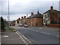
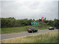
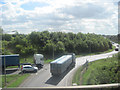
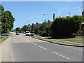

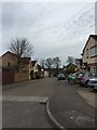
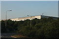
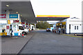
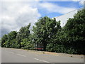
27 photos from this area
Area Information
Key information about the NN14 4NG including its size, population, and administrative classification.
- Area Type
- Postcode
- Area Size
- 2.8 hectares
- Population
- 1990
- Population Density
- 1480 people/km²
House Prices in NN14 4NG
32
Properties
£304,453
Average Sold Price
£62,100
Lowest Price
£750,000
Highest Price
Showing 32 properties
| Address | Type | Beds | Baths | Last Sale Price | Last Sale Date | |
|---|---|---|---|---|---|---|
| 131 Huntingdon Road, Thrapston, NN14 4NG | house | - | - | £735,000 | Feb 2025 | |
| 95 Huntingdon Road, Thrapston, NN14 4NG | Terraced | 2 | 1 | £195,000 | Jan 2025 | |
| 101 Huntingdon Road, Thrapston, NN14 4NG | Semi-detached | 2 | 1 | £200,000 | Oct 2024 | |
| 119 Huntingdon Road, Thrapston, NN14 4NG | house | - | - | £422,000 | Aug 2024 | |
| 123 Huntingdon Road, Thrapston, NN14 4NG | Semi-detached | 5 | 3 | £434,000 | Dec 2023 | |
| 147 Huntingdon Road, Thrapston, NN14 4NG | Semi-detached | 3 | 1 | £378,500 | Oct 2022 | |
| 109 Huntingdon Road, Thrapston, NN14 4NG | house | - | - | £355,000 | Jul 2022 | |
| 97 Huntingdon Road, Thrapston, NN14 4NG | house | - | - | £168,000 | Sep 2021 | |
| 137 Huntingdon Road, Thrapston, NN14 4NG | Detached | 4 | 3 | £750,000 | Aug 2020 | |
| 151 Huntingdon Road, Thrapston, NN14 4NG | house | 4 | - | £425,000 | Apr 2017 |
Page 1 of 4
Energy Efficiency in NN14 4NG
Amenities
Schools
| Rank | School | Type | Entry gender | Ages |
|---|
Explore more schools in this area
Go to Schools tabDemographics
Household Size
Family (3-5 people)
most common
Accommodation Type
Houses
most common
Tenure
78
majority
Ethnic Group
White
most common
Religion
N/A
most common
Household Composition
N/A
most common
Age
47
median
Adults (30-64 years)
most common
Household Deprivation
N/A
with no deprivation
NS-SEC
36
in Lower managerial occupations
Explore more demographic insights in this area
Go to Demographics tabPlanning
Planning Constraints
- Flood RiskPremium
- Ramsar Wetland SitesPremium
- Area of Outstanding Natural BeautyPremium
- Protected Nature ReservePremium
- Protected WoodlandPremium