Area Overview for NN14 1GE
Photos of NN14 1GE
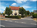
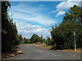
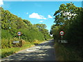
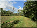
10 photos from this area
Area Information
Key information about the NN14 1GE including its size, population, and administrative classification.
- Area Type
- Postcode
- Area Size
- 2.4 hectares
- Population
- 1710
- Population Density
- 1999 people/km²
House Prices in NN14 1GE
28
Properties
£308,649
Average Sold Price
£157,000
Lowest Price
£562,500
Highest Price
Showing 28 properties
| Address | Type | Beds | Baths | Last Sale Price | Last Sale Date | |
|---|---|---|---|---|---|---|
| 43 Loddington Way, Mawsley, NN14 1GE | Detached | 4 | 3 | £427,500 | Dec 2025 | |
| 6 Loddington Way, Mawsley, NN14 1GE | house | 3 | 2 | £389,000 | Oct 2024 | |
| 5 Loddington Way, Mawsley, NN14 1GE | Detached | 5 | 3 | £562,500 | Oct 2022 | |
| 11 Loddington Way, Mawsley, NN14 1GE | house | - | - | £470,000 | Feb 2021 | |
| 47 Loddington Way, Mawsley, NN14 1GE | house | - | - | £380,000 | Aug 2020 | |
| 12 Loddington Way, Mawsley, NN14 1GE | Detached | 4 | - | £400,000 | Aug 2018 | |
| 41 Loddington Way, Mawsley, NN14 1GE | Detached | 6 | - | £495,000 | May 2018 | |
| 10 Loddington Way, Mawsley, NN14 1GE | Detached | 5 | 3 | £417,500 | Mar 2018 | |
| 39 Loddington Way, Mawsley, NN14 1GE | Terraced | 3 | - | £215,000 | Dec 2017 | |
| 7 Loddington Way, Mawsley, NN14 1GE | Detached | 6 | - | £380,000 | Dec 2015 |
Page 1 of 3
Energy Efficiency in NN14 1GE
Amenities
Schools
| Rank | School | Type | Entry gender | Ages |
|---|
Explore more schools in this area
Go to Schools tabDemographics
Household Size
Family (3-5 people)
most common
Accommodation Type
Houses
most common
Tenure
79
majority
Ethnic Group
White
most common
Religion
N/A
most common
Household Composition
N/A
most common
Age
47
median
Adults (30-64 years)
most common
Household Deprivation
N/A
with no deprivation
NS-SEC
50
in Lower managerial occupations
Explore more demographic insights in this area
Go to Demographics tabPlanning
Planning Constraints
- Flood RiskPremium
- Ramsar Wetland SitesPremium
- Area of Outstanding Natural BeautyPremium
- Protected Nature ReservePremium
- Protected WoodlandPremium