Area Overview for NN13 7DB
Photos of NN13 7DB
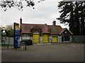
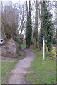
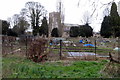
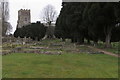
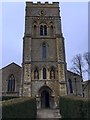
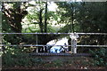
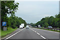
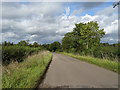
24 photos from this area
Area Information
Key information about the NN13 7DB including its size, population, and administrative classification.
- Area Type
- Postcode
- Area Size
- 1.4 hectares
- Population
- 1458
- Population Density
- 1416 people/km²
House Prices in NN13 7DB
43
Properties
£280,543
Average Sold Price
£37,000
Lowest Price
£765,000
Highest Price
Showing 43 properties
| Address | Type | Beds | Baths | Last Sale Price | Last Sale Date | |
|---|---|---|---|---|---|---|
| 16 St Peters Road, Brackley, NN13 7DB | Cottage | 3 | 1 | £415,000 | Dec 2025 | |
| 32 St Peters Road, Brackley, NN13 7DB | Semi-detached | 2 | 1 | £285,000 | Sep 2025 | |
| 30 St Peters Road, Brackley, NN13 7DB | Terraced | 2 | 1 | £265,000 | Jun 2025 | |
| St Peters House, 2 St Peters Road, Brackley, NN13 7DB | Semi-detached | 7 | 3 | £675,000 | Jul 2024 | |
| Magpie Cottage, 42 St Peters Road, Brackley, NN13 7DB | Detached | 3 | 1 | £515,000 | Jun 2024 | |
| 20A St Peters Road, Brackley, NN13 7DB | house | - | - | £360,000 | Dec 2023 | |
| Tanglewood, 1 St Peters Road, Brackley, NN13 7DB | house | 4 | - | £765,000 | Mar 2023 | |
| 36 St Peters Road, Brackley, NN13 7DB | Terraced | 2 | 1 | £265,000 | Mar 2023 | |
| 26 St Peters Road, Brackley, NN13 7DB | Terraced | 2 | 1 | £270,000 | Jun 2022 | |
| 10 St Peters Road, Brackley, NN13 7DB | house | - | - | £195,000 | Dec 2021 |
Page 1 of 5
Energy Efficiency in NN13 7DB
Amenities
Schools
| Rank | School | Type | Entry gender | Ages |
|---|
Explore more schools in this area
Go to Schools tabDemographics
Household Size
Two person
most common
Accommodation Type
Houses
most common
Tenure
68
majority
Ethnic Group
White
most common
Religion
N/A
most common
Household Composition
N/A
most common
Age
47
median
Adults (30-64 years)
most common
Household Deprivation
N/A
with no deprivation
NS-SEC
35
in Lower managerial occupations
Explore more demographic insights in this area
Go to Demographics tabPlanning
Planning Constraints
- Flood RiskPremium
- Ramsar Wetland SitesPremium
- Area of Outstanding Natural BeautyPremium
- Protected Nature ReservePremium
- Protected WoodlandPremium