Area Overview for NN13 6YA
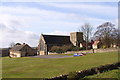
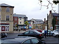
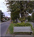
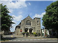
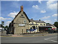
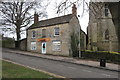
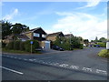
Photos of NN13 6YA


Area Information
Living in NN13 6YA offers a quiet residential experience within a small postcode cluster. This specific area encompasses a population of 1,491 people, creating a close-knit environment rather than a large urban sprawl. You will find yourself in a setting defined by stationary houses rather than high-rise developments. The majority of residents are adults aged between 30 and 64 years, indicating a demographic focused on stability and family life. Daily life here is manageable and practical, with access to essential services and transport links nearby. Residents of NN13 6YA benefit from a community that respects privacy while remaining well-connected to the wider region. The area avoids significant planning constraints such as flood risks or protected nature reserves, ensuring development standards remain predictable. You can expect a low flood risk environment with no designated Ramsar wetland sites or Areas of Outstanding Natural Beauty affecting immediate property concerns. Crime rates in NN13 6YA stand below the national average, contributing to a secure atmosphere for households. This location suits those who prefer established neighbourhoods with clear boundaries and reliable infrastructure. The character of NN13 6YA is defined by its homeownership density and lack of major industrial or commercial noise within the immediate residential cluster.
- Area Type
- Postcode
- Area Size
- Not available
- Population
- 1491
- Population Density
- 5226 people/km²
The property market in NN13 6YA is characterised by a substantial existing homeowner base. With 88 percent of the local population owning their homes, the area functions primarily as an owner-occupied zone. This high ownership rate typically results in a slower market with fewer transactions compared to rental hotspots. Buyers looking at homes in NN13 6YA are entering an established stock where properties have remained with single families for many years. The accommodation type is exclusively houses, meaning you will not find flats, terraced units, or bungalows as the primary housing stock. This uniformity simplifies the search for those seeking a detached or semi-detached lifestyle. Because the area is a small residential cluster covering the NN13 6YA postcode, buyers often look at immediate surroundings to expand their options. The lack of rental properties suggests that investment potential relies on long-term stability and local improvement plans rather than short-term let opportunities. Whether you are moving from rental accommodation or upgrading from a different estate, the nature of homes in NN13 6YA demands preparation. You should plan for a market where sellers are less frequent and negotiations may take longer due to the low turnover of single-family ownership.
House Prices in NN13 6YA
No properties found in this postcode.
Energy Efficiency in NN13 6YA
Your daily lifestyle in NN13 6YA is defined by proximity to established retail outlets and transport hubs. Within practical reach, you have five key retail venues including Tesco Brackley, Co-op High, and Waitrose Brackley. These supermarkets offer comprehensive grocery needs without requiring long drives to larger towns. The presence of an airport, Turweston Airport, nearby adds a layer of convenience for business travel or leisure flights. Kings Sutton Railway Station provides rail connectivity for those needing regular train services to connect with wider cities. Living in NN13 6YA means you can access daily essentials from Tesco Brackley and Waitrose Brackley without leaving the region. Shopping trips at Co-op High remain quick and manageable from your home. While parks or leisure centers are not explicitly named in this data, the retail density suggests a self-sufficient shopping environment. You do not need to travel far for food or household goods. The combination of rail access and local supermarkets creates a balanced routine. Buying homes in NN13 6YA places you within a short drive of an airport and high-street shopping. This accessibility reduces the need to stay up-to-date with drugstore schedules far away. The lifestyle here prioritises convenience through major chain stores like Waitrose Brackley and Tesco Brackley.
Amenities
Schools
Families living in NN13 6YA have direct access to Bracken Leas Primary School. This institution is located just beyond the immediate neighbourhood and holds a good Ofsted rating. The school serves as the primary educational option for children in this locality. No secondary schools are listed within the immediate data, suggesting students travel further for higher education or attend institutions in nearby towns like Brackley. The presence of Bracken Leas Primary School supports parents seeking a good-ofsted labelled facility close to home. Living in NN13 6YA means your children can start their education journey without crossing significant distances. The school type is specifically primary, indicating that the area caters to early years and primary stage development. For families requiring secondary options, the nearest school data does not provide specific names, suggesting you must check neighboring postcodes. Nevertheless, the capacity to attend a good-rated primary school adds tangible value to homes in NN13 6YA. Schools near NN13 6YA include only Bracken Leas Primary School based on current records. This focused educational offering makes the area attractive for those with young children before school moves to secondary levels.
| Rank | School | Type | Entry gender | Ages |
|---|---|---|---|---|
| 1 | Bracken Leas Primary School | primary | N/A | N/A |
| 2 | Bracken Leas Primary School | primary | N/A | N/A |
Explore more schools in this area
Go to Schools tabDemographics
The community in NN13 6YA reflects a mature and stable household structure. The median age for residents is 47 years, placing the most common age range squarely in adulthood between 30 and 64 years. This demographic profile suggests a population prioritising long-term living arrangements over rapid turnover. Homeownership is the dominant habit, with 88 percent of households owning their properties outright or with a mortgage. This high figure distinguishes NN13 6YA from areas where investment rentals or student accommodation drive the market. Almost all accommodation in this postcode consists of houses, catering to families or multi-generational groups rather than singles or young professionals in rental housing. The predominant ethnic group is White, aligning with traditional British suburban demographics. These figures indicate a neighbourhood where residents have likely established deep roots. Deprivation data is not included in the provided information, so this analysis focuses on ownership and age. The lack of young families or empty-nelder populations often found in retirement zones creates a balanced community atmosphere. Living in NN13 6YA means joining an area where financial stability and property tenure are the norm rather than the exception.
Household Size
Accommodation Type
Tenure
Ethnic Group
Religion
Household Composition
Age
Household Deprivation
NS-SEC
Explore more demographic insights in this area
Go to Demographics tabPlanning
Planning Constraints
- Flood RiskPremium
- Ramsar Wetland SitesPremium
- Area of Outstanding Natural BeautyPremium
- Protected Nature ReservePremium
- Protected WoodlandPremium
- Crime RiskPremium