Area Overview for NN13 6PT
Photos of NN13 6PT
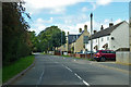

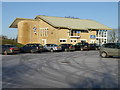
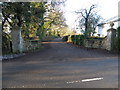
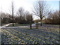
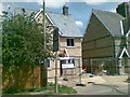
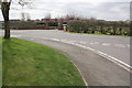
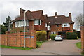
18 photos from this area
Area Information
Key information about the NN13 6PT including its size, population, and administrative classification.
- Area Type
- Postcode
- Area Size
- 1.2 hectares
- Population
- 1570
- Population Density
- 2430 people/km²
House Prices in NN13 6PT
37
Properties
£224,316
Average Sold Price
£82,950
Lowest Price
£410,000
Highest Price
Showing 37 properties
| Address | Type | Beds | Baths | Last Sale Price | Last Sale Date | |
|---|---|---|---|---|---|---|
| 40 Blackbird Close, Brackley, NN13 6PT | Detached | 3 | 2 | £397,000 | Aug 2025 | |
| 12 Blackbird Close, Brackley, NN13 6PT | Terraced | 3 | 1 | £295,000 | Jul 2025 | |
| 20 Blackbird Close, Brackley, NN13 6PT | Terraced | 2 | 1 | £255,000 | Aug 2022 | |
| 4 Blackbird Close, Brackley, NN13 6PT | Semi-detached | 3 | 3 | £273,000 | Feb 2021 | |
| 11 Blackbird Close, Brackley, NN13 6PT | Detached | 3 | 2 | £305,000 | Nov 2019 | |
| 3 Blackbird Close, Brackley, NN13 6PT | Detached | 3 | 1 | £310,000 | Apr 2019 | |
| 19 Blackbird Close, Brackley, NN13 6PT | Detached | 4 | - | £410,000 | Jul 2018 | |
| 15 Blackbird Close, Brackley, NN13 6PT | Detached | 3 | 2 | £295,000 | Jun 2018 | |
| 30 Blackbird Close, Brackley, NN13 6PT | Detached | 3 | 1 | £308,000 | Jan 2018 | |
| 18 Blackbird Close, Brackley, NN13 6PT | Terraced | 2 | 1 | £220,000 | Jan 2018 |
Page 1 of 4
Energy Efficiency in NN13 6PT
Amenities
Schools
| Rank | School | Type | Entry gender | Ages |
|---|
Explore more schools in this area
Go to Schools tabDemographics
Household Size
Family (3-5 people)
most common
Accommodation Type
Houses
most common
Tenure
87
majority
Ethnic Group
White
most common
Religion
N/A
most common
Household Composition
N/A
most common
Age
47
median
Adults (30-64 years)
most common
Household Deprivation
N/A
with no deprivation
NS-SEC
44
in Lower managerial occupations
Explore more demographic insights in this area
Go to Demographics tabPlanning
Planning Constraints
- Flood RiskPremium
- Ramsar Wetland SitesPremium
- Area of Outstanding Natural BeautyPremium
- Protected Nature ReservePremium
- Protected WoodlandPremium