Area Overview for NN13 5LU
Photos of NN13 5LU
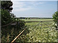
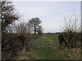
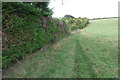
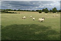
7 photos from this area
Area Information
Key information about the NN13 5LU including its size, population, and administrative classification.
- Area Type
- Postcode
- Area Size
- 2.3 km²
- Population
- 2431
- Population Density
- 76 people/km²
House Prices in NN13 5LU
28
Properties
£342,844
Average Sold Price
£85,000
Lowest Price
£945,000
Highest Price
Showing 28 properties
| Address | Type | Beds | Baths | Last Sale Price | Last Sale Date | |
|---|---|---|---|---|---|---|
| 3 Mill Lane, Croughton, NN13 5LU | house | 3 | - | £370,000 | Dec 2021 | |
| Hill View, 23 Mill Lane, Croughton, NN13 5LU | Cottage | 2 | 1 | £380,000 | Nov 2021 | |
| Orchard Loft, 27 Mill Lane, Croughton, NN13 5LU | Detached | 5 | 3 | £620,000 | Aug 2017 | |
| Chard Cottage, 17 Mill Lane, Croughton, NN13 5LU | Semi-detached | 2 | - | £275,000 | Aug 2015 | |
| 21 Mill Lane, Croughton, NN13 5LU | Cottage | 2 | 1 | £237,500 | Apr 2015 | |
| Millfields, 20 Mill Lane, Croughton, NN13 5LU | Detached | 4 | 2 | £567,500 | May 2014 | |
| Millbrook, 16 Mill Lane, Croughton, NN13 5LU | Bungalow | 3 | - | £376,000 | Nov 2012 | |
| 11 Mill Lane, Croughton, NN13 5LU | Terraced | 3 | 1 | £195,000 | Mar 2011 | |
| 10 Mill Lane, Croughton, NN13 5LU | Bungalow | 5 | - | £435,000 | Feb 2011 | |
| Brook House, 29 Mill Lane, Croughton, NN13 5LU | Detached | - | - | £945,000 | Jan 2004 |
Page 1 of 3
Energy Efficiency in NN13 5LU
Amenities
Schools
| Rank | School | Type | Entry gender | Ages |
|---|
Explore more schools in this area
Go to Schools tabDemographics
Household Size
Two person
most common
Accommodation Type
Houses
most common
Tenure
74
majority
Ethnic Group
White
most common
Religion
N/A
most common
Household Composition
N/A
most common
Age
47
median
Adults (30-64 years)
most common
Household Deprivation
N/A
with no deprivation
NS-SEC
43
in Lower managerial occupations
Explore more demographic insights in this area
Go to Demographics tabPlanning
Planning Constraints
- Flood RiskPremium
- Ramsar Wetland SitesPremium
- Area of Outstanding Natural BeautyPremium
- Protected Nature ReservePremium
- Protected WoodlandPremium