Area Overview for NN12 8HE
Photos of NN12 8HE


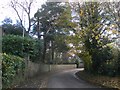
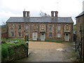

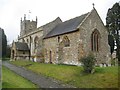
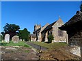

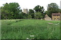


17 photos from this area
Area Information
Key information about the NN12 8HE including its size, population, and administrative classification.
- Area Type
- Postcode
- Area Size
- 1.6 km²
- Population
- 1738
- Population Density
- 65 people/km²
House Prices in NN12 8HE
32
Properties
£854,240
Average Sold Price
£71,000
Lowest Price
£5,482,601
Highest Price
Showing 32 properties
| Address | Type | Beds | Baths | Last Sale Price | Last Sale Date | |
|---|---|---|---|---|---|---|
| Wheelwrights Cottage, Maidford Road, Farthingstone, NN12 8HE | house | 4 | 2 | £720,000 | Dec 2024 | |
| Orchard House, Maidford Road, Farthingstone, NN12 8HE | house | 4 | - | £605,000 | Feb 2023 | |
| Blackberry Court, Maidford Road, Farthingstone, NN12 8HE | house | 6 | - | £975,000 | Oct 2022 | |
| Inglenook Cottage, Maidford Road, Farthingstone, NN12 8HE | house | - | - | £310,000 | Apr 2022 | |
| Lovers Cottage, Maidford Road, Farthingstone, NN12 8HE | house | - | - | £567,500 | Jul 2021 | |
| Englebrook, Maidford Road, Farthingstone, NN12 8HE | house | - | - | £350,000 | Mar 2021 | |
| Glebe Farm, Maidford Road, Farthingstone, NN12 8HE | house | - | - | £5,482,601 | Nov 2020 | |
| Littlecourt House, Maidford Road, Farthingstone, NN12 8HE | Bungalow | - | - | £688,005 | Sep 2016 | |
| Littlecourt Cottage, Maidford Road, Farthingstone, NN12 8HE | house | - | - | £275,000 | Jun 2012 | |
| Judkins House, Maidford Road, Farthingstone, NN12 8HE | house | 5 | - | £580,000 | Jul 2011 |
Page 1 of 4
Energy Efficiency in NN12 8HE
Amenities
Schools
| Rank | School | Type | Entry gender | Ages |
|---|
Explore more schools in this area
Go to Schools tabDemographics
Household Size
Two person
most common
Accommodation Type
Houses
most common
Tenure
85
majority
Ethnic Group
White
most common
Religion
N/A
most common
Household Composition
N/A
most common
Age
47
median
Adults (30-64 years)
most common
Household Deprivation
N/A
with no deprivation
NS-SEC
46
in Lower managerial occupations
Explore more demographic insights in this area
Go to Demographics tabPlanning
Planning Constraints
- Flood RiskPremium
- Ramsar Wetland SitesPremium
- Area of Outstanding Natural BeautyPremium
- Protected Nature ReservePremium
- Protected WoodlandPremium